
Nebraska Highway 40
Encyclopedia
Nebraska Highway 40 is a highway in central Nebraska
. It has a length of 85.73 miles (138 km). It has a western terminus at Nebraska Highway 92
in Arnold
and an eastern terminus north of Kearney
at an intersection with Nebraska Highway 10
.
at an intersection with Nebraska Highway 92
. It goes south out of Arnold into farmland and at an intersection with Nebraska Highway 47
, turns east. It continues east until Nebraska Spur 21B, a spur road into Callaway
, then turns southeasterly. At Oconto
, Highway 40 meets Nebraska Highway 21
. It continues in a southeasterly direction through Eddyville
and Sumner
and at Miller
, meets U.S. Highway 183. It continues southeast through Amherst
and Riverdale
and ends north of Kearney
at an intersection with Nebraska Highway 10
. Much of the alignment of Nebraska Highway 40 from Oconto southeastward to its eastern terminus lies parallel to the Wood River.
Nebraska
Nebraska is a state on the Great Plains of the Midwestern United States. The state's capital is Lincoln and its largest city is Omaha, on the Missouri River....
. It has a length of 85.73 miles (138 km). It has a western terminus at Nebraska Highway 92
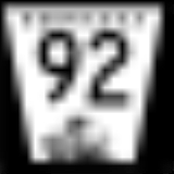
Nebraska Highway 92
Nebraska Highway 92 is a highway in Nebraska. Its western terminus is at the Wyoming border west of Lyman, Nebraska and its eastern terminus is in Omaha at the Missouri River, where it enters Iowa. Nebraska Highway 92 is part of a continuous 4-state "Highway 92" which begins in Torrington,...
in Arnold
Arnold, Nebraska
Arnold is a village in Custer County, Nebraska, United States. The population was 630 at the 2000 census.-Geography:Arnold is located at ....
and an eastern terminus north of Kearney
Kearney, Nebraska
Kearney is a city in and the county seat of Buffalo County, Nebraska, United States. The population was 30,787 at the 2010 census. It is home to the University of Nebraska-Kearney....
at an intersection with Nebraska Highway 10
Nebraska Highway 10
Nebraska Highway 10 is a highway in Nebraska. Its southern terminus is at the Kansas border south of Franklin. Its northern terminus is at an intersection with Nebraska Highway 92 and Nebraska Highway 58 in Loup City.-Route description:...
.
Route description
Nebraska Highway 40 begins in ArnoldArnold, Nebraska
Arnold is a village in Custer County, Nebraska, United States. The population was 630 at the 2000 census.-Geography:Arnold is located at ....
at an intersection with Nebraska Highway 92
Nebraska Highway 92
Nebraska Highway 92 is a highway in Nebraska. Its western terminus is at the Wyoming border west of Lyman, Nebraska and its eastern terminus is in Omaha at the Missouri River, where it enters Iowa. Nebraska Highway 92 is part of a continuous 4-state "Highway 92" which begins in Torrington,...
. It goes south out of Arnold into farmland and at an intersection with Nebraska Highway 47
Nebraska Highway 47
Nebraska Highway 47 is a highway in Nebraska. It is a highway split into two segments. The southern segment runs for between Nebraska Highway 89 near Wilsonville and U.S. Highway 6 and U.S. Highway 34 in Cambridge...
, turns east. It continues east until Nebraska Spur 21B, a spur road into Callaway
Callaway, Nebraska
Callaway is a village in Custer County, Nebraska, United States. The population was 539 at the 2010 census.-Geography:According to the United States Census Bureau, Callaway has a total area of , all land.-Demographics:...
, then turns southeasterly. At Oconto
Oconto, Nebraska
Oconto is a village in Custer County, Nebraska, United States. The population was 141 at the 2000 census.- History:The community was founded in 1887, but was originally called "Olax." The current name was adopted because the original name conflicted with another Nebraska location.-Geography:Oconto...
, Highway 40 meets Nebraska Highway 21
Nebraska Highway 21
Nebraska Highway 21 is a highway in central Nebraska. Its southern terminus is at Nebraska Highway 23 east of Eustis. Its northern terminus is at an intersection with Nebraska Highway 2 and Nebraska Highway 92 in Broken Bow.-Route description:...
. It continues in a southeasterly direction through Eddyville
Eddyville, Nebraska
Eddyville is a village in Dawson County, Nebraska, United States. It is part of the Lexington, Nebraska Micropolitan Statistical Area. The population was 96 at the 2000 census.-Geography:Eddyville is located at ....
and Sumner
Sumner, Nebraska
Sumner is a village in Dawson County, Nebraska, United States. It is part of the Lexington, Nebraska Micropolitan Statistical Area. The population was 237 at the 2000 census.-Geography:Sumner is located at ....
and at Miller
Miller, Nebraska
Miller is a village in Buffalo County, Nebraska, in the United States. It is part of the Kearney, Nebraska Micropolitan Statistical Area. As of the 2000 census, the village population was 156.-Geography:Miller is located at ....
, meets U.S. Highway 183. It continues southeast through Amherst
Amherst, Nebraska
Amherst is a village in Buffalo County, Nebraska, United States. It is part of the Kearney, Nebraska Micropolitan Statistical Area. The population was 277 at the 2000 census.-Geography:Amherst is located at ....
and Riverdale
Riverdale, Nebraska
Riverdale is a village in Buffalo County, Nebraska, United States. It is part of the Kearney, Nebraska Micropolitan Statistical Area. The population was 213 at the 2000 census.-Geography:Riverdale is located at ....
and ends north of Kearney
Kearney, Nebraska
Kearney is a city in and the county seat of Buffalo County, Nebraska, United States. The population was 30,787 at the 2010 census. It is home to the University of Nebraska-Kearney....
at an intersection with Nebraska Highway 10
Nebraska Highway 10
Nebraska Highway 10 is a highway in Nebraska. Its southern terminus is at the Kansas border south of Franklin. Its northern terminus is at an intersection with Nebraska Highway 92 and Nebraska Highway 58 in Loup City.-Route description:...
. Much of the alignment of Nebraska Highway 40 from Oconto southeastward to its eastern terminus lies parallel to the Wood River.