
.gif)
National Route 3 (Argentina)
Encyclopedia
Ruta Nacional 3 is an Argentine
highway
, stretching from the eastern side of the country in Buenos Aires
, crossing the province
s of Buenos Aires
, Río Negro
, Chubut Province
, Santa Cruz and Tierra del Fuego
. Since its start at Avenida General Paz
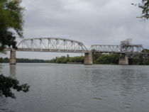
(A001) until the end, on the bridge over Lapataia River, it measures 3045 kilometres (1,892 mi).
The road is interrupted between km 2674 and 2696, due to the presence of Magellan Strait, which forces access between Santa Cruz and Tierra del Fuego Provinces through Chile
, over Ruta CH-255 and Ruta CH-257 paved 57 kilometres (35 mi) north of the strait and another paved and treated 148 kilometres (92 mi) long south of it. The crossing of the Magellan Strait is done in 20 minutes through the use of a ferry
traversing the width of 4.65 kilometres (2.89 mi) at that point.
After National Decree 1931 of 3 August 1983, this road is called Comandante Luis Piedrabuena south of National Route 22
, that is starting at km marker 719.
 Length: 339 kilometres (211 mi)(km 963-1304)
In 1990 the "Servicios de Mantenimiento de Carreteras" (Semacar) company, took charge of Corridor number 1, which includes Route 3 between km markers 19 and 677, in Buenos Aires Province, from the joining with Provincial Route 4 in San Justo
to Bahía Blanca
, with tolls collected in Cañuelas
(km marker 78), Azul
(km marker 263) and Tres Arroyos
(km marker 523).,
In 2003 the concession contracts expired, which lead to a modification of corridor numbers and a call for a new public bid.
Corridor Vial number 1 is now given to "Empresa Rutas al Sur" and runs from km marker 62 to 677 which corresponds to the crossing of Provincial Route 6 in Cañuelas until it joins National Route 252 in Grünbein.
Argentina
Argentina , officially the Argentine Republic , is the second largest country in South America by land area, after Brazil. It is constituted as a federation of 23 provinces and an autonomous city, Buenos Aires...
highway
Highway
A highway is any public road. In American English, the term is common and almost always designates major roads. In British English, the term designates any road open to the public. Any interconnected set of highways can be variously referred to as a "highway system", a "highway network", or a...
, stretching from the eastern side of the country in Buenos Aires
Buenos Aires
Buenos Aires is the capital and largest city of Argentina, and the second-largest metropolitan area in South America, after São Paulo. It is located on the western shore of the estuary of the Río de la Plata, on the southeastern coast of the South American continent...
, crossing the province
Province
A province is a territorial unit, almost always an administrative division, within a country or state.-Etymology:The English word "province" is attested since about 1330 and derives from the 13th-century Old French "province," which itself comes from the Latin word "provincia," which referred to...
s of Buenos Aires
Buenos Aires Province
The Province of Buenos Aires is the largest and most populous province of Argentina. It takes the name from the city of Buenos Aires, which used to be the provincial capital until it was federalized in 1880...
, Río Negro
Río Negro Province
Río Negro is a province of Argentina, located at the northern edge of Patagonia. Neighboring provinces are from the south clockwise Chubut, Neuquén, Mendoza, La Pampa and Buenos Aires. To the east lies the Atlantic Ocean.Its capital is Viedma...
, Chubut Province
Chubut Province
Chubut a province in the southern part of Argentina situated between the 42nd parallel south and the 46th parallel south , the Andes range separating Argentina from Chile, and the Atlantic ocean...
, Santa Cruz and Tierra del Fuego
Tierra del Fuego Province (Argentina)
Tierra del Fuego is an Argentine province entirely separated from mainland Argentina by the Strait of Magellan. It includes:* The eastern part of the Isla Grande of Tierra del Fuego archipelago and the Staten Island.* Argentina's claims to the Falkland Islands and to...
. Since its start at Avenida General Paz
Avenida General Paz
Avenida General Paz is a beltway freeway surrounding the city of Buenos Aires. Roughly following the boundary between the city and Buenos Aires Province, it is one of the few motorways in Argentina that is toll-free...
(A001) until the end, on the bridge over Lapataia River, it measures 3045 kilometres (1,892 mi).
The road is interrupted between km 2674 and 2696, due to the presence of Magellan Strait, which forces access between Santa Cruz and Tierra del Fuego Provinces through Chile
Chile
Chile ,officially the Republic of Chile , is a country in South America occupying a long, narrow coastal strip between the Andes mountains to the east and the Pacific Ocean to the west. It borders Peru to the north, Bolivia to the northeast, Argentina to the east, and the Drake Passage in the far...
, over Ruta CH-255 and Ruta CH-257 paved 57 kilometres (35 mi) north of the strait and another paved and treated 148 kilometres (92 mi) long south of it. The crossing of the Magellan Strait is done in 20 minutes through the use of a ferry
Ferry
A ferry is a form of transportation, usually a boat, but sometimes a ship, used to carry primarily passengers, and sometimes vehicles and cargo as well, across a body of water. Most ferries operate on regular, frequent, return services...
traversing the width of 4.65 kilometres (2.89 mi) at that point.
After National Decree 1931 of 3 August 1983, this road is called Comandante Luis Piedrabuena south of National Route 22
National Route 22 (Argentina)
National Route 22 is a highway located in Argentina, that connects the provinces of Buenos Aires, La Pampa, Río Negro and Neuquén in . The route starts at the connection with...
, that is starting at km marker 719.
Cities
These are the main (over 5,000 inhabitants) cities and towns joined by this route, North to South. In the provinces of Santa Cruz and Tierra del Fuego towns under 5,000 inhabitants are marked in italics.Buenos Aires Province
Length: 949 kilometres (590 mi) (from km marker 14 to 963).- La Matanza Partido: San JustoSan Justo, Buenos AiresSan Justo is a city and the seat of government of La Matanza Partido, Buenos Aires Province, Argentina.On the initiative of Judge Lino Lagos, the settlement was founded on December 25th, 1858 on land requisitioned from Justo Villegas, a prominent landowner...
(km 17), Isidro CasanovaIsidro CasanovaIsidro Casanova is a city in La Matanza Partido, Greater Buenos Aires, Argentina. It borders the towns of Villa Luzuriaga, San Justo, Ciudad Evita, Rafael Castillo, Laferrere, and Ezeiza.-History:...
(km 19), Gregorio de LaferrereGregorio de Laferrère, Buenos Aires-History and overview:The site of cattle ranches and part of the county seat of San Justo from 1858, the city was established as a real estate development on May 4, 1911, by playwright Gregorio de Laferrère, Honorio Luque, and Dr. Pedro Luro. The latter partner, a prominent area physician, had...
(km 26), González CatánGonzález CatánGonzález Catán is a city located in La Matanza Partido, Buenos Aires Province, Argentina. The city is the second-largest by area in the county , and the second most-populous.It forms part of the Greater Buenos Aires urban conurbation....
(km 32), Virrey del Pino (km 38). - Marcos Paz PartidoMarcos Paz PartidoMarcos Paz is a partido in the Argentine province of Buenos Aires. Its capital city is Marcos Paz.Established on 25 October 1878 , Marcos Paz is located at the eastern border of the Greater Buenos Aires with the rest of the province, although on an administrative sense, it is not considered part of...
: no towns over 5,000 people. - Cañuelas PartidoCañuelas PartidoCañuelas Partido is a partido of Buenos Aires Province in Argentina.The provincial subdivision has a population of around 42,500 inhabitants in an area of 1,200 km² , and its capital city is Cañuelas, which has a population of around 31,000.-Sports:Cañuelas is home to Cañuelas FC, a...
: CañuelasCañuelasCañuelas is a town in Buenos Aires Province, Argentina. It is the head town of the Cañuelas Partido. It is located near the outskirts of the Gran Buenos Aires conurbation....
(km 63-66). - Monte PartidoMonte PartidoMonte Partido is a partido located in the eastern part of Buenos Aires Province in Argentina.The provincial subdivision has a population of about 17,500 inhabitants in an area of , and its capital city is Monte, located from Buenos Aires on the banks of the Salado River.-Geography:The nortwhest...
: San Miguel del MonteSan Miguel del MonteSan Miguel del Monte is a town in Buenos Aires Province, Argentina. It is the head town of the Monte Partido.-External links:...
(km 109-112) - General Belgrano PartidoGeneral Belgrano PartidoGeneral Belgrano Partido is a partido situated towards the east of Buenos Aires Province in Argentina.The provincial subdivision has a population of about 16,000 inhabitants in an area of , and its capital city is General Belgrano, which is located from Buenos Aires.The partido is named after...
: no towns over 5,000 people. - Las Flores PartidoLas Flores PartidoLas Flores Partido is a partido of Buenos Aires Province in Argentina.The provincial subdivision has a population of about 23,000 inhabitants in an area of , and its capital city is Las Flores, which is located from Buenos Aires...
: Las FloresLas Flores, Buenos AiresLas Flores is a town in the province of Buenos Aires, Argentina, and the only city in the partido of the same name. It has a population of about 23,000 inhabitants as per the . It is located 187 km from Buenos Aires City. Its main economic activities are related to agriculture and cattle breeding....
(km 187). - Azul PartidoAzul PartidoAzul is a central partido of Buenos Aires Province in Argentina.The provincial subdivision has a population of 62,996 inhabitants in an area of 6,615 km² , and its capital city is Azul, which is located around 298 km from Buenos Aires.The province was founded on December 16,...
: AzulAzul, Buenos AiresAzul is the head city of the Azul Partido, located at the center of the Buenos Aires Province in Argentina, 300 km south of Buenos Aires. It has 63,000 inhabitants as per the ....
(km 299). - Benito Juárez PartidoBenito Juarez PartidoBenito Juárez is a partido in the south-central part of Buenos Aires Province in Argentina.The provincial subdivision has a population of 20,402 inhabitants in an area of 5,285 km² , and its capital city is Benito Juárez...
: Benito JuárezBenito Juárez, Buenos AiresBenito Juárez is a town in Buenos Aires Province, Argentina. It is the head town of the Benito Juárez Partido.The town and its Partido are named after former Mexican President Benito Juárez, the name was chosen to make a gesture of friendship between Argentina and Mexico....
(km 399-401). - Adolfo Gonzales Chaves PartidoAdolfo Gonzáles Chaves PartidoAdolfo Gonzáles Chaves Partido is a partido of Buenos Aires Province in Argentina, it is located at coordinates .The provincial subdivision has a population of 12,496 inhabitants in an area of 3,780 km² , and its capital city is Adolfo Gonzales Chaves, which is located around...
: Adolfo Gonzales Chaves (km 450). - Tres Arroyos PartidoTres Arroyos PartidoThe partido of Tres Arroyos is a subdivision of the Province of Buenos Aires in Argentina. Located on the Atlantic coast of the province, it was created in 1882 by the provincial government when they divided the territory of Tres Arroyos into the partidos of Coronel Suárez, Tres Arroyos and...
: Tres ArroyosTres ArroyosTres Arroyos is a city in Buenos Aires Province, Argentina. It is the capital of the Tres Arroyos Partido.The city has a sizable population of Dutch and Danish descent.- Archaeological site :...
(km 491-496). - Coronel Dorrego PartidoCoronel Dorrego PartidoCoronel Dorrego Partido is a partido located on the southern coast of Buenos Aires Province in Argentina.The provincial subdivision has a population of about 16,500 inhabitants in an area of , and its capital city is Coronel Dorrego, which is located around 628km from Buenos Aires.-Economy:The...
: Coronel Dorrego (km 593). - Coronel Rosales PartidoCoronel Rosales PartidoCoronel Rosales Partido is a partido located on the southern coast of Buenos Aires Province in Argentina.The provincial subdivision has a population of about 61,000 inhabitants in an area of , and its capital city is Punta Alta, which is located around from Buenos Aires.-Attractions:The coastal...
: no towns over 5,000 people. - Bahía Blanca PartidoBahia Blanca PartidoThe Partido de Bahía Blanca is a partido of the Buenos Aires Province is located at the south-west of the province in central Argentina at coordinates...
: access to Ingeniero White (km 677) over National Route 252, Bahía BlancaBahía BlancaBahía Blanca is a city located in the south-west of the province of Buenos Aires, Argentina, by the Atlantic Ocean, and seat of government of Bahía Blanca Partido. It has a population of 274,509 inhabitants according to the...
(km 681-695), access to General Daniel Cerri (km 698). - Villarino PartidoVillarino PartidoVillarino Partido is a partido in the south of Buenos Aires Province in Argentina.The provincial subdivision has a population of about 26,500 inhabitants in an area of , and its capital city is Médanos, which is located from Buenos Aires and that is known for its garlic and premium wine...
: no towns over 5,000 people. - Patagones PartidoPatagones PartidoPatagones Partido is the southernmost partido of Buenos Aires Province in Argentina.The provincial subdivision has a population of about 28,000 inhabitants in an area of 13,570 km², making it by far the largest partido in Buenos Aires Province....
: Carmen de PatagonesCarmen de Patagones- Geography :It is located 937 km from the city of Buenos Aires, on the north bank of the Río Negro , near the Atlantic Ocean, and opposite Viedma, capital of the province of Río Negro...
(km 962).
Río Negro Province
- Adolfo Alsina Department: Viedma (km 966).
- San Antonio Department: access to San Antonio OesteSan Antonio OesteSan Antonio Oeste is a port city in the Argentine province of Río Negro, and head of the department of San Antonio.The town is bordered by its sister communities of San Antonio Este, to the east, and Las Grutas, to the southwest. Discovered by an expedition of the Spanish Empire in 1779, San Matías...
(km 1139) and Sierra GrandeSierra GrandeSierra Grande is an extinct shield volcano in northeastern New Mexico that rises 2,200 feet above the surrounding plain. It is part of the inactive Raton-Clayton volcanic field. Sierra Grande is the easternmost point in the United States that reaches an altitude of more than 8,000 feet above sea...
(km 1265).
Chubut Province
Length: 552 kilometres (343 mi) (km 1304-km 1856)- Biedma DepartmentBiedma DepartmentBiedma is a department located in the north east of Chubut Province, on the Atlantic coast of Argentina.The provincial subdivision has a population of about 59,000 inhabitants in an area of 12,940km², and its capital city is Puerto Madryn, which is located around 1,334km from Buenos...
: access to Puerto MadrynPuerto MadrynPuerto Madryn is a city in the province of Chubut in the Argentine Patagonia. It is the head town of the Viedma Department, and has about 57,571 inhabitants according to the last census in 2001....
(km 1394). - Rawson DepartmentRawson DepartmentRawson Department may refer to:*Rawson Department, Chubut*Rawson Department, San Juan...
: TrelewTrelew-References:La Pasión según Trelew, Espejo de la Argentina, 1997, Editorial Planeta Argentina S.A.I.C.; Third Edition: April 2000, Buenos Aires, ISBN 950-742-859-3-External links:* * * *...
(km 1451) and access to RawsonRawsonRawson may refer to:Places*Rawson, Chubut, the capital of Chubut Province in Argentina, named after Guillermo Rawson*Rawson Department, Chubut, Argentina*Rawson Department, San Juan Province, Argentina...
(km 1456). - Gaiman DepartmentGaiman DepartmentGaiman Department is a department of Chubut Province in Argentina.The provincial subdivision has a population of about 9,612 inhabitants in an area of 11,076 km², and its capital city is Gaiman, which is located around 1,398 km from Capital Federal....
: no towns over 5,000 people. - Florentino Ameghino DepartmentFlorentino Ameghino DepartmentFlorentino Ameghino is a department of Chubut Province, it is located on the Atlantic coast of ArgentinaThe provincial subdivision has a population of about 1,484 inhabitants in an area of 16,088 km², and its capital city is Camarones, which is located around 1,654km from Capital Federal.The...
: no towns over 5,000 people. - Escalante DepartmentEscalante DepartmentEscalante Department is a department of Chubut Province in Argentina.The provincial subdivision has a population of about 143,000 inhabitants in an area of 14,015 km², and its capital city is Comodoro Rivadavia....
: Comodoro RivadaviaComodoro RivadaviaComodoro Rivadavia is a city in the Patagonian province of Chubut in southern Argentina, located on the San Jorge Gulf, an inlet of the Atlantic Ocean, at the foot of the Chenque Hill. Comodoro Rivadavia is the most important city of the San Jorge Basin....
(km 1831-1838) and Rada TillyRada TillyRada Tilly is a town in Escalante Department, Chubut Province , Argentina. The town is between Punta Piedras hill to the north and Punta del Marqués to the south...
(km 1843).
Santa Cruz Province
Length: 818 kilometres (508 mi) (km 1856-km 2674)- Deseado DepartmentDeseado DepartmentDeseado Department is a department in Santa Cruz Province, Argentina. It has a population of 72,953 and an area of 63,784 km². The seat of the department is in Puerto Deseado.-Municipalities:* Caleta Olivia* Cañadón Seco* Fitz Roy* Jaramillo...
: Caleta OliviaCaleta OliviaCaleta Olivia is a city located at the northeast of the Argentine province of Santa Cruz, on the San Jorge Gulf by the Atlantic Ocean. It has a population of 36,000 inhabitants...
(km 1908-1911). - Magallanes DepartmentMagallanes DepartmentMagallanes Department is a department in Santa Cruz Province, Argentina. It has a population of 6,536 and an area of 19,805 km². The seat of the department is in Puerto San Julián.-References:*Instituto Nacional de Estadísticas y Censos, INDEC...
: access to Puerto San JuliánPuerto San JuliánPuerto San Julián, also known historically as Port St Julian, is a natural harbour in Patagonia in the Santa Cruz Province of Argentina located at . In the days of sailing ships it formed a stopping point, south of Puerto Deseado...
(km 2252). - Corpen Aike DepartmentCorpen Aike DepartmentCorpen Aike Department is a department in Santa Cruz Province, Argentina. It has a population of 7942 and an area of26,350 km². The seat of the department is in Puerto Santa Cruz.-Municipalities:*Comandante Luis Piedrabuena*Puerto Santa Cruz...
: Comandante Luis PiedrabuenaComandante Luis PiedrabuenaComandante Luis Piedrabuena is a town with 4,175 inhabitants in the department of Corpen Aike in Santa Cruz province in Argentina.Located on the left bank of the Santa Cruz river on Ruta Nacional N° 3, it is 231 km from the city of Río Gallegos and 467 km from Caleta Olivia.It was first settled by...
(km 2372). - Güer Aike DepartmentGüer Aike DepartmentGüer Aike Department is a department in Santa Cruz Province, Argentina. It has a population of 92,878 and an area of 33,841 km². The seat of the department is in Río Gallegos.-Municipalities:* El Turbio* J. Dufour* Mina 3* Río Gallegos...
: Río Gallegos (km 2607-2609).
Tierra del Fuego Province
Length: 363 kilometres (226 mi) (km 2696-km 3059).- Río Grande Department: access to San Sebastián (Chile) (km 2740), Río GrandeRío Grande, Tierra del Fuego-External links:* * * *...
(km 2818) and TolhuinTolhuinTolhuin is a town in the province of Tierra del Fuego, Argentina. It has 1,382 inhabitants as per the . It is located on the eastern shore of Lake Fagnano, in the southern part of the Isla Grande de Tierra del Fuego. It is the third biggest settlement on the Argentine side of Tierra del Fuego after...
(km 2934). - Ushuaia Department: UshuaiaUshuaiaUshuaia may refer to the following:*Ushuaia, a city in Argentina.**Ushuaia Department, an administrative division**Ushuaia River**Ushuaia International Airport**Colegio Nacional de Ushuaia, National School of Ushuaia....
(km 3036-3041).
Tolls
In 1990 administration and maintenance of the most travelled roads was given to private companies with rights to collect tolls dividing the areas in "Corredores Viales" ("road corridors").In 1990 the "Servicios de Mantenimiento de Carreteras" (Semacar) company, took charge of Corridor number 1, which includes Route 3 between km markers 19 and 677, in Buenos Aires Province, from the joining with Provincial Route 4 in San Justo
San Justo
San Justo is the Spanish name for Saint Justus.As a place-name, San Justo may refer to:* San Justo, Santa Fe— main township of the San Justo Department, Argentina* San Justo Department , various places...
to Bahía Blanca
Bahía Blanca
Bahía Blanca is a city located in the south-west of the province of Buenos Aires, Argentina, by the Atlantic Ocean, and seat of government of Bahía Blanca Partido. It has a population of 274,509 inhabitants according to the...
, with tolls collected in Cañuelas
Cañuelas
Cañuelas is a town in Buenos Aires Province, Argentina. It is the head town of the Cañuelas Partido. It is located near the outskirts of the Gran Buenos Aires conurbation....
(km marker 78), Azul
Azul
Azul means "blue" in Portuguese and Spanish and may refer to:* Azul..., a poetry collection by Rubén Darío* Azul Azul, a Bolivian pop-dance music group* Azul, Buenos Aires Province, a town in Argentina...
(km marker 263) and Tres Arroyos
Tres Arroyos
Tres Arroyos is a city in Buenos Aires Province, Argentina. It is the capital of the Tres Arroyos Partido.The city has a sizable population of Dutch and Danish descent.- Archaeological site :...
(km marker 523).,
In 2003 the concession contracts expired, which lead to a modification of corridor numbers and a call for a new public bid.
Corridor Vial number 1 is now given to "Empresa Rutas al Sur" and runs from km marker 62 to 677 which corresponds to the crossing of Provincial Route 6 in Cañuelas until it joins National Route 252 in Grünbein.