

National Register of Historic Places listings in West Feliciana Parish, Louisiana
Encyclopedia
This is intended to be a complete list of the properties and districts on the National Register of Historic Places
National Register of Historic Places
The National Register of Historic Places is the United States government's official list of districts, sites, buildings, structures, and objects deemed worthy of preservation...
in West Feliciana Parish
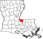
West Feliciana Parish, Louisiana
-Demographics:As of the census of 2000, there were 15,111 people, 3,645 households, and 2,704 families residing in the parish. The population density was 37 people per square mile . There were 4,485 housing units at an average density of 11 per square mile...
, Louisiana
Louisiana
Louisiana is a state located in the southern region of the United States of America. Its capital is Baton Rouge and largest city is New Orleans. Louisiana is the only state in the U.S. with political subdivisions termed parishes, which are local governments equivalent to counties...
, United States
United States
The United States of America is a federal constitutional republic comprising fifty states and a federal district...
. The locations of National Register properties and districts for which the latitude and longitude coordinates are included below, may be seen in a Google map.
There are 30 properties and districts listed on the National Register in the parish, including 1 National Historic Landmark
National Historic Landmark
A National Historic Landmark is a building, site, structure, object, or district, that is officially recognized by the United States government for its historical significance...
.
Current listings
| Landmark name | Image | Date listed | Location | City or Town | Summary | |
|---|---|---|---|---|---|---|
| 1 | 3 V Tourist Court | 111 E. Commerce St. 30°46′44"N 91°22′32"W |
St. Francisville St. Francisville, Louisiana St. Francisville is a town in and the parish seat of West Feliciana Parish, Louisiana, United States. The population was 1,712 at the 2000 census. It is part of the Baton Rouge Metropolitan Statistical Area.-Geography:St... |
|||
| 2 | Afton Villa Gardens | North of St. Francisville on U.S. Route 61 U.S. Route 61 U.S. Route 61 is the official designation for a United States highway that runs from New Orleans, Louisiana, to the city of Wyoming, Minnesota. The highway generally follows the course of the Mississippi River, and is designated the Great River Road for much of its route. As of 2004, the highway's... 30°51′6"N 91°23′17"W |
St. Francisville St. Francisville, Louisiana St. Francisville is a town in and the parish seat of West Feliciana Parish, Louisiana, United States. The population was 1,712 at the 2000 census. It is part of the Baton Rouge Metropolitan Statistical Area.-Geography:St... |
|||
| 3 | Bloodhound Site Bloodhound Site The Bloodhound Site is an archaeological site in West Feliciana Parish, Louisiana, United States. It was once occupied by the Tunica tribe from 1700 to 1749.-External links:*... |
Address Restricted | Angola | An archaeological site Archaeological site An archaeological site is a place in which evidence of past activity is preserved , and which has been, or may be, investigated using the discipline of archaeology and represents a part of the archaeological record.Beyond this, the definition and geographical extent of a 'site' can vary widely,... once occupied by the Tunica tribe. |
||
| 4 | Butler-Greenwood Plantation | North of St. Francisville on U.S. Route 61 U.S. Route 61 U.S. Route 61 is the official designation for a United States highway that runs from New Orleans, Louisiana, to the city of Wyoming, Minnesota. The highway generally follows the course of the Mississippi River, and is designated the Great River Road for much of its route. As of 2004, the highway's... 30°49′11"N 91°23′23"W |
St. Francisville St. Francisville, Louisiana St. Francisville is a town in and the parish seat of West Feliciana Parish, Louisiana, United States. The population was 1,712 at the 2000 census. It is part of the Baton Rouge Metropolitan Statistical Area.-Geography:St... |
|||
| 5 | Catalpa | U.S. Route 61 U.S. Route 61 U.S. Route 61 is the official designation for a United States highway that runs from New Orleans, Louisiana, to the city of Wyoming, Minnesota. The highway generally follows the course of the Mississippi River, and is designated the Great River Road for much of its route. As of 2004, the highway's... 30°51′4"N 91°22′33"W |
St. Francisville St. Francisville, Louisiana St. Francisville is a town in and the parish seat of West Feliciana Parish, Louisiana, United States. The population was 1,712 at the 2000 census. It is part of the Baton Rouge Metropolitan Statistical Area.-Geography:St... |
|||
| 6 | Cottage Plantation | 6 miles north of St. Francisville on U.S. Route 61 U.S. Route 61 U.S. Route 61 is the official designation for a United States highway that runs from New Orleans, Louisiana, to the city of Wyoming, Minnesota. The highway generally follows the course of the Mississippi River, and is designated the Great River Road for much of its route. As of 2004, the highway's... 30°51′11"N 91°21′37"W |
St. Francisville St. Francisville, Louisiana St. Francisville is a town in and the parish seat of West Feliciana Parish, Louisiana, United States. The population was 1,712 at the 2000 census. It is part of the Baton Rouge Metropolitan Statistical Area.-Geography:St... |
|||
| 7 | Grace Episcopal Church Grace Episcopal Church (St. Francisville, Louisiana) Grace Episcopal Church is an historic Episcopal church located at St. Francisville, West Feliciana Parish, Louisiana. The congregation was organized in 1827. The present church was completed in 1860, but was heavily damaged by Union gunboats in 1863 during the Civil War. The current appearance of... |
510 Ferdinand St. 30°46′33"N 91°23′14"W |
St. Francisville St. Francisville, Louisiana St. Francisville is a town in and the parish seat of West Feliciana Parish, Louisiana, United States. The population was 1,712 at the 2000 census. It is part of the Baton Rouge Metropolitan Statistical Area.-Geography:St... |
|||
| 8 | Hazelwood Plantation | Southeast of Laurel Hill on Hazelwood Rd. 30°56′56"N 91°19′56"W |
Laurel Hill | |||
| 9 | Highland | Northwest of St. Francisville, off Highland Rd. 30°53′8"N 91°25′49"W |
St. Francisville St. Francisville, Louisiana St. Francisville is a town in and the parish seat of West Feliciana Parish, Louisiana, United States. The population was 1,712 at the 2000 census. It is part of the Baton Rouge Metropolitan Statistical Area.-Geography:St... |
|||
| 10 | Laurel Hill | Northeast of St. Francisville 30°57′41"N 91°19′33"W |
St. Francisville St. Francisville, Louisiana St. Francisville is a town in and the parish seat of West Feliciana Parish, Louisiana, United States. The population was 1,712 at the 2000 census. It is part of the Baton Rouge Metropolitan Statistical Area.-Geography:St... |
|||
| 11 | Live Oak | 1.3 miles south of Weyanoke 30°56′0"N 91°27′17"W |
Weyanoke | |||
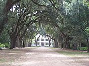
| 12 | Myrtles Plantation Myrtles Plantation The Myrtles Plantation is an antebellum plantation in St. Francisville, Louisiana, near Baton Rouge. Listed on the National Register of Historic Places, the plantation is a bed and breakfast, and it offers historical and mystery tours.-History:... |
U.S. Route 61 U.S. Route 61 U.S. Route 61 is the official designation for a United States highway that runs from New Orleans, Louisiana, to the city of Wyoming, Minnesota. The highway generally follows the course of the Mississippi River, and is designated the Great River Road for much of its route. As of 2004, the highway's... 30°48′11"N 91°23′15"W |
St. Francisville St. Francisville, Louisiana St. Francisville is a town in and the parish seat of West Feliciana Parish, Louisiana, United States. The population was 1,712 at the 2000 census. It is part of the Baton Rouge Metropolitan Statistical Area.-Geography:St... |
|||
| 13 | Oak Grove Plantation Dependencies | U.S. Route 61 U.S. Route 61 U.S. Route 61 is the official designation for a United States highway that runs from New Orleans, Louisiana, to the city of Wyoming, Minnesota. The highway generally follows the course of the Mississippi River, and is designated the Great River Road for much of its route. As of 2004, the highway's... , south of its junction with Louisiana Highway 421 30°52′34"N 91°21′58"W |
St. Francisville St. Francisville, Louisiana St. Francisville is a town in and the parish seat of West Feliciana Parish, Louisiana, United States. The population was 1,712 at the 2000 census. It is part of the Baton Rouge Metropolitan Statistical Area.-Geography:St... |
|||
| 14 | Oakley Plantation House | 4.5 miles east of St. Francisville in Audubon Memorial State Park 30°47′48"N 91°18′26"W |
St. Francisville St. Francisville, Louisiana St. Francisville is a town in and the parish seat of West Feliciana Parish, Louisiana, United States. The population was 1,712 at the 2000 census. It is part of the Baton Rouge Metropolitan Statistical Area.-Geography:St... |
|||
| 15 | The Oaks | U.S. Route 61 U.S. Route 61 U.S. Route 61 is the official designation for a United States highway that runs from New Orleans, Louisiana, to the city of Wyoming, Minnesota. The highway generally follows the course of the Mississippi River, and is designated the Great River Road for much of its route. As of 2004, the highway's... 30°48′34"N 91°23′12"W |
Hardwood | |||
| 16 | Propinquity | Royal and Johnson Sts. 30°46′27"N 91°23′11"W |
St. Francisville St. Francisville, Louisiana St. Francisville is a town in and the parish seat of West Feliciana Parish, Louisiana, United States. The population was 1,712 at the 2000 census. It is part of the Baton Rouge Metropolitan Statistical Area.-Geography:St... |
|||
| 17 | Red Hat Cell Block, Louisiana State Penitentiary | Louisiana State Penitentiary Louisiana State Penitentiary The Louisiana State Penitentiary is a prison farm in Louisiana operated by the Louisiana Department of Public Safety & Corrections. It is the largest maximum security prison in the United States with 5,000 offenders and 1,800 staff... 30°57′56"N 91°36′49"W |
Angola | |||
| 18 | Rosale Plantation | North of St. Francisville off U.S. Route 61 U.S. Route 61 U.S. Route 61 is the official designation for a United States highway that runs from New Orleans, Louisiana, to the city of Wyoming, Minnesota. The highway generally follows the course of the Mississippi River, and is designated the Great River Road for much of its route. As of 2004, the highway's... 30°51′52"N 91°21′36"W |
St. Francisville St. Francisville, Louisiana St. Francisville is a town in and the parish seat of West Feliciana Parish, Louisiana, United States. The population was 1,712 at the 2000 census. It is part of the Baton Rouge Metropolitan Statistical Area.-Geography:St... |
|||
| 19 | Rosebank Plantation House | Southeast of Weyanoke off Louisiana Highway 66 Louisiana Highway 66 Louisiana Highway 66 is a state highway in Louisiana.Highway 66 is parallel to the old Tunica Trace. In 1988 the Louisiana Legislature passed Act 350, which designated Highway 66 as "Tunica Trace." Highway 66 is the road to the Louisiana State Penitentiary .... 30°55′27"N 91°26′33"W |
Weyanoke | |||
| 20 | Rosedown Plantation Rosedown Plantation Rosedown Plantation is located in the West Feliciana community of St. Francisville along one of the most historic corridors in South Louisiana.Society in and around St. Francisville, at the time that Rosedown was constructed, was dominated by European, primarily British, settlers who became cotton... |
 |
U.S. Route 61 U.S. Route 61 U.S. Route 61 is the official designation for a United States highway that runs from New Orleans, Louisiana, to the city of Wyoming, Minnesota. The highway generally follows the course of the Mississippi River, and is designated the Great River Road for much of its route. As of 2004, the highway's... and Louisiana Highway 10 Louisiana Highway 10 Louisiana Highway 10 is a state highway in south-central Louisiana. It runs from west to east for . The western terminus is at the intersection of U.S. Route 171 in Pickering, Louisiana in Vernon Parish near Fort Polk and the eastern terminus is in Bogalusa at Pearl River and the Louisiana line... 30°47′58"N 91°22′23"W |
St. Francisville St. Francisville, Louisiana St. Francisville is a town in and the parish seat of West Feliciana Parish, Louisiana, United States. The population was 1,712 at the 2000 census. It is part of the Baton Rouge Metropolitan Statistical Area.-Geography:St... |
||
| 21 | St. Francisville Historic District | Royal and Prosperity Sts.; also Ferdinand and Sewell Sts. 30°46′28"N 91°23′9"W |
St. Francisville St. Francisville, Louisiana St. Francisville is a town in and the parish seat of West Feliciana Parish, Louisiana, United States. The population was 1,712 at the 2000 census. It is part of the Baton Rouge Metropolitan Statistical Area.-Geography:St... |
Second set of addresses represents a boundary increase of | ||
| 22 | St. John's Episcopal Church | Old Laurel Hill Rd. 30°57′24"N 91°20′29"W |
Laurel Hill | |||
| 23 | St. Mary's Episcopal Church | Northwest of Weyanoke on Louisiana Highway 66 Louisiana Highway 66 Louisiana Highway 66 is a state highway in Louisiana.Highway 66 is parallel to the old Tunica Trace. In 1988 the Louisiana Legislature passed Act 350, which designated Highway 66 as "Tunica Trace." Highway 66 is the road to the Louisiana State Penitentiary .... 30°57′56"N 91°28′11"W |
Weyanoke | |||
| 24 | Solitude Plantation House Solitude Plantation House Solitude Plantation House is located in St. Francisville, Louisiana. It was built in 1815 and was added to the National Register of Historic Places on January 27, 1983.... |
Northwest of St. Francisville on Tunica Rd. 30°49′17"N 91°25′26"W |
St. Francisville St. Francisville, Louisiana St. Francisville is a town in and the parish seat of West Feliciana Parish, Louisiana, United States. The population was 1,712 at the 2000 census. It is part of the Baton Rouge Metropolitan Statistical Area.-Geography:St... |
|||
| 25 | Star Hill Plantation Dependency | 5018 U.S. Route 61 U.S. Route 61 U.S. Route 61 is the official designation for a United States highway that runs from New Orleans, Louisiana, to the city of Wyoming, Minnesota. The highway generally follows the course of the Mississippi River, and is designated the Great River Road for much of its route. As of 2004, the highway's... 30°45′56"N 91°19′0"W |
Star Hill | |||
| 26 | Star Hill Post Office and Store | 4630 U.S. Route 61 U.S. Route 61 U.S. Route 61 is the official designation for a United States highway that runs from New Orleans, Louisiana, to the city of Wyoming, Minnesota. The highway generally follows the course of the Mississippi River, and is designated the Great River Road for much of its route. As of 2004, the highway's... 30°45′43"N 91°18′24"W |
St. Francisville St. Francisville, Louisiana St. Francisville is a town in and the parish seat of West Feliciana Parish, Louisiana, United States. The population was 1,712 at the 2000 census. It is part of the Baton Rouge Metropolitan Statistical Area.-Geography:St... |
|||
| 27 | Trudeau House | Junction of Louisiana Highway 66 Louisiana Highway 66 Louisiana Highway 66 is a state highway in Louisiana.Highway 66 is parallel to the old Tunica Trace. In 1988 the Louisiana Legislature passed Act 350, which designated Highway 66 as "Tunica Trace." Highway 66 is the road to the Louisiana State Penitentiary .... and Old Tunica Rd. 30°56′6"N 91°32′15"W |
Tunica Tunica, Louisiana Tunica is an unincorporated community in West Feliciana Parish, Louisiana, United States. Its elevation is 66 feet .The United States Postal Service operates the Tunica Post Office along Louisiana Highway 66.... |
|||
| 28 | Trudeau Landing Trudeau Landing The Trudeau Landing Site , also known as Tunica Village and Trudeau, is an archaeological site in Tunica, unincorporated West Feliciana Parish, Louisiana, United States. It was once occupied by the Tunica tribe.-Tunica treasure:... |
Address Restricted | Tunica Tunica, Louisiana Tunica is an unincorporated community in West Feliciana Parish, Louisiana, United States. Its elevation is 66 feet .The United States Postal Service operates the Tunica Post Office along Louisiana Highway 66.... |
An archaeological site Archaeological site An archaeological site is a place in which evidence of past activity is preserved , and which has been, or may be, investigated using the discipline of archaeology and represents a part of the archaeological record.Beyond this, the definition and geographical extent of a 'site' can vary widely,... once occupied by the Tunica Tunica-Biloxi The modern Tunica-Biloxi tribe live in Mississippi and east central Louisiana. The modern tribe is composed of descendants of Tunica, Biloxi , Ofo , Avoyel , and Muskogean Choctaw. They speak mostly English and French... tribe. |
||
| 29 | Wakefield | U.S. Route 61 U.S. Route 61 U.S. Route 61 is the official designation for a United States highway that runs from New Orleans, Louisiana, to the city of Wyoming, Minnesota. The highway generally follows the course of the Mississippi River, and is designated the Great River Road for much of its route. As of 2004, the highway's... 30°53′18"N 91°21′14"W |
Wakefield Wakefield, Louisiana Wakefield is an unincorporated community in West Feliciana Parish, Louisiana, United States. Its elevation is 246 feet .The United States Postal Service, along U.S. Highway 61, serves the community.... |
|||
| 30 | Weyanoke | Sligo Rd., 5 miles north of its junction with Louisiana Highway 66 Louisiana Highway 66 Louisiana Highway 66 is a state highway in Louisiana.Highway 66 is parallel to the old Tunica Trace. In 1988 the Louisiana Legislature passed Act 350, which designated Highway 66 as "Tunica Trace." Highway 66 is the road to the Louisiana State Penitentiary .... 30°56′14"N 91°25′3"W |
Weyanoke |
See also
- List of National Historic Landmarks in Louisiana
- National Register of Historic Places listings in Louisiana