
National Register of Historic Places listings in Mono County, California
Encyclopedia
This list includes properties and districts listed on the National Register of Historic Places
in Mono County, California
. Click the "Map of all coordinates" link to the right to view a Google map of all properties and districts with latitude and longitude coordinates in the table below.
|--
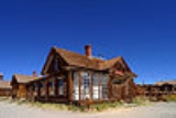
! | 4
| Mono County Courthouse
|
|
| Main St.
38°15′22"N 119°13′39"W
| Bridgeport
|
|}
National Register of Historic Places
The National Register of Historic Places is the United States government's official list of districts, sites, buildings, structures, and objects deemed worthy of preservation...
in Mono County, California
Mono County, California
Mono County is a county located in the east central portion of the U.S. state of California, to the east of the Sierra Nevada between Yosemite National Park and Nevada. As of the 2010 census, the population was 14,202, up from 12,853 at the 2000 census...
. Click the "Map of all coordinates" link to the right to view a Google map of all properties and districts with latitude and longitude coordinates in the table below.
|--
! | 4
| Mono County Courthouse
|
|
| Main St.
38°15′22"N 119°13′39"W
| Bridgeport
|
|}