

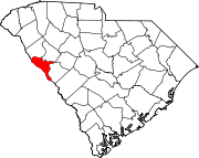
National Register of Historic Places listings in McCormick County, South Carolina
Encyclopedia
This is intended to be a complete list of the properties and districts on the National Register of Historic Places
National Register of Historic Places
The National Register of Historic Places is the United States government's official list of districts, sites, buildings, structures, and objects deemed worthy of preservation...
in McCormick County, South Carolina
South Carolina
South Carolina is a state in the Deep South of the United States that borders Georgia to the south, North Carolina to the north, and the Atlantic Ocean to the east. Originally part of the Province of Carolina, the Province of South Carolina was one of the 13 colonies that declared independence...
, United States
United States
The United States of America is a federal constitutional republic comprising fifty states and a federal district...
. The locations of National Register properties and districts for which the latitude and longitude coordinates are included below, may be seen in a Google map.
There are 20 properties and districts listed on the National Register in the county. Another property was once listed but has been removed.
Current listings
|}Former listing
| Landmark name | Image | Dates | Location | City or Town | Summary | |
|---|---|---|---|---|---|---|
| 1 | Long Cane Covered Bridge Bradley's Covered Bridge Bradley's Covered Bridge, also known as the Long Cane Covered Bridge, was a covered bridge located near Troy, South Carolina.Until its fiery destruction by vandals, the Long Cane Covered Bridge, listed in the National Register of Historic Places in 1977, was one of three covered bridges in South... |
(listed) (delisted) |
Long Cane Road 34°0′52"N 82°20′39"W |
Troy Troy, South Carolina Troy is a town in Greenwood County, South Carolina, United States. The population was 105 at the 2000 census.-Geography:Troy is located at .According to the United States Census Bureau, the town has a total area of , all of it land.... |
It burned. |
See also
- List of National Historic Landmarks in South Carolina
- National Register of Historic Places listings in South Carolina