

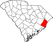
National Register of Historic Places listings in Georgetown County, South Carolina
Encyclopedia
This is intended to be a complete list of the properties and districts on the National Register of Historic Places
National Register of Historic Places
The National Register of Historic Places is the United States government's official list of districts, sites, buildings, structures, and objects deemed worthy of preservation...
in Georgetown County, South Carolina
South Carolina
South Carolina is a state in the Deep South of the United States that borders Georgia to the south, North Carolina to the north, and the Atlantic Ocean to the east. Originally part of the Province of Carolina, the Province of South Carolina was one of the 13 colonies that declared independence...
, United States
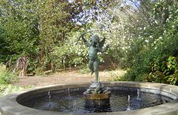
United States
The United States of America is a federal constitutional republic comprising fifty states and a federal district...
. The locations of National Register properties and districts for which the latitude and longitude coordinates are included below, may be seen in a Google map.
There are 37 properties and districts listed on the National Register in the county, including 3 National Historic Landmark
National Historic Landmark
A National Historic Landmark is a building, site, structure, object, or district, that is officially recognized by the United States government for its historical significance...
s. One of the National Historic Landmarks, Atalaya and Brookgreen Gardens
Atalaya and Brookgreen Gardens
Atalaya and Brookgreen Gardens is a historical site including the Atalaya Castle and a portion of Brookgreen Gardens, in South Carolina, United States...
, is composed of two parts that are listed on the Register separately. Another property was once listed but has been removed.
Current listings
|-! | 1
| All Saints' Episcopal Church, Waccamaw
All Saints' Episcopal Church, Waccamaw
All Saints' Episcopal Church, Waccamaw is a historic church on Pawleys Island, South Carolina.It was built in 1916 and added to the National Register in 1991....
|
|
| South Carolina Highway 255 0.2 miles north of its junction with South Carolina Highway 46
South Carolina Highway 46
South Carolina Highway 46 is a 17.2 mile state highway in Beaufort and Jasper counties in the Lowcountry region of South Carolina, connecting the rapidly growing communities of Bluffton and Hardeeville and serving as a parallel route to U.S. Highway 278.-Route description:From the eastern...
33°28′3"N 79°8′24"W
| Pawleys Island
Pawleys Island, South Carolina
Pawleys Island is a town in Georgetown County, South Carolina, United States, and the Atlantic coast barrier island on which the town sits. The population was 138 at the 2000 census...
|
|-
! | 2
| Annandale Plantation
|
|
| About 14 miles south of Georgetown between South Carolina Highways 18 and 30
South Carolina Highway 30
South Carolina Highway 30 is a long freeway in Charleston, South Carolina, United States. The freeway runs from South Carolina Highway 171 on James Island to U.S. Route 17 in downtown Charleston.- Route description :SC 30 begins at South Carolina Highway 171 on James Island, at exit 3...
33°13′1"N 79°18′10"W
| Georgetown
Georgetown, South Carolina
Georgetown is the third oldest city in the U.S. state of South Carolina and the county seat of Georgetown County, in the Low Country. Located on Winyah Bay at the confluence of the Great Pee Dee River, Waccamaw River, and Sampit River, Georgetown is the second largest seaport in South Carolina,...
|
|-
! | 3
| Arcadia Plantation
|
|
| 5 miles (8 km) east of Georgetown off U.S. Route 17
U.S. Route 17
U.S. Route 17 or U.S. Highway 17 is a north–south United States highway. The highway spans the southeastern United States and is close to the Atlantic Coast for much of its length. The highway's southern terminus is at Punta Gorda, Florida, at an intersection with U.S. Route 41...
33°23′1"N 79°13′25"W
| Georgetown
Georgetown, South Carolina
Georgetown is the third oldest city in the U.S. state of South Carolina and the county seat of Georgetown County, in the Low Country. Located on Winyah Bay at the confluence of the Great Pee Dee River, Waccamaw River, and Sampit River, Georgetown is the second largest seaport in South Carolina,...
|
|-
! | 4
| Atalaya
|
|
| Off U.S. Route 17
U.S. Route 17
U.S. Route 17 or U.S. Highway 17 is a north–south United States highway. The highway spans the southeastern United States and is close to the Atlantic Coast for much of its length. The highway's southern terminus is at Punta Gorda, Florida, at an intersection with U.S. Route 41...
33°30′50"N 79°5′7"W
| Murrells Inlet
Murrells Inlet, South Carolina
Murrells Inlet is a small fishing village in Horry County, South Carolina, United States that is considered to be the "Seafood Capital of South Carolina". The population was 5,519 at the 2000 census. It was once primarily a fishing village, but has grown substantially in modern time, along with the...
|
|-
! | 5
| Battery White
Battery White
Battery White was an artillery battery constructed by the Confederates during the American Civil War. Built in 1862–63 to defend Winyah Bay on the South Carolina coast, the battery was strongly situated and constructed; however, it was inadequately manned, and was captured without resistance...
|
|
| South of Georgetown on Belle Isle Rd.
33°18′13"N 79°17′46"W
| Georgetown
Georgetown, South Carolina
Georgetown is the third oldest city in the U.S. state of South Carolina and the county seat of Georgetown County, in the Low Country. Located on Winyah Bay at the confluence of the Great Pee Dee River, Waccamaw River, and Sampit River, Georgetown is the second largest seaport in South Carolina,...
|
|-
! | 6
| Belle Isle Rice Mill Chimney
|
|
| Cat Island
33°12′2"N 79°15′30"W
| Georgetown
Georgetown, South Carolina
Georgetown is the third oldest city in the U.S. state of South Carolina and the county seat of Georgetown County, in the Low Country. Located on Winyah Bay at the confluence of the Great Pee Dee River, Waccamaw River, and Sampit River, Georgetown is the second largest seaport in South Carolina,...
|
|-
! | 7
| Beneventum Plantation House
|
|
| Off County Road 431
33°26′43"N 79°15′39"W
| Georgetown
Georgetown, South Carolina
Georgetown is the third oldest city in the U.S. state of South Carolina and the county seat of Georgetown County, in the Low Country. Located on Winyah Bay at the confluence of the Great Pee Dee River, Waccamaw River, and Sampit River, Georgetown is the second largest seaport in South Carolina,...
|
|-
! | 8
| Black River Plantation House
|
|
| Southwestern side of South Carolina Highway 51
South Carolina Highway 51
South Carolina Highway 51 is a primary state highway in the U.S. state of South Carolina. It is unique for being signed in two different locations in the state; the first section from Georgetown to Florence, the second section in Fort Mill....
, 0.5 miles northwest of Peters Creek
33°30′37"N 79°18′1"W
| Georgetown
Georgetown, South Carolina
Georgetown is the third oldest city in the U.S. state of South Carolina and the county seat of Georgetown County, in the Low Country. Located on Winyah Bay at the confluence of the Great Pee Dee River, Waccamaw River, and Sampit River, Georgetown is the second largest seaport in South Carolina,...
|
|-
! | 9
| Brookgreen Gardens
Brookgreen Gardens
Brookgreen Gardens is a sculpture garden and wildlife preserve, located just south of Murrells Inlet, in South Carolina. The property includes several themed gardens with American figurative sculptures placed in them, the Lowcountry Zoo, and trails through several ecosystems in nature reserves on...
|
| 18 miles (28.8 km) northeast of Georgetown on U.S. Route 17
U.S. Route 17
U.S. Route 17 or U.S. Highway 17 is a north–south United States highway. The highway spans the southeastern United States and is close to the Atlantic Coast for much of its length. The highway's southern terminus is at Punta Gorda, Florida, at an intersection with U.S. Route 41...
33°31′14"N 79°5′59"W
| Georgetown
Georgetown, South Carolina
Georgetown is the third oldest city in the U.S. state of South Carolina and the county seat of Georgetown County, in the Low Country. Located on Winyah Bay at the confluence of the Great Pee Dee River, Waccamaw River, and Sampit River, Georgetown is the second largest seaport in South Carolina,...
|
|-
! | 10
| Cedar Grove Plantation Chapel
|
|
| South Carolina Highway 255, 0.2 miles north of its junction with South Carolina Highway 46
South Carolina Highway 46
South Carolina Highway 46 is a 17.2 mile state highway in Beaufort and Jasper counties in the Lowcountry region of South Carolina, connecting the rapidly growing communities of Bluffton and Hardeeville and serving as a parallel route to U.S. Highway 278.-Route description:From the eastern...
33°28′2"N 79°8′19"W
| Pawleys Island
Pawleys Island, South Carolina
Pawleys Island is a town in Georgetown County, South Carolina, United States, and the Atlantic coast barrier island on which the town sits. The population was 138 at the 2000 census...
|
|-
! | 11
| Chicora Wood Plantation
Chicora Wood Plantation
The Chicora Wood Plantation is a former rice plantation in Georgetown County, South Carolina. The plantation itself was established sometime between 1732 and 1736 and the 1819 plantation house still exists today...
|
|
| 12 miles northeast of Georgetown on County Road 52
33°31′3"N 79°10′32"W
| Georgetown
Georgetown, South Carolina
Georgetown is the third oldest city in the U.S. state of South Carolina and the county seat of Georgetown County, in the Low Country. Located on Winyah Bay at the confluence of the Great Pee Dee River, Waccamaw River, and Sampit River, Georgetown is the second largest seaport in South Carolina,...
|
|-
! | 12
| Fairfield Rice Mill Chimney
|
|
| Off U.S. Route 17
U.S. Route 17
U.S. Route 17 or U.S. Highway 17 is a north–south United States highway. The highway spans the southeastern United States and is close to the Atlantic Coast for much of its length. The highway's southern terminus is at Punta Gorda, Florida, at an intersection with U.S. Route 41...
33°23′33"N 79°13′11"W
| Georgetown
Georgetown, South Carolina
Georgetown is the third oldest city in the U.S. state of South Carolina and the county seat of Georgetown County, in the Low Country. Located on Winyah Bay at the confluence of the Great Pee Dee River, Waccamaw River, and Sampit River, Georgetown is the second largest seaport in South Carolina,...
|
|-
! | 13
| Friendfield Plantation
|
|
| Roughly bounded by U.S. Route 521
U.S. Route 521
U.S. Route 521 is an north–south United States highway that runs for from Georgetown, South Carolina to Charlotte, North Carolina.-South Carolina:...
-17A, the Sampit River
Sampit River
The Sampit River begins in a swampy area of western Georgetown County, South Carolina, USA. It flows in an easterly direction to Winyah Bay at Georgetown. Only small crafts can navigate the upper parts of the river...
, Whites Creek, and Creek Rd.
33°22′39"N 79°20′29"W
| Georgetown
Georgetown, South Carolina
Georgetown is the third oldest city in the U.S. state of South Carolina and the county seat of Georgetown County, in the Low Country. Located on Winyah Bay at the confluence of the Great Pee Dee River, Waccamaw River, and Sampit River, Georgetown is the second largest seaport in South Carolina,...
|
|-
! | 14
| Georgetown Historic District
|
|
| Along the northern side of the Sampit River
Sampit River
The Sampit River begins in a swampy area of western Georgetown County, South Carolina, USA. It flows in an easterly direction to Winyah Bay at Georgetown. Only small crafts can navigate the upper parts of the river...
33°21′58"N 79°16′51"W
| Georgetown
Georgetown, South Carolina
Georgetown is the third oldest city in the U.S. state of South Carolina and the county seat of Georgetown County, in the Low Country. Located on Winyah Bay at the confluence of the Great Pee Dee River, Waccamaw River, and Sampit River, Georgetown is the second largest seaport in South Carolina,...
|
|-
! | 15
| Georgetown Light
Georgetown Light
Georgetown Light on North Island at the entrance to Winyah Bay southeast of Georgetown, South Carolina, is an active light. The light is maintained by the U.S. Coast Guard, and the lighthouse is now under the control of State of South Carolina as part of the Tom Yawkey Wildlife Center Heritage...
house
|
|
| On North Island, about 12 miles southeast of Georgetown
33°13′20"N 79°11′7"W
| Georgetown
Georgetown, South Carolina
Georgetown is the third oldest city in the U.S. state of South Carolina and the county seat of Georgetown County, in the Low Country. Located on Winyah Bay at the confluence of the Great Pee Dee River, Waccamaw River, and Sampit River, Georgetown is the second largest seaport in South Carolina,...
|
|-
! | 16
| Hobcaw Barony
Hobcaw Barony
Hobcaw Barony, also known as Bellefield Plantation is a tract on a peninsula called Waccamaw Neck between the Winyah Bay and the Atlantic Ocean in Georgetown County, South Carolina. Much of Hobcaw Barony is south of US Highway 17. The land was purchased by the investor, philanthropist,...
|
_5a31131r.jpg)
| Roughly bounded by U.S. Route 17
U.S. Route 17
U.S. Route 17 or U.S. Highway 17 is a north–south United States highway. The highway spans the southeastern United States and is close to the Atlantic Coast for much of its length. The highway's southern terminus is at Punta Gorda, Florida, at an intersection with U.S. Route 41...
, Winyah and Mud Bays and Jones Creek
33°19′23"N 79°13′6"W
| Georgetown
Georgetown, South Carolina
Georgetown is the third oldest city in the U.S. state of South Carolina and the county seat of Georgetown County, in the Low Country. Located on Winyah Bay at the confluence of the Great Pee Dee River, Waccamaw River, and Sampit River, Georgetown is the second largest seaport in South Carolina,...
|
|-
! | 17
| Hopsewee
Hopsewee
Hopsewee Plantation, also known as Thomas Lynch, Jr., Birthplace or Hopsewee-on-the-Santee, is a house built in 1749 near Georgetown, South Carolina...
|
|
| 12 miles south of Georgetown on U.S. Route 17
U.S. Route 17
U.S. Route 17 or U.S. Highway 17 is a north–south United States highway. The highway spans the southeastern United States and is close to the Atlantic Coast for much of its length. The highway's southern terminus is at Punta Gorda, Florida, at an intersection with U.S. Route 41...
33°12′38"N 79°23′5"W
| Georgetown
Georgetown, South Carolina
Georgetown is the third oldest city in the U.S. state of South Carolina and the county seat of Georgetown County, in the Low Country. Located on Winyah Bay at the confluence of the Great Pee Dee River, Waccamaw River, and Sampit River, Georgetown is the second largest seaport in South Carolina,...
|
|-
! | 18
| Keithfield Plantation
|
|
| Off County Road 52
33°26′21"N 79°14′31"W
| Georgetown
Georgetown, South Carolina
Georgetown is the third oldest city in the U.S. state of South Carolina and the county seat of Georgetown County, in the Low Country. Located on Winyah Bay at the confluence of the Great Pee Dee River, Waccamaw River, and Sampit River, Georgetown is the second largest seaport in South Carolina,...
|
|-
! | 19
| Mansfield Plantation
Mansfield Plantation
Mansfield Plantation is a well-preserved antebellum rice plantation, established in 1718 on the banks of the Black River in historic Georgetown, South Carolina, U.S. Spanning nearly of pine forest, rice fields and cypress swamps, Mansfield Plantation was once one of the largest rice producing...
|

| 5 miles north of Georgetown off U.S. Route 701
U.S. Route 701
U.S. Route 701 is a spur of U.S. Route 1, although the two routes never intersect. However, using U.S. Route 301 or U.S. Route 501 would connect to U.S. Route 1. It runs 172 miles from Four Oaks, North Carolina at U.S. Route 301 to Georgetown, South Carolina at U.S. Route 17. It passes through...
33°26′5"N 79°15′33"W
| Georgetown
Georgetown, South Carolina
Georgetown is the third oldest city in the U.S. state of South Carolina and the county seat of Georgetown County, in the Low Country. Located on Winyah Bay at the confluence of the Great Pee Dee River, Waccamaw River, and Sampit River, Georgetown is the second largest seaport in South Carolina,...
|
|-
! | 20
| Milldam Rice Mill and Rice Barn
|
|
| Off County Road 30
33°12′9"N 79°19′58"W
| Georgetown
Georgetown, South Carolina
Georgetown is the third oldest city in the U.S. state of South Carolina and the county seat of Georgetown County, in the Low Country. Located on Winyah Bay at the confluence of the Great Pee Dee River, Waccamaw River, and Sampit River, Georgetown is the second largest seaport in South Carolina,...
|
|-
! | 21
| Minim Island Shell Midden (38GE46)
|
|
| Address Restricted
| Georgetown
Georgetown, South Carolina
Georgetown is the third oldest city in the U.S. state of South Carolina and the county seat of Georgetown County, in the Low Country. Located on Winyah Bay at the confluence of the Great Pee Dee River, Waccamaw River, and Sampit River, Georgetown is the second largest seaport in South Carolina,...
|
|-
! | 22
| Murrells Inlet Historic District
|
|
| Off U.S. Route 17
U.S. Route 17
U.S. Route 17 or U.S. Highway 17 is a north–south United States highway. The highway spans the southeastern United States and is close to the Atlantic Coast for much of its length. The highway's southern terminus is at Punta Gorda, Florida, at an intersection with U.S. Route 41...
33°33′44"N 79°1′14"W
| Murrells Inlet
Murrells Inlet, South Carolina
Murrells Inlet is a small fishing village in Horry County, South Carolina, United States that is considered to be the "Seafood Capital of South Carolina". The population was 5,519 at the 2000 census. It was once primarily a fishing village, but has grown substantially in modern time, along with the...
|
|-
! | 23
| Nightingale Hall Rice Mill Chimney
|
|
| Off County Road 52
33°26′46"N 79°12′46"W
| Georgetown
Georgetown, South Carolina
Georgetown is the third oldest city in the U.S. state of South Carolina and the county seat of Georgetown County, in the Low Country. Located on Winyah Bay at the confluence of the Great Pee Dee River, Waccamaw River, and Sampit River, Georgetown is the second largest seaport in South Carolina,...
|
|-
! | 24
| Old Market Building
|
|
| Front and Screven Sts.
33°21′56"N 79°16′57"W
| Georgetown
Georgetown, South Carolina
Georgetown is the third oldest city in the U.S. state of South Carolina and the county seat of Georgetown County, in the Low Country. Located on Winyah Bay at the confluence of the Great Pee Dee River, Waccamaw River, and Sampit River, Georgetown is the second largest seaport in South Carolina,...
|
|-
! | 25
| Pawleys Island Historic District
|
|
| Western side of Pawleys Island
33°25′26"N 79°7′50"W
| Pawleys Island
Pawleys Island, South Carolina
Pawleys Island is a town in Georgetown County, South Carolina, United States, and the Atlantic coast barrier island on which the town sits. The population was 138 at the 2000 census...
|
|-
! | 26
| Pee Dee River Rice Planters Historic District
|
|
| Along the Pee Dee
Pee Dee River
The Pee Dee River, also known as the Great Pee Dee River, is a river in North Carolina and South Carolina. It originates in the Appalachian Mountains in North Carolina, where its upper course above the mouth of the Uwharrie River is known as the Yadkin River. It is extensively dammed for flood...
and Waccamaw
Waccamaw River
The Waccamaw River is a river, approximately 140 miles long, in southeastern North Carolina and eastern South Carolina in the United States. It drains an area of approximately 1110 square miles in the coastal plain along the eastern border between the two states into the Atlantic Ocean...
Rivers
33°30′13"N 79°10′11"W
| Georgetown
Georgetown, South Carolina
Georgetown is the third oldest city in the U.S. state of South Carolina and the county seat of Georgetown County, in the Low Country. Located on Winyah Bay at the confluence of the Great Pee Dee River, Waccamaw River, and Sampit River, Georgetown is the second largest seaport in South Carolina,...
|
|-
! | 27
| Pleasant Hill Consolidated School
|
|
| 11957 Pleasant Hill Dr.
33°40′44"N 79°22′7"W
| Hemingway
Hemingway, South Carolina
Hemingway is a town in Williamsburg County, South Carolina. The population was 573 at the 2000 census.- Historical Sketch :Hemingway was created from a crossroads community named Lamberts in 1911 by Dr. W. C. Hemingway, in an effort to secure a depot for the proposed Seaboard Air Line Railroad,...
|
|-
! | 28
| Prince Frederick's Chapel Ruins
Prince Frederick's Chapel Ruins
Prince Frederick's Chapel Ruins is a historic site in Plantersville, South Carolina.It was built in 1859 and added to the National Register in 1974....
|
|
| Southeast of Plantersville on County Road 52
33°30′20"N 79°10′49"W
| Plantersville
Plantersville, South Carolina
Plantersville is an unincorporated community in Georgetown County, South Carolina, United States. The community is also growing in population. It is 6 miles north Georgetown on U.S. Route 701. Plantersville is home to many plantations and rice fields. Plantersville Elementary School is also...
|
|-
! | 29
| Prince George Winyah Church (Episcopal) and Cemetery
Prince George Winyah Episcopal Church
Prince George Winyah Church is an Episcopal church in Georgetown, South Carolina. Prince George Winyah is one of the oldest continuous congregations in South Carolina, and the church building is one of the oldest churches in continuous service in South Carolina...
|
|
| Corner of Broad and Highmarket Sts.
33°22′8"N 79°16′49"W
| Georgetown
Georgetown, South Carolina
Georgetown is the third oldest city in the U.S. state of South Carolina and the county seat of Georgetown County, in the Low Country. Located on Winyah Bay at the confluence of the Great Pee Dee River, Waccamaw River, and Sampit River, Georgetown is the second largest seaport in South Carolina,...
|
|-
! | 30
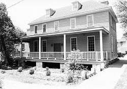
| Joseph H. Rainey House
Joseph H. Rainey House
Joseph H. Rainey House, also known as Rainey-Camlin House, was the Georgetown, South Carolina home of the first black United States Congressman, Joseph H. Rainey, a former slave.-Rainey:...
|
| 909 Prince St.
33°22′8"N 79°17′5"W
| Georgetown
Georgetown, South Carolina
Georgetown is the third oldest city in the U.S. state of South Carolina and the county seat of Georgetown County, in the Low Country. Located on Winyah Bay at the confluence of the Great Pee Dee River, Waccamaw River, and Sampit River, Georgetown is the second largest seaport in South Carolina,...
|
|-
! | 31
| Richmond Hill Plantation Archeological Sites
|
|
| Address Restricted
| Murrells Inlet
Murrells Inlet, South Carolina
Murrells Inlet is a small fishing village in Horry County, South Carolina, United States that is considered to be the "Seafood Capital of South Carolina". The population was 5,519 at the 2000 census. It was once primarily a fishing village, but has grown substantially in modern time, along with the...
|
|-
! | 32
| Rural Hall Plantation House
|
|
| Off County Road 179
33°30′46"N 79°20′40"W
| Georgetown
Georgetown, South Carolina
Georgetown is the third oldest city in the U.S. state of South Carolina and the county seat of Georgetown County, in the Low Country. Located on Winyah Bay at the confluence of the Great Pee Dee River, Waccamaw River, and Sampit River, Georgetown is the second largest seaport in South Carolina,...
|
|-
! | 33
| Summer Chapel Rectory, Prince Frederick's Episcopal Church
Summer Chapel Rectory, Prince Frederick's Episcopal Church
Summer Chapel Rectory, Prince Frederick's Episcopal Church is a historic church on CR 52 in Plantersville, South Carolina.It was added to the National Register in 1988....
|
|
| County Road 52
33°33′18"N 79°12′53"W
| Plantersville
Plantersville, South Carolina
Plantersville is an unincorporated community in Georgetown County, South Carolina, United States. The community is also growing in population. It is 6 miles north Georgetown on U.S. Route 701. Plantersville is home to many plantations and rice fields. Plantersville Elementary School is also...
|
|-
! | 34
| Summer Chapel, Prince Frederick's Episcopal Church
Summer Chapel, Prince Frederick's Episcopal Church
Summer Chapel, Prince Frederick's Episcopal Church is a historic church on CR 52 in Plantersville, South Carolina.It was built in 1877 and added to the National Register in 1988....
|
|
| County Road 52
33°33′17"N 79°12′42"W
| Plantersville
Plantersville, South Carolina
Plantersville is an unincorporated community in Georgetown County, South Carolina, United States. The community is also growing in population. It is 6 miles north Georgetown on U.S. Route 701. Plantersville is home to many plantations and rice fields. Plantersville Elementary School is also...
|
|-
! | 35
| Weehaw Rice Mill Chimney
|
|
| Off County Road 325
33°24′18"N 79°16′4"W
| Georgetown
Georgetown, South Carolina
Georgetown is the third oldest city in the U.S. state of South Carolina and the county seat of Georgetown County, in the Low Country. Located on Winyah Bay at the confluence of the Great Pee Dee River, Waccamaw River, and Sampit River, Georgetown is the second largest seaport in South Carolina,...
|
|-
! | 36
| Wicklow Hall Plantation
|
|
| South of Georgetown on South Carolina Highway 30
South Carolina Highway 30
South Carolina Highway 30 is a long freeway in Charleston, South Carolina, United States. The freeway runs from South Carolina Highway 171 on James Island to U.S. Route 17 in downtown Charleston.- Route description :SC 30 begins at South Carolina Highway 171 on James Island, at exit 3...
33°12′50"N 79°18′56"W
| Georgetown
Georgetown, South Carolina
Georgetown is the third oldest city in the U.S. state of South Carolina and the county seat of Georgetown County, in the Low Country. Located on Winyah Bay at the confluence of the Great Pee Dee River, Waccamaw River, and Sampit River, Georgetown is the second largest seaport in South Carolina,...
|
|-
! | 37
| Winyah Indigo School
|
|
| 1200 Highmarket St.
33°22′22"N 79°17′11"W
| Georgetown
Georgetown, South Carolina
Georgetown is the third oldest city in the U.S. state of South Carolina and the county seat of Georgetown County, in the Low Country. Located on Winyah Bay at the confluence of the Great Pee Dee River, Waccamaw River, and Sampit River, Georgetown is the second largest seaport in South Carolina,...
|
|}
Former listing
| Landmark name | Image | Dates | Location | City or Town | Summary | |
|---|---|---|---|---|---|---|
| 1 | China Grove | (delisted) | It burned. |
See also
- List of National Historic Landmarks in South Carolina
- National Register of Historic Places listings in South Carolina