
Moro, Oregon
Encyclopedia
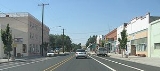
Moro is a city in Sherman County
, Oregon
, United States
. The population was 337 at the 2000 census. It is the county seat
of Sherman County
(the smallest county seat in Oregon). Moro was incorporated on February 17, 1899, by the Oregon Legislative Assembly
.
, the city has a total area of 0.5 square miles (1.3 km²), all land.
of 2000, there were 337 people, 133 households, and 94 families residing in the city. The population density
was 696.4 people per square mile (271.1/km²). There were 150 housing units at an average density of 310.0 per square mile (120.7/km²). The racial makeup of the city was 92.58% White, 1.19% African American, 1.19% Native American, 0.30% Asian, 3.26% from other races
, and 1.48% from two or more races. Hispanic or Latino of any race were 5.34% of the population.
There were 133 households out of which 35.3% had children under the age of 18 living with them, 52.6% were married couples
living together, 15.0% had a female householder with no husband present, and 29.3% were non-families. 27.1% of all households were made up of individuals and 16.5% had someone living alone who was 65 years of age or older. The average household size was 2.53 and the average family size was 3.10.
In the city the population was spread out with 30.9% under the age of 18, 6.5% from 18 to 24, 22.3% from 25 to 44, 23.1% from 45 to 64, and 17.2% who were 65 years of age or older. The median age was 40 years. For every 100 females there were 97.1 males. For every 100 females age 18 and over, there were 94.2 males.
The median income for a household in the city was $35,625, and the median income for a family was $40,625. Males had a median income of $35,313 versus $15,417 for females. The per capita income
for the city was $14,887. About 14.7% of families and 16.8% of the population were below the poverty line, including 19.0% of those under age 18 and 9.8% of those age 65 or over.
Sherman County, Oregon
Sherman County is a county located in the U.S. state of Oregon. The county is named for William Tecumseh Sherman, a Union general in the American Civil War. In 2010, its population was 1,765. The seat of the county is Moro. The largest city is Wasco....
, Oregon
Oregon
Oregon is a state in the Pacific Northwest region of the United States. It is located on the Pacific coast, with Washington to the north, California to the south, Nevada on the southeast and Idaho to the east. The Columbia and Snake rivers delineate much of Oregon's northern and eastern...
, United States
United States
The United States of America is a federal constitutional republic comprising fifty states and a federal district...
. The population was 337 at the 2000 census. It is the county seat
County seat
A county seat is an administrative center, or seat of government, for a county or civil parish. The term is primarily used in the United States....
of Sherman County
Sherman County, Oregon
Sherman County is a county located in the U.S. state of Oregon. The county is named for William Tecumseh Sherman, a Union general in the American Civil War. In 2010, its population was 1,765. The seat of the county is Moro. The largest city is Wasco....
(the smallest county seat in Oregon). Moro was incorporated on February 17, 1899, by the Oregon Legislative Assembly
Oregon Legislative Assembly
The Oregon Legislative Assembly is the state legislature for the U.S. state of Oregon. The Legislative Assembly is bicameral, consisting of an upper and lower house: the Senate, whose 30 members are elected to serve four-year terms; and the House of Representatives, with 60 members elected to...
.
Geography
According to the United States Census BureauUnited States Census Bureau
The United States Census Bureau is the government agency that is responsible for the United States Census. It also gathers other national demographic and economic data...
, the city has a total area of 0.5 square miles (1.3 km²), all land.
Demographics
As of the censusCensus
A census is the procedure of systematically acquiring and recording information about the members of a given population. It is a regularly occurring and official count of a particular population. The term is used mostly in connection with national population and housing censuses; other common...
of 2000, there were 337 people, 133 households, and 94 families residing in the city. The population density
Population density
Population density is a measurement of population per unit area or unit volume. It is frequently applied to living organisms, and particularly to humans...
was 696.4 people per square mile (271.1/km²). There were 150 housing units at an average density of 310.0 per square mile (120.7/km²). The racial makeup of the city was 92.58% White, 1.19% African American, 1.19% Native American, 0.30% Asian, 3.26% from other races
Race (United States Census)
Race and ethnicity in the United States Census, as defined by the Federal Office of Management and Budget and the United States Census Bureau, are self-identification data items in which residents choose the race or races with which they most closely identify, and indicate whether or not they are...
, and 1.48% from two or more races. Hispanic or Latino of any race were 5.34% of the population.
There were 133 households out of which 35.3% had children under the age of 18 living with them, 52.6% were married couples
Marriage
Marriage is a social union or legal contract between people that creates kinship. It is an institution in which interpersonal relationships, usually intimate and sexual, are acknowledged in a variety of ways, depending on the culture or subculture in which it is found...
living together, 15.0% had a female householder with no husband present, and 29.3% were non-families. 27.1% of all households were made up of individuals and 16.5% had someone living alone who was 65 years of age or older. The average household size was 2.53 and the average family size was 3.10.
In the city the population was spread out with 30.9% under the age of 18, 6.5% from 18 to 24, 22.3% from 25 to 44, 23.1% from 45 to 64, and 17.2% who were 65 years of age or older. The median age was 40 years. For every 100 females there were 97.1 males. For every 100 females age 18 and over, there were 94.2 males.
The median income for a household in the city was $35,625, and the median income for a family was $40,625. Males had a median income of $35,313 versus $15,417 for females. The per capita income
Per capita income
Per capita income or income per person is a measure of mean income within an economic aggregate, such as a country or city. It is calculated by taking a measure of all sources of income in the aggregate and dividing it by the total population...
for the city was $14,887. About 14.7% of families and 16.8% of the population were below the poverty line, including 19.0% of those under age 18 and 9.8% of those age 65 or over.