
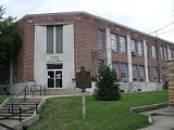
Monticello, Kentucky
Overview
Monticello is a city in Wayne County
, Kentucky
, United States
. The population was 5,981 at the 2000 census. It is the county seat
of Wayne County
. It advertises itself as "The Houseboat Capital of the World" due to the large number of houseboat
manufacturers in the city. The city sits next to Lake Cumberland
, and much of its economy is built on servicing the recreational and tourist traffic to the lake.
Monticello is located at 36°50′17"N 84°51′0"W (36.838194, -84.850022).
According to the United States Census Bureau
, the city has a total area of 6.1 square miles (15.8 km²), all of it land.
As of the census
of 2000, there were 5,981 people, 2,508 households, and 1,635 families residing in the city.
Wayne County, Kentucky
Wayne County is a county located in the U.S. state of Kentucky. As of 2000, the population was 19,923. Its county seat is Monticello. The county was named for Gen. Anthony Wayne. It is a prohibition or dry county.-History:...
, Kentucky
Kentucky
The Commonwealth of Kentucky is a state located in the East Central United States of America. As classified by the United States Census Bureau, Kentucky is a Southern state, more specifically in the East South Central region. Kentucky is one of four U.S. states constituted as a commonwealth...
, United States
United States
The United States of America is a federal constitutional republic comprising fifty states and a federal district...
. The population was 5,981 at the 2000 census. It is the county seat
County seat
A county seat is an administrative center, or seat of government, for a county or civil parish. The term is primarily used in the United States....
of Wayne County
Wayne County, Kentucky
Wayne County is a county located in the U.S. state of Kentucky. As of 2000, the population was 19,923. Its county seat is Monticello. The county was named for Gen. Anthony Wayne. It is a prohibition or dry county.-History:...
. It advertises itself as "The Houseboat Capital of the World" due to the large number of houseboat
Houseboat
A houseboat is a boat that has been designed or modified to be used primarily as a human dwelling. Some houseboats are not motorized, because they are usually moored, kept stationary at a fixed point and often tethered to land to provide utilities...
manufacturers in the city. The city sits next to Lake Cumberland
Lake Cumberland
Lake Cumberland is a reservoir in Clinton, Laurel, McCreary, Pulaski, Russell, and Wayne counties in Kentucky. The primary reasons for its construction were a means for flood control and the production of hydroelectric power. Its shoreline measures 1,255 miles and the lake is spread over at the...
, and much of its economy is built on servicing the recreational and tourist traffic to the lake.
Monticello is located at 36°50′17"N 84°51′0"W (36.838194, -84.850022).
According to the United States Census Bureau
United States Census Bureau
The United States Census Bureau is the government agency that is responsible for the United States Census. It also gathers other national demographic and economic data...
, the city has a total area of 6.1 square miles (15.8 km²), all of it land.
As of the census
Census
A census is the procedure of systematically acquiring and recording information about the members of a given population. It is a regularly occurring and official count of a particular population. The term is used mostly in connection with national population and housing censuses; other common...
of 2000, there were 5,981 people, 2,508 households, and 1,635 families residing in the city.