
Montana Highway 83
Encyclopedia
Highway 83 in the U.S. State
of Montana
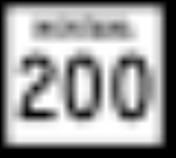
is a route running northerly from an intersection with Montana Highway 200
at Clearwater Junction, about 40 miles (64.4 km) east of Missoula
. The route extends some 91 miles (146.4 km), mostly through broad, forested valleys and along scenic lakeshores, before ending at an intersection with Montana Highway 35 about 3 miles (4.8 km) north of the town of Bigfork
. The region is sparsely settled, with small communities economically dependent on a mixture of logging and tourism. The largest community along the route is Seeley Lake
, about 15 miles (24.1 km) north of Clearwater Junction.
Before receiving its current designation, the southerly 84 miles (135.2 km) of Highway 83 were a part of Montana Secondary Highway 209, and the northernmost 7 miles (11.3 km) were designated as Secondary Highway 326. A small segment of Secondary 209 survives under its original designation, between Bigfork and a junction with the current Highway 83 near Ferndale. (The Secondary 326 designation was later reused on an unrelated highway in southeastern Carter County, Montana
.)
U.S. state
A U.S. state is any one of the 50 federated states of the United States of America that share sovereignty with the federal government. Because of this shared sovereignty, an American is a citizen both of the federal entity and of his or her state of domicile. Four states use the official title of...
of Montana
Montana
Montana is a state in the Western United States. The western third of Montana contains numerous mountain ranges. Smaller, "island ranges" are found in the central third of the state, for a total of 77 named ranges of the Rocky Mountains. This geographical fact is reflected in the state's name,...
is a route running northerly from an intersection with Montana Highway 200
Montana Highway 200
Highway 200 in the U.S. State of Montana is a route running westerly covering the entire state of Montana, from the starting point of ND 200 near Fairview, Montana to ID 200, near Heron, Montana...
at Clearwater Junction, about 40 miles (64.4 km) east of Missoula
Missoula, Montana
Missoula is a city located in western Montana and is the county seat of Missoula County. The 2010 Census put the population of Missoula at 66,788 and the population of Missoula County at 109,299. Missoula is the principal city of the Missoula Metropolitan Area...
. The route extends some 91 miles (146.4 km), mostly through broad, forested valleys and along scenic lakeshores, before ending at an intersection with Montana Highway 35 about 3 miles (4.8 km) north of the town of Bigfork
Bigfork, Montana
Bigfork is a census-designated place in Flathead County, Montana, United States. The population was 1,421 at the 2000 census.-Geography:Bigfork is located at ....
. The region is sparsely settled, with small communities economically dependent on a mixture of logging and tourism. The largest community along the route is Seeley Lake
Seeley Lake, Montana
Seeley Lake is a census-designated place in Missoula County, Montana, United States. It is part of the 'Missoula, Montana Metropolitan Statistical Area'...
, about 15 miles (24.1 km) north of Clearwater Junction.
Before receiving its current designation, the southerly 84 miles (135.2 km) of Highway 83 were a part of Montana Secondary Highway 209, and the northernmost 7 miles (11.3 km) were designated as Secondary Highway 326. A small segment of Secondary 209 survives under its original designation, between Bigfork and a junction with the current Highway 83 near Ferndale. (The Secondary 326 designation was later reused on an unrelated highway in southeastern Carter County, Montana
Carter County, Montana
-Demographics:As of the census of 2000, there were 1,360 people, 543 households, and 382 families residing in the county. The population density was -Demographics:...
.)