
Mineiros do Tietê
Encyclopedia
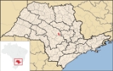
Mineiros do Tietê is a municipality in the state of São Paulo
in Brazil
, located at 22º24'34" S latitude
and 48º27'02" W longitude
, at an altitude of 669 meters. The estimated population in 2004 is 12,407 and the area is 212.44 km². It is situated in the center of the state of São Paulo, near the following cities: Dois Córregos
(9 km), Barra Bonita
(13 km), Jaú
(18 km), São Manuel
(45 km), Torrinha
(35 km), Igaraçu do Tietê
(15 km), Lençois Paulista
(46 km), Pederneiras
(45 km) and Bauru
(82 km).
s of land to the Catholic Church for a diocese, and to build a chapel.
On January 17, 1891, this diocese and chapel were elevated to the status of District of Peace for the town of Dois Córregos.
On August 29, 1898, State Law number 581 was passed, elevating the town to the status of Municipality with the name of Mineiros, and electing a City Council, Mayor and other administrators.
In 1944, after a local election, the name was changed to Mineiros do Tietê, named after the local Tietê River
, because there was another town named Mineiros
in the neighboring state of Goiás
.
São Paulo (state)
São Paulo is a state in Brazil. It is the major industrial and economic powerhouse of the Brazilian economy. Named after Saint Paul, São Paulo has the largest population, industrial complex, and economic production in the country. It is the richest state in Brazil...
in Brazil
Brazil
Brazil , officially the Federative Republic of Brazil , is the largest country in South America. It is the world's fifth largest country, both by geographical area and by population with over 192 million people...
, located at 22º24'34" S latitude
Latitude
In geography, the latitude of a location on the Earth is the angular distance of that location south or north of the Equator. The latitude is an angle, and is usually measured in degrees . The equator has a latitude of 0°, the North pole has a latitude of 90° north , and the South pole has a...
and 48º27'02" W longitude
Longitude
Longitude is a geographic coordinate that specifies the east-west position of a point on the Earth's surface. It is an angular measurement, usually expressed in degrees, minutes and seconds, and denoted by the Greek letter lambda ....
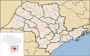
, at an altitude of 669 meters. The estimated population in 2004 is 12,407 and the area is 212.44 km². It is situated in the center of the state of São Paulo, near the following cities: Dois Córregos
Dois Córregos
Dois Córregos is a municipality in the state of São Paulo in Brazil. The population in 2004 is 24,412 and the area is 634.25 km². The elevation is 673 m....
(9 km), Barra Bonita
Barra Bonita
Barra Bonita is a municipality in the state of São Paulo in Brazil. The population in 2003 is 37,871 and the area is 150.56 km². The elevation is 457 m....
(13 km), Jaú
Jaú
Jaú is a municipality in the center of the state of São Paulo, in Brazil. The population in 2008 was 133,333 and the area is 690.18 km². The elevation is 522 m...
(18 km), São Manuel
São Manuel
São Manuel is a municipality in the state of São Paulo in Brazil. The population in 2007 was 37,797 and the area is 652.72 km². The elevation is 709 m.-People from São Manuel:* Alice Sommerlath , mother of Queen Silvia of Sweden....
(45 km), Torrinha
Torrinha
Torrinha is a municipality in the state of São Paulo in Brazil. The population in 2004 was 9,521. The elevation is 802 m.-History:The occupation and settlements where today is located in the municipality of Torrinha, have been shaped by the advancement of frontiers of colonization towards interior...
(35 km), Igaraçu do Tietê
Igaraçu do Tietê
Igaraçu do Tietê is a municipality in the state of São Paulo in Brazil. The population in 2004 is 23,509 and the area is 96.851 km². The elevation is 498 m. This place name comes from the Tupi language....
(15 km), Lençois Paulista
Lençóis Paulista
Lençóis Paulista is a municipality/county in the Central West region of the state of São Paulo. The estimated population in 2010 is 70,331 and the area is 805.8 km²...
(46 km), Pederneiras
Pederneiras
Pederneiras is a municipality in the state of São Paulo in Brazil. The population in 2010 according to is 41,497 people and the total area is 729 km². The elevation is 475 m.- History :* Foundation: May 22nd, 1891...
(45 km) and Bauru
Bauru
Bauru is a Brazilian city and municipality in midwestern region of the state of São Paulo. It is also the capital of the micro-region of Bauru...
(82 km).
History
The city was founded in 1840, when many tropical convoys left the mining towns of Caldas Novas, Santana do Sapucai and Alfenas with the objective of taking undeveloped lands. The same happened with the neighboring towns of Jaú, Brotas and Dois Córregos. A town was formed in the area, known as the Miners' Barrio. In 1875, after legalizing his properties, Vicente Valério dos Santos donated 4 alqueireAlqueire
The alqueire is a measure of land used in Brazil and Portugal.Several regional versions of the measurement exist:The alqueire was also an old Portuguese measure of capacity which varied between 13 and 22 litres. It was generally used for grain....
s of land to the Catholic Church for a diocese, and to build a chapel.
On January 17, 1891, this diocese and chapel were elevated to the status of District of Peace for the town of Dois Córregos.
On August 29, 1898, State Law number 581 was passed, elevating the town to the status of Municipality with the name of Mineiros, and electing a City Council, Mayor and other administrators.
In 1944, after a local election, the name was changed to Mineiros do Tietê, named after the local Tietê River
Tietê River
The Tietê River is a Brazilian river in the state of São Paulo.The source is in Salesópolis in the Serra do Mar, at 1,120 m altitude...
, because there was another town named Mineiros
Mineiros
Mineiros is a city in the southwest of the state of Goiás, Brazil. Mineiros is the westernmost city in Goiás and a great producer of cattle, soybeans, and corn....
in the neighboring state of Goiás
Goiás
Goiás is a state of Brazil, located in the central part of the country. The name Goiás comes from the name of an indigenous community...
.