
Mexican Federal Highway 34
Encyclopedia
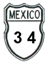
Mexican Federal Highway 34 (Carretera Federal 34, locally as Carretera Rodeo-Nazas and Carretera Nazas-Cuatillos) is a Federal Highway of Mexico
. The highway starts in the west about 5 km (3.1 mi) south of Rodeo, Durango
along Mexican Federal Highway 45
and travels east then northeast towards the city of Nazas
. From Nazas, the highway travels east until just before it reaches the western portion of Presa Francisco Zarco lake; from there, the highway travels southeast, traversing Mexican Federal Highway 40
and ending in Velardeña.http://www.bing.com/maps/default.aspxhttp://maps.google.com/ The total distance of Mexican Federal Highway is 102.7 km (63.8 mi). http://mapper.acme.com/http://espanol.maps.yahoo.com/#mvt=m&lat=25.165895&lon=-104.137505&zoom=10&q1=N%2025.12912%20W%20104.53697&q2=N%2025.06982%20W%20103.73506
Mexico
The United Mexican States , commonly known as Mexico , is a federal constitutional republic in North America. It is bordered on the north by the United States; on the south and west by the Pacific Ocean; on the southeast by Guatemala, Belize, and the Caribbean Sea; and on the east by the Gulf of...
. The highway starts in the west about 5 km (3.1 mi) south of Rodeo, Durango
Rodeo, Durango
Rodeo is a city and seat of the municipality of Rodeo, in the state of Durango, north-western Mexico....
along Mexican Federal Highway 45
Mexican Federal Highway 45
Mexican Federal Highway 45 connects Ciudad Juárez, Chihuahua, to Panales, Hidalgo.It is located in the north of Mexico connecting Portezuelo in Hidalgo to Ciudad Juárez in Chihuahua...
and travels east then northeast towards the city of Nazas
Nazas
Nazas is a city and seat of the municipality of Nazas, in the state of Durango, north-western Mexico....
. From Nazas, the highway travels east until just before it reaches the western portion of Presa Francisco Zarco lake; from there, the highway travels southeast, traversing Mexican Federal Highway 40
Mexican Federal Highway 40
Mexican Federal Highway 40, also called the "Carretera Interoceánica" is a road beginning at Reynosa, Tamaulipas, and ending at Mazatlán, Sinaloa, at the Pacific coast...
and ending in Velardeña.http://www.bing.com/maps/default.aspxhttp://maps.google.com/ The total distance of Mexican Federal Highway is 102.7 km (63.8 mi). http://mapper.acme.com/http://espanol.maps.yahoo.com/#mvt=m&lat=25.165895&lon=-104.137505&zoom=10&q1=N%2025.12912%20W%20104.53697&q2=N%2025.06982%20W%20103.73506