

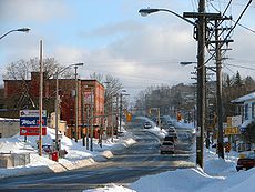
Merivale Road (Ottawa)
Encyclopedia
Ottawa
Ottawa is the capital of Canada, the second largest city in the Province of Ontario, and the fourth largest city in the country. The city is located on the south bank of the Ottawa River in the eastern portion of Southern Ontario...
, Ontario
Ontario
Ontario is a province of Canada, located in east-central Canada. It is Canada's most populous province and second largest in total area. It is home to the nation's most populous city, Toronto, and the nation's capital, Ottawa....
, Canada
Canada
Canada is a North American country consisting of ten provinces and three territories. Located in the northern part of the continent, it extends from the Atlantic Ocean in the east to the Pacific Ocean in the west, and northward into the Arctic Ocean...
. It starts at Island Park Drive
Island Park Drive
Island Park Drive is a short, but important and scenic, north-south street in Ottawa, Ontario, Canada. It is one of several parkways in Ottawa administered by the National Capital Commission providing scenic routes throughout Canada's capital region....
just north of Highway 417
Highway 417 (Ontario)
King's Highway 417, also known as Highway 417 and the Queensway through Ottawa is a 400-series highways in the Canadian province of Ontario which connects Montreal with Ottawa. It is the backbone of the transportation system in the Ottawa region, where it forms part of the Queensway along with...
and continues south until it ends at Prince of Wales Drive
Prince of Wales Drive (Ottawa)
Prince of Wales Drive is a road serving Ottawa, Ontario, named after the eponymous road in Battersea, London, U.K. The northern section is a low-speed street running along the west bank of the Rideau River, while southern portions of the road were formerly Highway 16 .Prince of Wales Drive is the...
in Rideau Glen. South of Clyde Avenue, Merivale is known as Ottawa Road #17, while north of Clyde it is Ottawa Road #63.
From Island Park Drive to Carling Avenue
Carling Avenue
Carling Avenue is a major east-west arterial road in the west end of Ottawa, Ontario, Canada. It runs from March Road in Kanata to Bronson Avenue in the Glebe...
the road is as a small collector route, passing the Westgate Shopping Centre
Westgate Shopping Centre
Westgate Shopping Centre may refer to:* A shopping centre in Horizon View, Johannesburg.* Westgate Shopping Centre in Oxford, England.* Westgate Shopping Centre In Ottawa, Ontario...
. South of Carling Avenue it is a minor arterial road
Arterial road
An arterial road, or arterial thoroughfare, is a high-capacity urban road. The primary function of an arterial road is to deliver traffic from collector roads to freeways, and between urban centres at the highest level of service possible. As such, many arteries are limited-access roads, or feature...
that goes through the Carlington
Carlington
Carlington is a residential neighbourhood in the city of Ottawa, Ontario, Canada. It had a population of 12,585 in 2001, which dropped to 10,107 in 2006...
residential neighborhood. It passes just west of the Central Experimental Farm
Central Experimental Farm
The Central Experimental Farm is an agricultural facility, working farm, and research centre of the Research Branch of Agriculture and Agri-Food Canada. As the name indicates, this farm is centrally located in and completely surrounded by the City of Ottawa, Ontario, Canada...
, land owned by the federal Government of Canada
Government of Canada
The Government of Canada, formally Her Majesty's Government, is the system whereby the federation of Canada is administered by a common authority; in Canadian English, the term can mean either the collective set of institutions or specifically the Queen-in-Council...
.
South of Baseline Road
Baseline Road (Ottawa)
Baseline Road is a road in Ottawa, Ontario, Canada.Baseline runs from Richmond Road east in a straight line until it ends at the Heron Road Bridge over the Rideau River and Rideau Canal when it becomes Heron Road. Before the 2001 City of Ottawa amalgamation, Baseline formed the border of the city...
, Merivale Road turns (it is actually the continuation of Clyde Avenue and Maitland Avenue
Maitland Avenue (Ottawa)
Maitland Avenue is a secondary arterial road in Ottawa, Ontario, Canada. Maitland Avenue runs from Carling Avenue in the north to Clyde Avenue in the south, 4 lanes for its entire length...
) and becomes a major arterial route through a commercial district that contains several major malls, dozens of restaurants and radio and CTV broadcast facilities (CJOH-TV
CJOH-TV
CJOH-DT is a television station serving Ottawa, Ontario, Canada, and the surrounding region. Owned by Bell Media, it is part of the CTV Television Network....
, though this last was badly damaged by fire in 2010). During the 1950s through the 1990s prior to the City of Nepean
Nepean
-People:* Augustus Nepean , Middlesex county cricketer* Charles Nepean , Middlesex county cricketer and Oxford University footballer* Evan Nepean , British politician and colonial administrator...
's amalgamation with the city of Ottawa, this area of Merivale Road formed the largest commercial shopping district within the city of Nepean and a major shopping area for the National Capital region. During the 1950s and 1960s several major box stores, such as Towers, Miracle Mart
Miracle Mart
Miracle Mart may refer to:*Miracle Mart , a former discount department store in Quebec and Ontario*Miracle Mart , a chain of supermarkets in North Dakota...
, Pascals, and Kmart
Kmart
Kmart, sometimes styled as "K-Mart," is a chain of discount department stores. The chain acquired Sears in 2005, forming a new corporation under the name Sears Holdings Corporation. The company was founded in 1962 and is the third largest discount store chain in the world, behind Wal-Mart and...
, were located along Merivale Road along with major Canadian grocery chains such as Steinberg's
Steinberg's
Steinberg's was a Canadian grocery store chain that mainly operated in the province of Quebec. In addition to its flagship supermarket chain, the company operated several subsidiaries across the country...
and Dominion
Dominion
A dominion, often Dominion, refers to one of a group of autonomous polities that were nominally under British sovereignty, constituting the British Empire and British Commonwealth, beginning in the latter part of the 19th century. They have included Canada, Australia, New Zealand, Newfoundland,...
. The late 1970s saw the building of Merivale Mall
Merivale Mall
The Merivale Mall is a medium-sized shopping centre located on Merivale Road in the south-west of Ottawa, Ontario owned by Darton Properties. During the 1970s and 1980s, Merivale Mall was anchored by the two story Woolco store at the south end, and by A&P at the north...
at the intersection of Merivale and Viewmont Road on the site of a former farm house and farm lands. It contained the box store Woolco
Woolco
Woolco was an American-based discount retail chain. It was founded in 1962 in the city of Columbus, Ohio, by the F.W. Woolworth Company. It was a full-line discount department store unlike the five-and-dime Woolworth stores which operated at the time. At its peak, Woolco had hundreds of stores in...
as one of its major anchor stores. The building of the Meadowlands Mall at the intersection of Merivale Road and Meadowlands Road took place around this time, but it contained no large box stores. The late 1970s also saw the waning of popularity of many of the other box stores along Merivale, while the recession of the 1980s put pressure on all the merchants of the area. Towers, Miracle Mart, and Pascals were closed during the late 1970s and early 1980s, and eventually they were followed by Kmart in the mid-1980s. Grocery stores Steinbergs and Dominion likewise closed during this period. After sitting derelict for a time, a series of major renovations of the affected strip malls these stores occupied took place in the late 1980s and early 1990s. Large retailers such as Staples
Staples
-Places:*Staples, Minnesota, United States*Staples, Texas, United States*Staples Center, an arena in Los Angeles, California*Staples High School, a high school in Connecticut*Staples , a train station in Staples, Minnesota served by Amtrak...
, Winners, Zellers
Zellers
Zellers Inc. is Canada's second-largest chain of mass merchandise discount stores, with locations in communities across Canada. A subsidiary of the Hudson's Bay Company , it has 273 locations across the country....
and restaurant chains such as The Olive Garden and eventually Red Lobster
Red Lobster
Red Lobster is a U.S. chain of seafood restaurants. It also operates in Canada, the UAE and Japan . It is aimed at the mid-level "casual dining" segment of the market...
took the places vacated by the older stores.
This area of Merivale Road also leads to the City of Nepean's first experiment in promoting industrial development through the creation of industrial parks. The Colonnade Road Industrial Park at the intersection of Merivale and Colonnade lies just to the south of Viewmount Road and is/was the location for branches, production facilities and headquarters of many large high tech companies such as Gandalf Technologies, and Mitel
Mitel
Mitel Networks, is a high-tech company providing unified communications solutions for business. The company previously produced TDM PBX systems and applications but after a change in ownership in 2001 now focuses almost entirely on Voice-over-IP products.Mitel is headquartered in Ottawa,...
as well as OC Transpo
OC Transpo
OC Transpo is the urban transit service of the City of Ottawa, Ontario, Canada. An integrated hub-and-spoke system of services is available consisting of: regular buses travelling on fixed routes in mixed traffic, typical of most urban transit systems; a bus rapid transit system — a high...
's south west garage facilities. Through the 1980s it was also home to Ottawa's largest Flea Market at the time, the Colonnade Flea Market (the Flea Market has since been renamed to the Bentley Flea Market and relocated further south on Merivale to 7 Cleopatra Drive).
During the 1990s another major commercial area was developed further south on Merivale road located at the intersection of Hunt Club Road
Hunt Club Road (Ottawa)
Hunt Club Road also known as Ottawa Road #32, is a major east-west route in Ottawa, Ontario, Canada. Hunt Club originally ran from Albion Road to Riverside Drive, but was extended east to Hawthorne Road in the late 1980s. The section between Bank Street and Riverside Drive, originally only one lane...
. This was precipitated by the extension of the Hunt Club Road west across the Rideau River
Rideau River
thumb|Rapids on the Rideau River opposite [[Carleton University]].The Rideau River is a Southern Ontario river which flows north from Upper Rideau Lake and empties into the Ottawa River at Rideau Falls in Ottawa, Ontario. Its length is 146 km...
creating a new intersection with Merivale Road in what used to be a rural farming field. This area includes various large box stores such as Canadian Tire
Canadian Tire
Canadian Tire Corporation, Limited is one of Canada's 60 largest publicly traded companies. The firm operates an inter-related network of businesses engaged in retailing hardgoods, apparel and petroleum as well as financial and automotive services, employing more than 58,000 people across Canada...
, Petsmart
PetSmart
PetSmart, Inc. is a retail chain doing business in the United States and Canada engaged in the sale of specialty pet supplies and services such as grooming and dog training, PetSmart PetsHotel dog and cat boarding facilities and Doggie Day Care.- History :...
, Rona, Costco
Costco
Costco Wholesale Corporation is the largest membership warehouse club chain in the United States. it is the third largest retailer in the United States, where it originated, and the ninth largest in the world...
and the Brick
The Brick
The Brick Ltd. opened its first store in Edmonton, Alberta in 1971, and has grown to become one of Canada's largest volume retailers of furniture, mattresses, appliances and home electronics. The company was founded as The Brick Warehouse LP in Edmonton, Alberta with the first warehouse opening on...
as well as various large restaurant chains such as Boston Pizza
Boston Pizza
Boston Pizza is a Canadian-based restaurant chain which owns and franchises locations in Canada, the United States and Mexico.-History:...
and Eastside Mario's, fast food places such as Burger King
Burger King
Burger King, often abbreviated as BK, is a global chain of hamburger fast food restaurants headquartered in unincorporated Miami-Dade County, Florida, United States. The company began in 1953 as Insta-Burger King, a Jacksonville, Florida-based restaurant chain...
and A&W
A&W
A&W is a three-letter acronym that may refer to:* A&W Restaurants, American restaurant chain* A&W , Canadian restaurant chain* A&W Root Beer* Ahnapee and Western Railway* Alexandria and Western Railway...
, car dealerships, workout gyms and smaller specialty stores.
South of Hunt Club Road, Merivale runs through an industrial district with many small businesses which during the 1970s and 1980s was the second location for intense industrial development lead by the City of Nepean. This area also contains extensive oil and fuel storage depots.
South of the intersection of Merivale and Slack Road, Merival enters the neighbourhood of Country Place which is largely suburban and one of the few communities in Ottawa which is not on city water and which sits in an area of Ottawa known as the Green Belt
Green belt
A green belt or greenbelt is a policy and land use designation used in land use planning to retain areas of largely undeveloped, wild, or agricultural land surrounding or neighbouring urban areas. Similar concepts are greenways or green wedges which have a linear character and may run through an...
; an area protected from further urban development. South of this Merivale passes through rural farming fields leading to Rideau Glen, just east of the growing subdivision of Barrhaven
Barrhaven, Ontario
Barrhaven is a rapidly growing suburban neighbourhood in the southwest of the urban area of the city of Ottawa, Ontario, Canada, about southwest of downtown Ottawa. Prior to amalgamation with Ottawa in 2001, Barrhaven was part of the City of Nepean. Its population as of the Canada 2006 Census was...
.
Speed limits
Speed limits vary throughout this long stretch:- Between Island Park Drive and the Central Experimental Farm, the speed limit is 50 km/h.
- Between the Central Experimental FarmCentral Experimental FarmThe Central Experimental Farm is an agricultural facility, working farm, and research centre of the Research Branch of Agriculture and Agri-Food Canada. As the name indicates, this farm is centrally located in and completely surrounded by the City of Ottawa, Ontario, Canada...
and MacFarlane Road in the industrial district the speed limit is 60 km/h. - A small section afterwards has a speed limit of 50 km/h while the rest of the road from north of Fallowfield Road to Prince of Wales Drive the speed limit is 80 km/h.
Major intersections
- Carling AvenueCarling AvenueCarling Avenue is a major east-west arterial road in the west end of Ottawa, Ontario, Canada. It runs from March Road in Kanata to Bronson Avenue in the Glebe...
- Kirkwood Avenue
- Baseline RoadBaseline Road (Ottawa)Baseline Road is a road in Ottawa, Ontario, Canada.Baseline runs from Richmond Road east in a straight line until it ends at the Heron Road Bridge over the Rideau River and Rideau Canal when it becomes Heron Road. Before the 2001 City of Ottawa amalgamation, Baseline formed the border of the city...
- Clyde Avenue
- Meadowlands Drive
- Hunt Club RoadHunt Club Road (Ottawa)Hunt Club Road also known as Ottawa Road #32, is a major east-west route in Ottawa, Ontario, Canada. Hunt Club originally ran from Albion Road to Riverside Drive, but was extended east to Hawthorne Road in the late 1980s. The section between Bank Street and Riverside Drive, originally only one lane...
- Fallowfield Road
- Prince of Wales Drive