
Melbourne tram route 86
Encyclopedia
Tram
route 86 is a public transport
service in Melbourne
, Victoria
, Australia
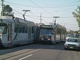
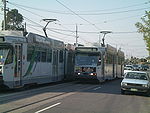
. It runs from Bundoora
in the northern suburbs
to Waterfront City Docklands in the city. It is one of Melbourne's busiest tram routes carrying 44,200 passengers a day. Route 86 will be one of two suburban tram routes to provide a transport link to The Southern Star observation wheel.
Unlike most tram routes in Melbourne, it falls within Metcard
/myki
ticketing Zone 1 and Zone 1/2.
An extension from Docklands along Footscray Road to Footscray is proposed.
In 2010 Melbourne-based musical comedian The Bedroom Philosopher
released an album Songs from the 86 Tram
inspired by the tram route as well as an award-winning comedy show of the same name.
line operated by the Melbourne Tramway and Omnibus Company opened on 10 August 1887, operating along Bourke Street, Gurtrude Street, Smith Street and Queens Parade to the Merri Creek
. On 18 February 1890 a group of Northcote land speculators built a line between the Melbourne Tramway and Omnibus Company terminus and Dundas Street, the line was not as successful as they had hoped, closed down and reopened twice before the municipal government bought it in 1901 and leased out its operation. At the end of the lease council took over operation for a short time. The Melbourne Tramway and Omnibus Company line was taken over by the Melbourne and Metropolitan Tramways Board on 1 November 1919 with the Northcote Cable Tramway line coming under Melbourne and Metropolitan Tramways Board control on 20 February 1920.
The Fitzroy, Northcote and Preston Tramways Trust had started constructing a system but it wasn't until after its takeover by the Melbourne and Metropolitan Tramways Board that services first ran, on 1 April 1920, part of this system included a line from Dundas Street to Tyler Street. This network was orphaned from the rest of the electric network until 24 March 1925 when a line along Holden Street, Pilkington Street and Barkly Street was built by the Melbourne and Metropolitan Tramways Board to allow access to the CBD via Lygon Street.
The two cable lines were through routed by the Melbourne and Metropolitan Tramways Board, and operated until 26 October 1940, when the Bourke Street cable lines were abandoned by the Melbourne and Metropolitan Tramways Board in favour of double decker buses. The Bourke Street cable lines were the last cable trams to operate in Melbourne. Melbourne and Metropolitan Tramways Board, unhappy with the performance of the buses wished to rebuilt the lines as electric tram services, it was decided to reinstate trams when the buses were life expired, trams first ran on the 88 (predecessor to the modern 86) on 26 June 1955, with East Brunswick starting operating on 6 May 1956.
On 18 May 1983 the suburban terminus was extended from Tyler Street to Boldrewood Parade, then to La Trobe University on 10 January 1985, to Settlement Road on 26 April 1987 and to the current terminus at McKimmies Road on 12 October 1995. This final extension cost $12.6 million and was funded as part of the Commonwealth Government's Building Better Cities program.
As part of the Docklands redevelopment project La Trobe Street was extended west over the Spencer Street railyards in 2000, and with this extension route 86 was extended along Spencer Street and La Trobe Street to Docklands Stadium.
In July 2008 route 30
and route 86 swapped terminus's, with route 30 terminating in Harbour Esplanade at Central Pier, and route 86 being extended to Waterfront City.
In August 2008 route 86 was the first route to see tram based testing of the myki
ticketing system, using special services not open to normal fare-paying passengers.
Prior the all trams stops in Zone 2 being rezoned as Zone 1/2 overlap - as a result of the introduction of myki - stops 61 to 71 were in Zone 2.
A project to: improve access through platform stops, perform track and overhead renewal and improve speed and reliability on a 6.8km section of route 86, along High Street and Plenty Road, between Westgarth Street, Westgarth and Albert Street, Reservoir was started in 2011.
 Route 86 runs from Bundoora
, travelling south on Plenty Road traversing the suburbs of, Reservoir
and Preston
, passing RMIT Bundoora Campus and La Trobe University
. Plenty Road ends in Preston at Dundas Street and High Street, route 86 turns slightly into High Street and continues south through Thornbury
and Northcote
. It then crosses the Merri Creek
, continuing along Queens Parade Clifton Hill
, heading south west, turning south into Smith Street passing between Fitzroy
and Collingwood
. Just before the end of Smith Street it turns west into Gurtrude Street, Fitzroy, and south into Nicholson Street, Carlton, past the Royal Exhibition Building
in the Carlton Gardens
, a World Heritage Site
.
It enters the CBD
on Spring Street
turning west into Bourke Street
at Parliament House
, travels through the Bourke Street Mall and turns north into Spencer Street
, passing Southern Cross Station, it turns west at La Trobe Street, passing over the Spencer Street rail yards into Docklands, it travels north briefly on Harbour Esplanade before turning west into Docklands Drive, where it terminates in Waterfront City Docklands.
Tram
A tram is a passenger rail vehicle which runs on tracks along public urban streets and also sometimes on separate rights of way. It may also run between cities and/or towns , and/or partially grade separated even in the cities...
route 86 is a public transport
Public transport
Public transport is a shared passenger transportation service which is available for use by the general public, as distinct from modes such as taxicab, car pooling or hired buses which are not shared by strangers without private arrangement.Public transport modes include buses, trolleybuses, trams...
service in Melbourne
Melbourne
Melbourne is the capital and most populous city in the state of Victoria, and the second most populous city in Australia. The Melbourne City Centre is the hub of the greater metropolitan area and the Census statistical division—of which "Melbourne" is the common name. As of June 2009, the greater...
, Victoria
Victoria (Australia)
Victoria is the second most populous state in Australia. Geographically the smallest mainland state, Victoria is bordered by New South Wales, South Australia, and Tasmania on Boundary Islet to the north, west and south respectively....
, Australia
Australia
Australia , officially the Commonwealth of Australia, is a country in the Southern Hemisphere comprising the mainland of the Australian continent, the island of Tasmania, and numerous smaller islands in the Indian and Pacific Oceans. It is the world's sixth-largest country by total area...
. It runs from Bundoora
Bundoora, Victoria
Bundoora is a suburb in Melbourne, Victoria, Australia, 16 km north from the Melbourne central business district. Its Local Government Area are the cities of Banyule, Darebin and Whittlesea. At the 2006 Census, Bundoora had a population of 24,018....
in the northern suburbs
Suburb
The word suburb mostly refers to a residential area, either existing as part of a city or as a separate residential community within commuting distance of a city . Some suburbs have a degree of administrative autonomy, and most have lower population density than inner city neighborhoods...
to Waterfront City Docklands in the city. It is one of Melbourne's busiest tram routes carrying 44,200 passengers a day. Route 86 will be one of two suburban tram routes to provide a transport link to The Southern Star observation wheel.
Unlike most tram routes in Melbourne, it falls within Metcard
Metcard
"OneLink" redirects here. For the computer/cable company, see OneLink Communications.Metcard is the brand name of an integrated ticketing system used to access public transport in Melbourne, Australia. It is a universal ticket which allows users to ride on the city's Metlink network, consisting of...
/myki
Myki
myki is the contactless smartcard ticketing system being introduced on public transport in Victoria, Australia. myki is designed to replace a number of ticket systems in Victoria, primarily the Metcard and V/Line ticketing systems...
ticketing Zone 1 and Zone 1/2.
An extension from Docklands along Footscray Road to Footscray is proposed.
In 2010 Melbourne-based musical comedian The Bedroom Philosopher
The Bedroom Philosopher
The Bedroom Philosopher is the performance persona of Australian comedian, author, actor and songwriter Justin Heazlewood. Most known for his musical comedy works, The Bedroom Philosopher has released several albums, performed at many arts festivals, been nominated for an ARIA Award and is a...
released an album Songs from the 86 Tram
Songs from the 86 Tram
Songs from the 86 Tram is the ARIA-nominated third full-length album by Australian musical comedian The Bedroom Philosopher, the performing persona of Justin Heazlewood and acts as a soundtrack to his award-winning live comedy show...
inspired by the tram route as well as an award-winning comedy show of the same name.
History
A cable tramCable car (railway)
A cable car or cable railway is a mass transit system using rail cars that are hauled by a continuously moving cable running at a constant speed. Individual cars stop and start by releasing and gripping this cable as required...
line operated by the Melbourne Tramway and Omnibus Company opened on 10 August 1887, operating along Bourke Street, Gurtrude Street, Smith Street and Queens Parade to the Merri Creek
Merri Creek
The Merri Creek is a waterway in southern parts of Victoria, Australia which flows through the northern suburbs of Melbourne. It begins in Wallan north of Melbourne and flows south for 70km until it joins the Yarra River at Dights Falls...
. On 18 February 1890 a group of Northcote land speculators built a line between the Melbourne Tramway and Omnibus Company terminus and Dundas Street, the line was not as successful as they had hoped, closed down and reopened twice before the municipal government bought it in 1901 and leased out its operation. At the end of the lease council took over operation for a short time. The Melbourne Tramway and Omnibus Company line was taken over by the Melbourne and Metropolitan Tramways Board on 1 November 1919 with the Northcote Cable Tramway line coming under Melbourne and Metropolitan Tramways Board control on 20 February 1920.
The Fitzroy, Northcote and Preston Tramways Trust had started constructing a system but it wasn't until after its takeover by the Melbourne and Metropolitan Tramways Board that services first ran, on 1 April 1920, part of this system included a line from Dundas Street to Tyler Street. This network was orphaned from the rest of the electric network until 24 March 1925 when a line along Holden Street, Pilkington Street and Barkly Street was built by the Melbourne and Metropolitan Tramways Board to allow access to the CBD via Lygon Street.
The two cable lines were through routed by the Melbourne and Metropolitan Tramways Board, and operated until 26 October 1940, when the Bourke Street cable lines were abandoned by the Melbourne and Metropolitan Tramways Board in favour of double decker buses. The Bourke Street cable lines were the last cable trams to operate in Melbourne. Melbourne and Metropolitan Tramways Board, unhappy with the performance of the buses wished to rebuilt the lines as electric tram services, it was decided to reinstate trams when the buses were life expired, trams first ran on the 88 (predecessor to the modern 86) on 26 June 1955, with East Brunswick starting operating on 6 May 1956.
On 18 May 1983 the suburban terminus was extended from Tyler Street to Boldrewood Parade, then to La Trobe University on 10 January 1985, to Settlement Road on 26 April 1987 and to the current terminus at McKimmies Road on 12 October 1995. This final extension cost $12.6 million and was funded as part of the Commonwealth Government's Building Better Cities program.
As part of the Docklands redevelopment project La Trobe Street was extended west over the Spencer Street railyards in 2000, and with this extension route 86 was extended along Spencer Street and La Trobe Street to Docklands Stadium.
In July 2008 route 30
Melbourne tram route 30
Tram route 30 is a public transport service in Melbourne, Victoria, Australia. It runs from St Vincents Plaza to Etihad Stadium. It only runs on weekdays, during daylight hours and is one of three fare paying routes to use heritage W class trams....
and route 86 swapped terminus's, with route 30 terminating in Harbour Esplanade at Central Pier, and route 86 being extended to Waterfront City.
In August 2008 route 86 was the first route to see tram based testing of the myki
Myki
myki is the contactless smartcard ticketing system being introduced on public transport in Victoria, Australia. myki is designed to replace a number of ticket systems in Victoria, primarily the Metcard and V/Line ticketing systems...
ticketing system, using special services not open to normal fare-paying passengers.
Prior the all trams stops in Zone 2 being rezoned as Zone 1/2 overlap - as a result of the introduction of myki - stops 61 to 71 were in Zone 2.
A project to: improve access through platform stops, perform track and overhead renewal and improve speed and reliability on a 6.8km section of route 86, along High Street and Plenty Road, between Westgarth Street, Westgarth and Albert Street, Reservoir was started in 2011.
Route
Bundoora, Victoria
Bundoora is a suburb in Melbourne, Victoria, Australia, 16 km north from the Melbourne central business district. Its Local Government Area are the cities of Banyule, Darebin and Whittlesea. At the 2006 Census, Bundoora had a population of 24,018....
, travelling south on Plenty Road traversing the suburbs of, Reservoir
Reservoir, Victoria
Reservoir is a suburb in Melbourne, Victoria, Australia, 12 km north from Melbourne's central business district. Its Local Government Area is the City of Darebin. At the 2006 Census, Reservoir had a population of 45,970....
and Preston
Preston, Victoria
Preston is a suburb in Melbourne, Victoria, Australia, 9 km north from Melbourne's central business district. Its Local Government Area is the City of Darebin. At the 2006 Census, Preston had a population of 27,892.-Settlement:...
, passing RMIT Bundoora Campus and La Trobe University
La Trobe University
La Trobe University is a multi-campus university in Victoria, Australia. It was established in 1964 by an Act of Parliament to become the third oldest university in the state of Victoria. The main campus of La Trobe is located in the Melbourne suburb of Bundoora; two other major campuses are...
. Plenty Road ends in Preston at Dundas Street and High Street, route 86 turns slightly into High Street and continues south through Thornbury
Thornbury, Victoria
Thornbury originalSince the 1960s, the vast majority of Melburnians pronounce the name phonetically. The 'h' is no longer silent, and there is more stress placed upon the 'o'. pronunciation is a suburb in Melbourne, Victoria, Australia, 7 km north from Melbourne's central business district....
and Northcote
Northcote, Victoria
Northcote is a suburb in Melbourne, Victoria, Australia, 7 km north-east from Melbourne's central business district. Its Local Government Area is the City of Darebin...
. It then crosses the Merri Creek
Merri Creek
The Merri Creek is a waterway in southern parts of Victoria, Australia which flows through the northern suburbs of Melbourne. It begins in Wallan north of Melbourne and flows south for 70km until it joins the Yarra River at Dights Falls...
, continuing along Queens Parade Clifton Hill
Clifton Hill, Victoria
Clifton Hill is a suburb of Melbourne, Victoria, Australia, 4 km north-east from Melbourne's central business district. The border between Clifton Hill and Fitzroy North is Queens Parade and Smith Street. Merri Creek defines the eastern border of Clifton Hill. Its Local Government Area is...
, heading south west, turning south into Smith Street passing between Fitzroy
Fitzroy, Victoria
Fitzroy is an inner city suburb of Melbourne, Victoria, Australia, 2 km north-east from Melbourne's central business district. Its Local Government Area is the City of Yarra. Its borders are Alexandra Parade , Victoria Parade , Smith Street and Nicholson Street. Fitzroy is Melbourne's...
and Collingwood
Collingwood, Victoria
Collingwood is an inner city suburb of Melbourne, Victoria, Australia, 3 km north-east from Melbourne's central business district. Its Local Government Area is the City of Yarra...
. Just before the end of Smith Street it turns west into Gurtrude Street, Fitzroy, and south into Nicholson Street, Carlton, past the Royal Exhibition Building
Royal Exhibition Building
The Royal Exhibition Building is a World Heritage Site-listed building in Melbourne, Australia, completed in 1880. It is located at 9 Nicholson Street in the Carlton Gardens, flanked by Victoria, Nicholson, Carlton and Rathdowne Streets, at the north-eastern edge of the central business district...
in the Carlton Gardens
Carlton Gardens, Melbourne
The Carlton Gardens is a World Heritage Site located on the northeastern edge of the Central Business District in the suburb of Carlton, in Melbourne, Victoria, Australia....
, a World Heritage Site
World Heritage Site
A UNESCO World Heritage Site is a place that is listed by the UNESCO as of special cultural or physical significance...
.
It enters the CBD
Melbourne city centre
Melbourne City Centre is an area of Melbourne in Victoria, Australia. It is not to be confused with the larger local government area of the City of Melbourne...
on Spring Street
Spring Street, Melbourne
Spring Street is a major street in the central business district of Melbourne, Victoria, Australia. It runs roughly north-south, and is the easternmost street in the Hoddle Grid. The street travels from Flinders Street in the south, to La Trobe Street and the Carlton Gardens in the north...
turning west into Bourke Street
Bourke Street, Melbourne
Bourke Street is one of Melbourne's best known streets. Historically been regarded as Melbourne's "second street", with the main street being Collins Street and "busier than Bourke Street" is a popular catchphrase. Bourke Street has traditionally been Melbourne's entertainment hub...
at Parliament House
Parliament House, Melbourne
Parliament House in Melbourne, located at Spring Street in East Melbourne at the edge of the Melbourne city centre, has been the seat of the Parliament of Victoria, Australia, since 1855 .- History :In 1851, even before the colony of Victoria acquired full parliamentary self-government, Governor...
, travels through the Bourke Street Mall and turns north into Spencer Street
Spencer Street, Melbourne
Spencer Street is a major street in the central business district of Melbourne, Victoria, Australia. It is named for John Spencer, 3rd Earl Spencer, Chancellor of the Exchequer under Lord Melbourne, the Prime Minister of the United Kingdom....
, passing Southern Cross Station, it turns west at La Trobe Street, passing over the Spencer Street rail yards into Docklands, it travels north briefly on Harbour Esplanade before turning west into Docklands Drive, where it terminates in Waterfront City Docklands.