

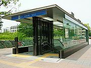
Meijo Line
Encyclopedia
Rapid transit
A rapid transit, underground, subway, elevated railway, metro or metropolitan railway system is an electric passenger railway in an urban area with a high capacity and frequency, and grade separation from other traffic. Rapid transit systems are typically located either in underground tunnels or on...
line, part of the system in Nagoya
Nagoya, Aichi
is the third-largest incorporated city and the fourth most populous urban area in Japan.Located on the Pacific coast in the Chūbu region on central Honshu, it is the capital of Aichi Prefecture and is one of Japan's major ports along with those of Tokyo, Osaka, Kobe, Yokohama, Chiba, and Moji...
, Japan
Japan
Japan is an island nation in East Asia. Located in the Pacific Ocean, it lies to the east of the Sea of Japan, China, North Korea, South Korea and Russia, stretching from the Sea of Okhotsk in the north to the East China Sea and Taiwan in the south...
. It is a loop line that runs from Kanayama
Kanayama Station (Aichi)
is a train station partly in Naka-ku, and partly in Atsuta-ku, Nagoya, Aichi Prefecture, Japan. This station is a concentrated terminal of JR Central, Meitetsu and Nagoya Municipal Subway...
, through Sakae
Sakae Station (Aichi)
is a train station in Sakae, which is in Naka-ku, Nagoya, Aichi Prefecture, Japan-Lines:*Nagoya Municipal Subway**Higashiyama Line **Meijō Line -Platforms:...
, Ōzone
Ozone Station
is a train station in Kita-ku, Nagoya, Aichi Prefecture, Japan-Lines:*Nagoya Municipal Subway**Meijō Line *Central Japan Railway Company**Chūō Main Line*Nagoya Railroad**Meitetsu Seto Line*Nagoya Guideway Bus...
, Nagoya Daigaku
Nagoya Daigaku Station
is a train station in Chikusa-ku, Nagoya, Aichi Prefecture, Japan.It was opened on .This station provides access to the Motoyama campus of Nagoya University, which is the station's namesake, and the Nagoya campus of Nanzan University.-Platforms:...
, and back to Kanayama, all within Nagoya. The Meijō Line's color on maps is wisteria purple. Its stations carry the letter M followed by a number. Officially, the line is consisted of , the western part, and , the eastern part. All the stations accept Tranpass
Tranpass
is the name of a magnetic fare card that can be used with many trains and buses running in Nagoya and its suburbs, especially trains and buses operated by Nagoya City and Nagoya Railroad, commonly known as Meitetsu...
, a prepaid magnetic card.
This is the second loop subway line built in Japan, after Toei Ōedo Line
Toei Oedo Line
The is a subway line in Tokyo, Japan operated by the Tokyo Metropolitan Bureau of Transportation . It commenced full operations on December 12, 2000; using the Japanese calendar this reads "12/12/12" as the year 2000 equals Heisei 12...
. Ōedo Line, however, has a railway zig zag
Zig Zag (railway)
A railway zig zag, also called a switchback, is a way of climbing hills in difficult country with a minimal need for tunnels and heavy earthworks. For a short distance , the direction of travel is reversed, before the original direction is resumed.A location on railways constructed e.g...
at Tochōmae
Tochomae Station
is located in Shinjuku, Tokyo, Japan.This is a connected station for a toroidal part and the radiant section of the Toei Oedo Line, and trains from Iidabashi terminate at this station.-History:* December 19, 1997 Opened....
, meaning Meijō Line is the first (and currently the only) true loop subway line in the nation. The line is longer than JR Ōsaka Loop Line
Osaka Loop Line
The is a railway line in Japan operated by West Japan Railway Company . It encircles central Osaka.The second loop line, the Osaka Higashi Line, from Hanaten to Kyuhoji was opened on March 15, 2008, and the line from Shigino to Shin-Ōsaka is planned to open in 2020.-Outline:This loop line consists...
(21.7 km), but shorter than JR Yamanote Line
Yamanote Line
The is commuter rail loop line in Tokyo, Japan, operated by East Japan Railway Company . It is one of Tokyo's busiest and most important lines, connecting most of Tokyo's major stations and urban centres, including the Yūrakuchō/Ginza area, Shibuya, Shinjuku, and Ikebukuro, with all but two of its...
(34.5 km). It takes 48 minutes to complete the loop.
The name Meijō derives itself from the abbreviated kanji
Kanji
Kanji are the adopted logographic Chinese characters hanzi that are used in the modern Japanese writing system along with hiragana , katakana , Indo Arabic numerals, and the occasional use of the Latin alphabet...
form of .
Basic data
- Distance: 26.4 km / 16.4 mi.
- Line 2: From Ōzone to Kanayama, via Sakae: 8.9 km / 5.5 mi.
- Line 4: From Ōzone to Kanayama, via Nagoya Daigaku: 17.5 km / 10.9 mi.
- Stations: 28
- GaugeRail gaugeTrack gauge or rail gauge is the distance between the inner sides of the heads of the two load bearing rails that make up a single railway line. Sixty percent of the world's railways use a standard gauge of . Wider gauges are called broad gauge; smaller gauges, narrow gauge. Break-of-gauge refers...
: 1435 mm / 4 ft. 8½ in. (Standard gauge, in contrast to the narrow gauge of most Japanese railways.) - Rolling stock: 2000 seriesNagoya Municipal Subway 2000 seriesThe is a rapid transit electric multiple unit operated by the Transportation Bureau City of Nagoya on the Nagoya Subway Meijō Line and Meikō Line in Japan since 1989.- Specifications:...
- Double-track line: Entire line
- Electric supply: Entire line (600 VVoltThe volt is the SI derived unit for electric potential, electric potential difference, and electromotive force. The volt is named in honor of the Italian physicist Alessandro Volta , who invented the voltaic pile, possibly the first chemical battery.- Definition :A single volt is defined as the...
DCDirect currentDirect current is the unidirectional flow of electric charge. Direct current is produced by such sources as batteries, thermocouples, solar cells, and commutator-type electric machines of the dynamo type. Direct current may flow in a conductor such as a wire, but can also flow through...
, third railThird railA third rail is a method of providing electric power to a railway train, through a semi-continuous rigid conductor placed alongside or between the rails of a railway track. It is used typically in a mass transit or rapid transit system, which has alignments in its own corridors, fully or almost...
) - Railway signallingRailway signallingRailway signalling is a system used to control railway traffic safely, essentially to prevent trains from colliding. Being guided by fixed rails, trains are uniquely susceptible to collision; furthermore, trains cannot stop quickly, and frequently operate at speeds that do not enable them to stop...
: CSCab signallingCab signalling is a railway safety system that communicates track status information to the cab, crew compartment or driver's compartment of a locomotive, railcar or multiple unit, where the train driver or engine driver can see the information....
-ATCAutomatic Train ControlAutomatic Train Control is a train protection system for railways, ensuring the safe and smooth operation of trains on ATC-enabled lines. Its main advantages include making possible the use of cab signalling instead of track-side signals and the use of smooth deceleration patterns in lieu of the... - Maximum speed at service: 65 km/h
History
The first section of Line 2, between Sakae-machi (current Sakae) and Shiyakusho, opened in 1965. The line was nicknamed Meijō Line in 1969, and the extension was completed in 1971. Line 4, on the other hand, opened its first section between Aratama-bashi and Kanayama in 1974. The line was extended fairly recently, and the extension completed in 2004, making a loop line together with Line 2. At this timing, the whole loop line was re-nicknamed as Meijō Line, and the section of Line 2 between Kanayama and Nagoyakō, out of the loop, changed its nickname to Meikō Line.Stations
Listed clockwise:| Number | | Station name | | Japanese | | Total distance | | Transfers | | Location | |
|---|---|---|---|---|---|---|
| M01 | Kanayama Kanayama Station (Aichi) is a train station partly in Naka-ku, and partly in Atsuta-ku, Nagoya, Aichi Prefecture, Japan. This station is a concentrated terminal of JR Central, Meitetsu and Nagoya Municipal Subway... |
金山 | 0 km | JR Central Japan Railway Company The is the main railway company operating in the Chūbu region of central Japan. It is officially abbreviated in English as JR Central and in Japanese as . Its headquarters are located in the JR Central Towers in Nakamura-ku, Nagoya, Aichi Prefecture.The company's operational hub is Nagoya Station... : Chūō Main Line Chuo Main Line The , commonly called the Chūō Line, is one of the major trunk railway lines in Japan. It runs between Tokyo and Nagoya, although it is the slowest direct railway connection between the two cities; the coastal Tōkaidō Main Line is slightly faster, while the Tōkaidō Shinkansen is the fastest rail... , Tōkaidō Main Line Tokaido Main Line The is the busiest trunk line of the Japan Railways Group , connecting Tōkyō and Kōbe stations. It is long, not counting its many freight feeder lines around the major cities... Meitetsu Nagoya Railroad , often abbreviated as , is a railroad company operating around Aichi Prefecture and Gifu Prefecture of Japan.Some of the more famous trains operated by Nagoya Railroad include the Panorama Car and the Panorama Car Super, both of which offer views through their wide front windows... : Nagoya Line Nagoya Municipal Subway: Kanayama Line 1, Meikō Line (E01) 2 |
Naka Naka-ku, Nagoya is the heart of Nagoya, Aichi Prefecture, Japan. Largely hemmed in by Sakura-dōri , Ōtsu-dōri , Fushimi-dōri and Tsurumai-dōri , it contains the main shopping area of Sakae, a massive air-conditioned 5 square-kilometer underground mall) and the 'after-five' semi-red light districts of Nishiki and... |
Nagoya Nagoya, Aichi is the third-largest incorporated city and the fourth most populous urban area in Japan.Located on the Pacific coast in the Chūbu region on central Honshu, it is the capital of Aichi Prefecture and is one of Japan's major ports along with those of Tokyo, Osaka, Kobe, Yokohama, Chiba, and Moji... , Aichi Aichi Prefecture is a prefecture of Japan located in the Chūbu region. The region of Aichi is also known as the Tōkai region. The capital is Nagoya. It is the focus of the Chūkyō Metropolitan Area.- History :... |
| M02 | Higashi Betsuin Higashi Betsuin Station is a train station in Ōimachi, Naka-ku, Nagoya, Aichi Prefecture, Japan.It is close to Nagoya Broadcasting Network and Higashi Betsuin Temple, after which it is named... |
東別院 | 0.7 km | |||
| M03 | Kamimaezu | 上前津 | 1.6 km | Nagoya Municipal Subway: Tsurumai Line Tsurumai Line The is a subway line which forms part of the Nagoya Municipal Subway system in Nagoya, Japan. It runs from Kami Otai in Nishi-ku, Nagoya to Akaike in Nisshin. The Tsurumai Line's color on maps is light blue. Its stations carry the letter T followed by a number. Officially, the line is called... (T09) |
||
| M04 | Yabachō | 矢場町 | 2.3 km | Nagoya Municipal Subway: Tōbu Line 1 | ||
| M05 | Sakae Sakae Station (Aichi) is a train station in Sakae, which is in Naka-ku, Nagoya, Aichi Prefecture, Japan-Lines:*Nagoya Municipal Subway**Higashiyama Line **Meijō Line -Platforms:... |
栄 | 3 km | Meitetsu: Seto Line Meitetsu Seto Line The is a Japanese railway line which connects Sakaemachi Station in Higashi-ku, Nagoya. Aichi Prefecture with Owari Seto Station in Seto, Aichi Prefecture. It is owned and run by Nagoya Railroad .-Stations:-Rolling stock:... (Sakaemachi Sakaemachi Station Sakaemachi Station is the name of two train stations in Japan:*Sakaemachi Station * Sakaemachi Station -See also:*Sakaechō Station - Train stations in Japan with the same kanji, but different pronunciation... ) Nagoya Municipal Subway: Higashiyama Line Higashiyama Line The is a subway line, part of the Nagoya Municipal Subway system in Nagoya, Japan. Officially, the line is referred to as . It runs from Takabata, Nakagawa Ward to Fujigaoka, Meitō Ward, all within Nagoya. The Higashiyama Line's color on maps is Windsor yellow; its stations carry the letter H... (H10) |
||
| M06 | Hisaya-ōdōri | 久屋大通 | 3.4 km | Nagoya Municipal Subway: Sakura-dōri Line Sakura-dori Line The is a subway line, part of the system in Nagoya, Japan. It runs from Nakamura Kuyakusho, Nakamura Ward to , Midori Ward, all within Nagoya. The Sakura-dōri Line's color on maps is red. In 2004, the city started to change all station signs. The new signs have a station name followed by a single... (S05) |
||
| M07 | Shiyakusho Shiyakusho Station is a train station in Naka-ku, Nagoya, Aichi Prefecture, Japan.This station provides access to its namesake, Nagoya City Hall, as well as Aichi Prefectural Government Office, Nagoya City Archives, Nagoya Noh Theatre and Nagoya Castle.It was opened on .... (City Hall) |
市役所 | 4.3 km | |||
| M08 | Meijō Kōen | 名城公園 | 5.4 km | Kita Kita-ku, Nagoya is one of the wards of the city of Nagoya in Aichi Prefecture, Japan.Kita Ward contains Nagoya Airfield as well as Meijō Park.... |
||
| M09 | Kurokawa | 黒川 | 6.4 km | Nagoya Municipal Subway: Kanayama Line 1 | ||
| M10 | Shiga-hondōri | 志賀本通 | 7.4 km | |||
| M11 | Heian-dōri | 平安通 | 8.2 km | Nagoya Municipal Subway: Kamiiida Line Kamiiida Line The is a subway line, part of the system in Nagoya, Japan. It runs between two stations, Kamiiida and Heian-dōri, both at Kita Ward, Nagoya. Both stations have automatic platform gates.... (K02) |
||
| M12 | Ōzone Ozone Station is a train station in Kita-ku, Nagoya, Aichi Prefecture, Japan-Lines:*Nagoya Municipal Subway**Meijō Line *Central Japan Railway Company**Chūō Main Line*Nagoya Railroad**Meitetsu Seto Line*Nagoya Guideway Bus... |
大曽根 | 8.9 km | JR: Chūō Main Line Meitetsu: Seto Line Nagoya Guideway Bus: Yutorīto Line Yutorito Line is a bus rapid transit line in Nagoya, Aichi, Japan. The line is officially called . Its official nickname, Yutorīto Line, is a portmanteau of yutori and . As such, the name is also unofficially spelt Yutreet Line. The line is owned by Nagoya Guideway Bus, whose name is also often used as the... (Y01) |
||
| M13 | Nagoya Dome-mae Yada Nagoya Dome-mae Yada Station is a train station in Higashi-ku, Nagoya, Aichi Prefecture, Japan.It provides access to Nagoya Dome, where baseball games and various other large public events are held in Nagoya.-Lines:*Nagoya Municipal Subway**Meijō Line... |
ナゴヤドーム前矢田 | 9.7 km | Nagoya Guideway Bus: Yutorīto Line (Y02) | Higashi Higashi-ku, Nagoya , is one of the 16 wards of the city of Nagoya in Aichi Prefecture, Japan.Higashi Ward has the headquarters of Tōkai Television Broadcasting as well as the NHK Nagoya Broadcasting Station.... |
|
| M14 | Sunadabashi | 砂田橋 | 10.6 km | Nagoya Guideway Bus: Yutorīto Line (Y03) | ||
| M15 | Chayagasaka | 茶屋ヶ坂 | 11.5 km | Chikusa Chikusa-ku, Nagoya is one of the 16 wards of the city of Nagoya in Aichi Prefecture, Japan, in the eastern part of the city.-Places:It has a number of large parks such as Higashiyama Park and Heiwa Park, is the home to the Higashiyama Zoo and Botanical Gardens, and contains the Higashiyama Sky Tower... |
||
| M16 | Jiyūgaoka | 自由ヶ丘 | 12.7 km | |||
| M17 | Motoyama Motoyama Station (Aichi) is a train station in Chikusa-ku, Nagoya, Aichi Prefecture, JapanIt was opened on .The station provides access to Tōgan-ji which includes the Nagoya Daibutsu, Nagoya's large statue of Buddha... |
本山 | 14.1 km | Nagoya Municipal Subway: Higashiyama Line (H16) | ||
| M18 | Nagoya Daigaku Nagoya Daigaku Station is a train station in Chikusa-ku, Nagoya, Aichi Prefecture, Japan.It was opened on .This station provides access to the Motoyama campus of Nagoya University, which is the station's namesake, and the Nagoya campus of Nanzan University.-Platforms:... |
名古屋大学 | 15.1 km | Nagoya Municipal Subway: Tōbu Line 1 | ||
| M19 | Yagoto Nisseki | 八事日赤 | 16.2 km | Shōwa Showa-ku, Nagoya is one of the 16 wards of the city of Nagoya in Aichi Prefecture, Japan.Currently, it has the highest population density of any of the 16 wards of Nagoya City at 9,641 people per square kilometer -Notable Places:... |
||
| M20 | Yagoto Yagoto Station is a train station in Shōwa-ku, Nagoya, Aichi Prefecture, Japan.It was opened on .This station is located in part of the upper class district of Nagoya.-Lines:*Nagoya Municipal Subway**Tsurumai Line **Meijō Line... |
八事 | 17.2 km | Nagoya Municipal Subway: Tsurumai Line (T15) | ||
| M21 | Sōgō Rihabiri Center | 総合リハビリセンター | 18.5 km | Mizuho Mizuho-ku, Nagoya is one of the 16 wards of the city of Nagoya in Aichi Prefecture, Japan.It includes Mizuho athletics park and Mizuho rugby stadium.... |
||
| M22 | Mizuho Undōjō Higashi | 瑞穂運動場東 | 19.5 km | |||
| M23 | Aratama-bashi | 新瑞橋 | 20.7 km | Nagoya Municipal Subway: Sakura-dōri Line (S14) | ||
| M24 | Myōon-dōri | 妙音通 | 21.4 km | |||
| M25 | Horita | 堀田 | 22.2 km | |||
| M26 | Temma-chō | 伝馬町 | 23.4 km | Atsuta Atsuta-ku, Nagoya is one of the wards of the city of Nagoya in Aichi Prefecture, Japan. At the 2005 census it had a population of 63,608. Atsuta Shrine is well known. The rolling stock manufacturer Nippon Sharyo has its headquarters in the ward.-References:... |
||
| M27 | Jingū-Nishi | 神宮西 | 24.4 km | |||
| M28 | Nishi Takakura | 西高蔵 | 25.3 km | |||
| M01 | Kanayama | 金山 | 26.4 km | Naka | ||
- 1: Planned lines.
- 2: There is a through service to/from Meijō Line.