

May Township, Christian County, Illinois
Encyclopedia
May Township is one of seventeen townships
in Christian County
, Illinois
, USA
. As of the 2000 census
, its population was 1,436.
in the Mexican-American War.
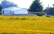
, May Township covers an area of 36.47 square miles (94.5 km²); of this, 36.39 square miles (94.2 km²) (99.78 percent) is land and 0.08 square mile (0.2071990488 km²) (0.22 percent) is water.
The highest point in May Township is located approximately 20 feet south of the centerline of County Road 1600 North, at roughly 1816 East (.16 miles East of 1800 North Road, a/k/a Christian County Highway #7).
Civil township
A civil township is a widely used unit of local government in the United States, subordinate to, and geographic divisions of, a county. Specific responsibilities and the degree of autonomy vary based on each state. Civil townships are distinct from survey townships, but in states that have both,...
in Christian County
Christian County, Illinois
Christian County is a county located in the U.S. state of Illinois. According to the 2010 census, it has a population of 34,800, which is a decrease of 1.6% from 35,372 in 2000...
, Illinois
Illinois
Illinois is the fifth-most populous state of the United States of America, and is often noted for being a microcosm of the entire country. With Chicago in the northeast, small industrial cities and great agricultural productivity in central and northern Illinois, and natural resources like coal,...
, USA
United States
The United States of America is a federal constitutional republic comprising fifty states and a federal district...
. As of the 2000 census
United States Census, 2000
The Twenty-second United States Census, known as Census 2000 and conducted by the Census Bureau, determined the resident population of the United States on April 1, 2000, to be 281,421,906, an increase of 13.2% over the 248,709,873 persons enumerated during the 1990 Census...
, its population was 1,436.
History
May Township was established November 7, 1865, as Smith Township, but was later changed to Howard, then Penn, and finally to May. References as to when the name changes happened have been lost. It was named in honor of Colonel Charles May, of the artillery arm of the serviceArmy of Occupation (Mexico)
The Army of Occupation was the name of the U.S. Army commanded by Zachary Taylor during the Mexican-American War.-Creation:On April 23, 1845 General Zachary Taylor was appointed to command the 1st Military District along the Texas/Louisiana border. On April 27 Taylor received orders to move with a...
in the Mexican-American War.
Geography
According to the United States Census BureauUnited States Census Bureau
The United States Census Bureau is the government agency that is responsible for the United States Census. It also gathers other national demographic and economic data...
, May Township covers an area of 36.47 square miles (94.5 km²); of this, 36.39 square miles (94.2 km²) (99.78 percent) is land and 0.08 square mile (0.2071990488 km²) (0.22 percent) is water.
The highest point in May Township is located approximately 20 feet south of the centerline of County Road 1600 North, at roughly 1816 East (.16 miles East of 1800 North Road, a/k/a Christian County Highway #7).
Unincorporated towns
- Hewittville at 39.5361554°N 89.2167533°W
- Old StoningtonOld Stonington, IllinoisOld Stonington is an unincorporated community in Christian County, Illinois, United States. It lies at ....
at 39.6114309°N 89.1478606°W - Willey StationWilley Station, IllinoisWilley Station is an unincorporated community in Christian County, Illinois, United States. It lies on land donated by , for whom it was named. He arrived in Christian County in 1845. The town was laid out by , who built and owned the station house...
at 39.5969883°N 89.2334185°W
Cemeteries
The township contains these four cemeteries: Fraley, Harris Number 2, Long and Tanner.Major highways
-
 Illinois Route 29Illinois Route 29Illinois Route 29 is a two to four lane state road that runs south from U.S. Route 6/Illinois Route 89 at Spring Valley to U.S. Route 51/Illinois Route 16 at Pana, running through Pekin, Peoria and Springfield. The nearest major north–south highway, Interstate 39, runs parallel to Illinois...
 -
 Illinois Route 48Illinois Route 48Illinois Route 48 is a north–south highway with its southern terminus at I-55 and Illinois Route 127 in Raymond and its northern terminus at Illinois Route 54 east of Clinton. This is a distance of .- Route description :...
School districts
- Central A & M Community Unit School District 21
- Taylorville Community Unit School District 3
Political districts
- State House District 87
- State House District 98
- State Senate District 44
- State Senate District 49