
Maryland Route 713
Encyclopedia
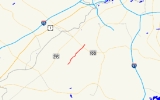
Maryland Route 713 is a state highway
in the U.S. state
of Maryland
. The state highway runs 3.05 mi (4.9 km) from an entrance to Fort George G. Meade
north to MD 176
in Hanover
. In addition to serving as an access point to the U.S. Army installation, MD 713 provides the primary access to the Arundel Mills
regional shopping mall
.
in the hamlet of Provinces. MD 713 heads north from MD 175 as two-lane Ridge Road through residential subdivisions. At Stoney Run Drive, the state highway expands to a four-lane divided highway and enters a commercial area. MD 713 passes Ridge Chapel Road (MD 713B), part of the old alignment of MD 713, before reaching an intersection with Arundel Mills Boulevard, which heads southwest to an interchange with the Baltimore–Washington Parkway, and Arundel Way, an entrance to Arundel Mills
. MD 713 turns north onto Arundel Mills Boulevard, a six-lane divided highway, toward an interchange with MD 100
(Paul T. Pitcher Memorial Highway). The state highway reaches its northern terminus just north of the MD 100 interchange at MD 176 (Dorsey Road). New Ridge Road continues straight as a county highway toward a collection of industrial and business parks in Hanover.
.
auxiliary routes and one former auxiliary route. MD 713A through 713E are associated with the construction of MD 100 through Hanover in the 1990s. MD 713F was assigned as part of the project to connect Arundel Mills Boulevard with the Baltimore–Washington Parkway.
State highway
State highway, state road or state route can refer to one of three related concepts, two of them related to a state or provincial government in a country that is divided into states or provinces :#A...
in the U.S. state
U.S. state
A U.S. state is any one of the 50 federated states of the United States of America that share sovereignty with the federal government. Because of this shared sovereignty, an American is a citizen both of the federal entity and of his or her state of domicile. Four states use the official title of...
of Maryland
Maryland
Maryland is a U.S. state located in the Mid Atlantic region of the United States, bordering Virginia, West Virginia, and the District of Columbia to its south and west; Pennsylvania to its north; and Delaware to its east...
. The state highway runs 3.05 mi (4.9 km) from an entrance to Fort George G. Meade
Fort George G. Meade
Fort George G. Meade is a United States Army installation that includes the Defense Information School, the United States Army Field Band, and the headquarters of United States Cyber Command, the National Security Agency, and the Defense Courier Service...
north to MD 176
Maryland Route 176
Maryland Route 176 is an east–west route in Anne Arundel County.-Route description:MD 176 begins at a cul-de-sac near Wright Rd., a local neighborhood street, within sight of its old interchange with MD 295, now used by MD 100. Continuing east it intersects the northern end of MD 713 north of...
in Hanover
Hanover, Maryland
Hanover, Maryland is a locality in unincorporated northwestern Anne Arundel County, Maryland in the United States, located south of Baltimore near the Howard County line....
. In addition to serving as an access point to the U.S. Army installation, MD 713 provides the primary access to the Arundel Mills
Arundel Mills
Arundel Mills is a mall located in Hanover, Maryland and is now owned by Simon Property Group. With its GLA, it was the largest mall in Maryland, until the Westfield Annapolis Mall surpassed it with its 2007 expansion...
regional shopping mall
Shopping mall
A shopping mall, shopping centre, shopping arcade, shopping precinct or simply mall is one or more buildings forming a complex of shops representing merchandisers, with interconnecting walkways enabling visitors to easily walk from unit to unit, along with a parking area — a modern, indoor version...
.
Route description
MD 713 begins just north of the Rockenbach Road entrance to Fort Meade. The state highway heads north as a five-lane road with center turn lane to its intersection with MD 175Maryland Route 175
-Annapolis Road:MD 175 begins at MD 3, just south of the latter's northern terminus at Interstate 97, known as Annapolis Road. It runs west as a two-lane suburban highway, passing through local neighborhoods and south of Arundel High School before widening into a four-lane suburban arterial south...
in the hamlet of Provinces. MD 713 heads north from MD 175 as two-lane Ridge Road through residential subdivisions. At Stoney Run Drive, the state highway expands to a four-lane divided highway and enters a commercial area. MD 713 passes Ridge Chapel Road (MD 713B), part of the old alignment of MD 713, before reaching an intersection with Arundel Mills Boulevard, which heads southwest to an interchange with the Baltimore–Washington Parkway, and Arundel Way, an entrance to Arundel Mills
Arundel Mills
Arundel Mills is a mall located in Hanover, Maryland and is now owned by Simon Property Group. With its GLA, it was the largest mall in Maryland, until the Westfield Annapolis Mall surpassed it with its 2007 expansion...
. MD 713 turns north onto Arundel Mills Boulevard, a six-lane divided highway, toward an interchange with MD 100
Maryland Route 100
Maryland Route 100 is a major east–west highway connecting U.S. Route 29 in Ellicott City and MD 177 in Pasadena. MD 100 also connects to Interstate 95 , US 1, the Baltimore-Washington Parkway , and I-97...
(Paul T. Pitcher Memorial Highway). The state highway reaches its northern terminus just north of the MD 100 interchange at MD 176 (Dorsey Road). New Ridge Road continues straight as a county highway toward a collection of industrial and business parks in Hanover.
Junction list
The entire route is in Anne Arundel CountyAnne Arundel County, Maryland
Anne Arundel County is a county located in the U.S. state of Maryland. It is named for Anne Arundell , a member of the ancient family of Arundells in Cornwall, England and the wife of Cæcilius Calvert, 2nd Baron Baltimore. Its county seat is Annapolis, which is also the capital of the state...
.
| Location | Mile |
Destinations | Notes |
|---|---|---|---|
| Fort Meade Fort Meade, Maryland Fort Meade is a census-designated place in Anne Arundel County, Maryland, United States. The population was 9,882 at the 2000 census. It is the home to the National Security Agency, which is located on the US Army post Fort George G... |
0.00 | Rockenbach Road south – Entrance to Fort Meade | Southern terminus |
| 0.49 | |||
| Hanover Hanover, Maryland Hanover, Maryland is a locality in unincorporated northwestern Anne Arundel County, Maryland in the United States, located south of Baltimore near the Howard County line.... |
2.37 | Ridge Chapel Road east | Old alignment of MD 713 |
| 2.48 | Arundel Mills Boulevard south to / Arundel Way west – Arundel Mills Arundel Mills Arundel Mills is a mall located in Hanover, Maryland and is now owned by Simon Property Group. With its GLA, it was the largest mall in Maryland, until the Westfield Annapolis Mall surpassed it with its 2007 expansion... |
MD 713 turns north onto Arundel Mills Boulevard | |
| 2.86 | MD 100 Exit 10 | ||
| 3.05 | Northern terminus | ||
| New Ridge Road north |
Auxiliary routes
MD 713 has five unsignedUnsigned highway
An unsigned highway is a highway that has been assigned a route number, but does not bear conventional road markings that would normally be used to identify the route with that number...
auxiliary routes and one former auxiliary route. MD 713A through 713E are associated with the construction of MD 100 through Hanover in the 1990s. MD 713F was assigned as part of the project to connect Arundel Mills Boulevard with the Baltimore–Washington Parkway.
- MD 713A was the designation for Clark Road, a 0.05 mile (0.080467 km) connection between MD 713 south of Arundel Mills Boulevard and the county-maintained portion of Clark Road. MD 713A was removed from the state highway system in 2008.
- MD 713B is the designation for Ridge Chapel Road, a 0.26 mile (0.4184284 km) connection between MD 713 south of Arundel Mills Boulevard and the county-maintained portion of Ridge Chapel Road. The road originally heads north, then turns east at the intersection with MD 713C. The first part of MD 713B is part of the old alignment of MD 713.
- MD 713C is the designation for Teague Road, a 0.27 mile (0.4345218 km) section of the old alignment of MD 713 between MD 713B and a cul-de-sac adjacent to MD 100. The state highway provides access to Harmans Park, which contains Joe Cannon Stadium, a local baseball venue.
- MD 713D is the designation for Ridge Road, a 0.15 mile (0.241401 km) section of the old alignment of MD 713 between a dead end adjacent to MD 100 and MD 176.
- MD 713E is the designation for Ridge Road, a 0.17 mile (0.2735878 km) section of the old alignment of MD 713 between MD 176 and a point north of New Ridge Road, immediately north of the northern terminus of MD 713D.
- MD 713F is the designation for a 0.25 mile (0.402335 km) section of Arundel Mills Boulevard through its dumbbell interchange with the Baltimore–Washington Parkway. MD 713F was assigned in 2002.