
Maryland Route 662
Encyclopedia
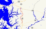
Maryland Route 662 is a collection of state highway
s in the U.S. state
of Maryland
. These highways are sections of old alignment of U.S. Route 50
(US 50) between Easton
and Wye Mills
in Talbot County
and Queen Anne's County
. MD 662C runs from Easton to Longwoods. MD 662B runs from Longwoods to Skipton. MD 662 runs from Skipton to Wye Mills. MD 662A is an unsigned
ramp at the northern end of MD 662. MD 662D is an unsigned connector along MD 662C. The three main sections of MD 662 were designated in 1948 following the construction of US 50's bypasses of Easton and Wye Mills. MD 662C was extended south in Easton in the late 1990s.
. MD 662C immediately intersects Airpark Drive (unsigned MD 322B), which is used to access MD 322 (Easton Parkway) and Washington Street, the main north–south street through the center of Easton. The state highway continues north between US 50 on the east and the airport on the west. At the northeast corner of the airport property, MD 662C intersects Airport Road, which provides access to the airport to the west and US 50 and MD 309 to the east. The state highway's name changes to Longwoods Road. After passing a 0.04 mile (0.0643736 km) connector to US 50, unsigned MD 662D, the highway veers away from US 50 through farmland, passing All Saints' Church
. MD 662C crosses Potts Mill Creek before passing through the hamlet of Longwoods. After passing Probasco Landing Road, the state highway reaches its northern terminus at US 50 opposite the southern terminus of MD 662B.
MD 662B is the designation for Old Skipton Road, a 2.16 mi (3.5 km) section of the old alignment of US 50 on the westbound side of the federal highway between Longwoods and Skipton. The state highway begins at US 50 opposite the northern terminus of MD 662C. MD 662C heads northeast and passes between residences on large lots before entering a forested area and crossing Skipton Creek. The highway veers north and then northwest, crossing another creek and passing through the hamlet of Skipton before reaching its northern terminus at US 50.
and Wye Oak State Park, which contains the remains of the Wye Oak
. MD 662 meets the west end of MD 404 (Queen Annes Highway) before crossing the Wye East River, a tributary of the Wye River
, and entering Queen Anne's County. MD 213 (College Drive) splits to the north as MD 662, now named Wye Mills Road, veers to the northwest. MD 662 passes Chesapeake College
before reaching its northern terminus at US 50. The ramp from eastbound US 50 to southbound MD 662 is unsigned MD 662A, which is 0.08 mi (0.1287472 km) in length.
.
State highway
State highway, state road or state route can refer to one of three related concepts, two of them related to a state or provincial government in a country that is divided into states or provinces :#A...
s in the U.S. state
U.S. state
A U.S. state is any one of the 50 federated states of the United States of America that share sovereignty with the federal government. Because of this shared sovereignty, an American is a citizen both of the federal entity and of his or her state of domicile. Four states use the official title of...
of Maryland
Maryland
Maryland is a U.S. state located in the Mid Atlantic region of the United States, bordering Virginia, West Virginia, and the District of Columbia to its south and west; Pennsylvania to its north; and Delaware to its east...
. These highways are sections of old alignment of U.S. Route 50
U.S. Route 50 in Maryland
U.S. Route 50 is a major east–west route of the U.S. Highway system, stretching just over from Ocean City, Maryland on the Atlantic Ocean to West Sacramento, California. In the U.S. state of Maryland, US 50 exists in two sections. The longer of these serves as a major route connecting...
(US 50) between Easton
Easton, Maryland
Easton, founded 1710, is a town within the Easton District of Talbot County, Maryland, United States. The population was 11,708 at the 2000 census, and 14,677 according to current July 2008 census estimates. It is the county seat of Talbot County. The primary ZIP Code is 21601, and the...
and Wye Mills
Wye Mills, Maryland
Wye Mills is an unincorporated community in Talbot County, Maryland, United States, located at an altitude of 13 feet . It is the home of the Wye Grist Mill which has been in nearly continuous operation since 1682, and Wye Oak and of Chesapeake College.-References:...
in Talbot County
Talbot County, Maryland
-2010:Whereas according to the 2010 U.S. Census Bureau:*81.4% White*12.8% Black*0.2% Native American*1.2% Asian*0.1% Native Hawaiian or Pacific Islander*1.6% Two or more races*2.7% Other races*5.5% Hispanic or Latino -2000:...
and Queen Anne's County
Queen Anne's County, Maryland
Queen Anne's County is a county located on the Eastern Shore of the U.S. state of Maryland.As of 2010, the population was 47,798. Its county seat and most populous municipality is Centreville. The census-designated place of Stevensville is the county's most populous place...
. MD 662C runs from Easton to Longwoods. MD 662B runs from Longwoods to Skipton. MD 662 runs from Skipton to Wye Mills. MD 662A is an unsigned
Unsigned highway
An unsigned highway is a highway that has been assigned a route number, but does not bear conventional road markings that would normally be used to identify the route with that number...
ramp at the northern end of MD 662. MD 662D is an unsigned connector along MD 662C. The three main sections of MD 662 were designated in 1948 following the construction of US 50's bypasses of Easton and Wye Mills. MD 662C was extended south in Easton in the late 1990s.
MD 662C and MD 662B
MD 662C is the designation for Centreville Road and Longwoods Road, a 6.1 miles (9.8 km) section of the old alignment of US 50 on the eastbound side of the federal highway between Easton and Longwoods. The state highway begins as Centreville Road at a dead end in an industrial area adjacent to Easton AirportEaston Airport (Maryland)
Easton Airport , also known as Newnam Field, is a county-owned, public-use airport located two nautical miles north of the central business district of Easton, a town in Talbot County, Maryland, United States....
. MD 662C immediately intersects Airpark Drive (unsigned MD 322B), which is used to access MD 322 (Easton Parkway) and Washington Street, the main north–south street through the center of Easton. The state highway continues north between US 50 on the east and the airport on the west. At the northeast corner of the airport property, MD 662C intersects Airport Road, which provides access to the airport to the west and US 50 and MD 309 to the east. The state highway's name changes to Longwoods Road. After passing a 0.04 mile (0.0643736 km) connector to US 50, unsigned MD 662D, the highway veers away from US 50 through farmland, passing All Saints' Church
All Saints' Church (Easton, Maryland)
All Saints' Church is a historic Carpenter Gothic style Episcopal church at Easton, Talbot County, Maryland, United States. It is a small rectangular frame church constructed in 1900-1901. The exterior features of the church include a three-stage bell tower with a shingled spire...
. MD 662C crosses Potts Mill Creek before passing through the hamlet of Longwoods. After passing Probasco Landing Road, the state highway reaches its northern terminus at US 50 opposite the southern terminus of MD 662B.
MD 662B is the designation for Old Skipton Road, a 2.16 mi (3.5 km) section of the old alignment of US 50 on the westbound side of the federal highway between Longwoods and Skipton. The state highway begins at US 50 opposite the northern terminus of MD 662C. MD 662C heads northeast and passes between residences on large lots before entering a forested area and crossing Skipton Creek. The highway veers north and then northwest, crossing another creek and passing through the hamlet of Skipton before reaching its northern terminus at US 50.
MD 662
MD 662 is the designation for Old Wye Mills Road and Wye Mills Road, a 4.43 mi (7.1 km) section of the old alignment of US 50 on the eastbound side of the federal highway between Skipton and Wye Mills. The state highway begins at US 50 as Old Wye Mills Road a short distance north of the northern terminus of MD 662B. MD 662 heads north and west, crossing Mill Creek, before turning north through a mix of residences and farmland. The state highway enters the unincorporated village of Wye Mills, where it passes Old Wye ChurchOld Wye Church
Old Wye Church is a historic Episcopal church at Wye Mills, Talbot County, Maryland. It is a one-story, gable-roofed, rectangular brick structure originally constructed in 1717-1721. It was extensively renovated in 1854 and restored to its 18th century appearance in 1947-1949...
and Wye Oak State Park, which contains the remains of the Wye Oak
Wye Oak
The Wye Oak was the honorary state tree of Maryland, and the largest white oak tree in the United States. Located in the town of Wye Mills, Talbot County, Maryland, the Wye Oak was believed to be over 460 years old at the time of its destruction during a severe thunderstorm on June 6, 2002, and...
. MD 662 meets the west end of MD 404 (Queen Annes Highway) before crossing the Wye East River, a tributary of the Wye River
Wye River (Maryland)
The Wye River is a tributary of the Chesapeake Bay, on the Eastern Shore of Maryland. It was named by the Lloyd family, Edward Lloyd , and Edward Lloyd , after the River Wye in Wales. It falls within Queen Anne's County and Talbot County, and joins the Miles River near its mouth to the Eastern Bay...
, and entering Queen Anne's County. MD 213 (College Drive) splits to the north as MD 662, now named Wye Mills Road, veers to the northwest. MD 662 passes Chesapeake College
Chesapeake College
Chesapeake College is a two-year college that provides an A.A. degree with its primary campus located in Wye Mills, Maryland, at the intersection of U.S. Route 50 and Maryland Route 213. It serves five Mid-Shore counties: Caroline, Dorchester, Kent, Queen Anne's, and Talbot. Its mascot is the...
before reaching its northern terminus at US 50. The ramp from eastbound US 50 to southbound MD 662 is unsigned MD 662A, which is 0.08 mi (0.1287472 km) in length.
History
The three mainline sections of MD 662 comprise the original alignment of US 213 from Easton to Wye Mills and of MD 404 north of Wye Mills. MD 662 was assigned in 1948 to those segments when Easton and Wye Mills were bypassed with a straighter highway that in 1949 became part of an extended US 50. MD 662C's southern terminus was originally north of Airport Road where it merged with US 50. MD 662C was extended south parallel to US 50 by 1999. MD 662A has existed since at least 1999, while MD 662D was assigned in 2009.MD 662C and MD 662B
MD 662C and MD 662B are entirely in Talbot CountyTalbot County, Maryland
-2010:Whereas according to the 2010 U.S. Census Bureau:*81.4% White*12.8% Black*0.2% Native American*1.2% Asian*0.1% Native Hawaiian or Pacific Islander*1.6% Two or more races*2.7% Other races*5.5% Hispanic or Latino -2000:...
.
| Location | Mile |
Destinations | Notes |
|---|---|---|---|
| Easton Easton, Maryland Easton, founded 1710, is a town within the Easton District of Talbot County, Maryland, United States. The population was 11,708 at the 2000 census, and 14,677 according to current July 2008 census estimates. It is the county seat of Talbot County. The primary ZIP Code is 21601, and the... |
0.00 | Dead end | Southern terminus of MD 662C |
| 0.02 | Airpark Drive to / Washington Street | Airpark Drive east is unsigned MD 322B | |
| 1.30 | Airport Road to | ||
| Longwoods | 6.10 | Northern terminus of MD 662C; southern terminus of MD 662B | |
| 0.00 | |||
| Skipton | 2.16 | Northern terminus of MD 662B |
MD 662
| County | Location | Mile |
Destinations | Notes |
|---|---|---|---|---|
| Talbot Talbot County, Maryland -2010:Whereas according to the 2010 U.S. Census Bureau:*81.4% White*12.8% Black*0.2% Native American*1.2% Asian*0.1% Native Hawaiian or Pacific Islander*1.6% Two or more races*2.7% Other races*5.5% Hispanic or Latino -2000:... |
Skipton | 0.00 | Southern terminus of MD 662 | |
| Wye Mills Wye Mills, Maryland Wye Mills is an unincorporated community in Talbot County, Maryland, United States, located at an altitude of 13 feet . It is the home of the Wye Grist Mill which has been in nearly continuous operation since 1682, and Wye Oak and of Chesapeake College.-References:... |
2.98 | |||
| Queen Anne's Queen Anne's County, Maryland Queen Anne's County is a county located on the Eastern Shore of the U.S. state of Maryland.As of 2010, the population was 47,798. Its county seat and most populous municipality is Centreville. The census-designated place of Stevensville is the county's most populous place... |
3.11 | |||
| 4.43 | Northern terminus of MD 662 |