
Maryland Route 579
Encyclopedia
Maryland Route 579 is a state highway
in the U.S. state
of Maryland
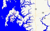
. Known as Bozman Neavitt Road, the state highway runs 7.35 mi (11.8 km) from the beginning of state maintenance in Neavitt
north to MD 33
near St. Michaels
. MD 579 provides access to the peninsula containing Neavitt and Bozman
, which lies between Harris Creek and Broad Creek in western Talbot County
. The state highway was constructed from MD 33 to Bozman in the mid 1930s and extended to Neavitt in the late 1950s.
.
{|class=wikitable
!Location
!Mile
!Destinations
!Notes
|-
|rowspan=1|Neavitt
|0.00
|Long Point Road south
|Southern terminus
|-
|rowspan=1|St. Michaels
|7.35
|
|Northern terminus
State highway
State highway, state road or state route can refer to one of three related concepts, two of them related to a state or provincial government in a country that is divided into states or provinces :#A...
in the U.S. state
U.S. state
A U.S. state is any one of the 50 federated states of the United States of America that share sovereignty with the federal government. Because of this shared sovereignty, an American is a citizen both of the federal entity and of his or her state of domicile. Four states use the official title of...
of Maryland
Maryland
Maryland is a U.S. state located in the Mid Atlantic region of the United States, bordering Virginia, West Virginia, and the District of Columbia to its south and west; Pennsylvania to its north; and Delaware to its east...
. Known as Bozman Neavitt Road, the state highway runs 7.35 mi (11.8 km) from the beginning of state maintenance in Neavitt
Neavitt, Maryland
Neavitt is an unincorporated community in Talbot County, Maryland, United States.-References:...
north to MD 33
Maryland Route 33
Maryland Route 33 is a state highway in the U.S. state of Maryland. The state highway runs from Tilghman Island east to Washington Street in Easton...
near St. Michaels
St. Michaels, Maryland
Saint Michaels is a town in Talbot County, Maryland, United States. The population was 1,193 at the 2000 census. Saint Michaels derives its name from the Episcopal Parish established here in 1677...
. MD 579 provides access to the peninsula containing Neavitt and Bozman
Bozman, Maryland
Bozman is an unincorporated community in Talbot County, Maryland, United States.-References:...
, which lies between Harris Creek and Broad Creek in western Talbot County
Talbot County, Maryland
-2010:Whereas according to the 2010 U.S. Census Bureau:*81.4% White*12.8% Black*0.2% Native American*1.2% Asian*0.1% Native Hawaiian or Pacific Islander*1.6% Two or more races*2.7% Other races*5.5% Hispanic or Latino -2000:...
. The state highway was constructed from MD 33 to Bozman in the mid 1930s and extended to Neavitt in the late 1950s.
Route description
MD 579 begins at the beginning of state maintenance at the southern end of the village of Neavitt. Long Point Road continues south 0.49 mi (0.7885766 km) to its southern terminus, and another road continues south a short distance further to Long Point. MD 579 heads northwest through Neavitt, which sits on Balls Creek to the northeast. The state highway curves north after leaving Neavitt and passes Wells Point Lane, which leads to the Jean Ellen duPont Shehan Audubon Sanctuary. MD 579 continues north through a mix of farms and residences on large, waterfront lots, curving northeast around the head of Leadenham Creek and into the village of Bozman. Within Bozman, the state highway intersects Bush Neck Road, which leads to Bush Neck and the Cooper Point peninsula, which flank Grace Creek. MD 579 heads north out of Bozman, passing through the narrow neck of land between Harris Creek and Broad Creek before reaching the highway's northern terminus at MD 33 (St. Michaels Road) northwest of the town of St. Michaels.History
MD 579 was constructed as a modern road from MD 33 south to just north of Bozman in 1935. The state highway was extended to its present terminus in Neavitt in 1957.Junction list
The entire route is in Talbot CountyTalbot County, Maryland
-2010:Whereas according to the 2010 U.S. Census Bureau:*81.4% White*12.8% Black*0.2% Native American*1.2% Asian*0.1% Native Hawaiian or Pacific Islander*1.6% Two or more races*2.7% Other races*5.5% Hispanic or Latino -2000:...
.
{|class=wikitable
!Location
!Mile
!Destinations
!Notes
|-
|rowspan=1|Neavitt
Neavitt, Maryland
Neavitt is an unincorporated community in Talbot County, Maryland, United States.-References:...
|0.00
|Long Point Road south
|Southern terminus
|-
|rowspan=1|St. Michaels
St. Michaels, Maryland
Saint Michaels is a town in Talbot County, Maryland, United States. The population was 1,193 at the 2000 census. Saint Michaels derives its name from the Episcopal Parish established here in 1677...
|7.35
|
|Northern terminus