
Maryland Route 414
Encyclopedia
Maryland Route 414 (Oxon Hill Road west of I-495/I-95 and Saint Barnabas Road east of I-495/I95) is a state road in Prince George's County
in the U.S. state
of Maryland
. It starts at Harborview Avenue just past MD 210's intersection with the Capital Beltway (I-495/I-95) and the Oxon Hill Park and Ride lot near the National Harbor
project and terminates at MD 458, going east passing through the communities of Forest Heights, Oxon Hill including the Rivertowne shopping center, Hillcrest Heights, and Suitland.
before it meets an interchange with MD 210 (Indian Head Highway). This interchange also provides connections to Interstate 295
further west. MD 414 continues eastbound, losing its median to a shared left-turn lane as it passes through the dense retail area of Oxon Hill
. After it crosses John Hanson Lane, the route's name changes to Saint Barnabas Road. It then curves northeast, interchanging with the Capital Beltway itself.
The route continues to serve homes and shopping centers as it passes northeast through Marlow Heights
, dualizing once again within the town and widening to six lanes. The route also passes by a number of churches. It curves to the north, narrowing again to four lanes, and meets an interchange with MD 5
(Branch Avenue), continuing north through the residential area. Just beyond its intersection with MD 458 (Silver Hill Road), the route curves sharply west and thins to two undivided lanes, following Old Silver Hill Road and passing through Silver Hill. The route then turns onto Bonita Street and follows it to end the MD 414 designation at another MD 5 intersection.
Prince George's County, Maryland
Prince George's County is a county located in the U.S. state of Maryland, immediately north, east, and south of Washington, DC. As of 2010, it has a population of 863,420 and is the wealthiest African-American majority county in the nation....
in the U.S. state
U.S. state
A U.S. state is any one of the 50 federated states of the United States of America that share sovereignty with the federal government. Because of this shared sovereignty, an American is a citizen both of the federal entity and of his or her state of domicile. Four states use the official title of...
of Maryland
Maryland
Maryland is a U.S. state located in the Mid Atlantic region of the United States, bordering Virginia, West Virginia, and the District of Columbia to its south and west; Pennsylvania to its north; and Delaware to its east...
. It starts at Harborview Avenue just past MD 210's intersection with the Capital Beltway (I-495/I-95) and the Oxon Hill Park and Ride lot near the National Harbor
Gaylord National Resort & Convention Center
The Gaylord National Resort & Convention Center is a large hotel and convention center located in National Harbor, Maryland and owned by Gaylord Hotels, a division of Gaylord Entertainment Company...
project and terminates at MD 458, going east passing through the communities of Forest Heights, Oxon Hill including the Rivertowne shopping center, Hillcrest Heights, and Suitland.
Route description
Maryland Route 414 begins along Oxon Hill Road at a point west of National Harbor Road intersection. It begins travelling north, and the route spreads to a four-lane divided orientation before this intersection. It curves to the east after, skirting the Capital BeltwayInterstate 495 (Capital Beltway)
Interstate 495 is a Interstate Highway that surrounds the United States' capital of Washington, D.C., and its inner suburbs in adjacent Maryland and Virginia. I-495 is widely known as the Capital Beltway or simply the Beltway, especially when the context of Washington, D.C., is clear...
before it meets an interchange with MD 210 (Indian Head Highway). This interchange also provides connections to Interstate 295
Interstate 295 (District of Columbia)
Interstate 295 in the U.S. state of Maryland and in Washington, D.C. is a spur route connecting I-95/I-495 and Maryland Route 210 on the Potomac River to Interstate 695 in downtown Washington.-Route description:Although I-295 technically begins at the Capital Beltway , a pair of mainline...
further west. MD 414 continues eastbound, losing its median to a shared left-turn lane as it passes through the dense retail area of Oxon Hill
Oxon Hill, Maryland
Oxon Hill is part of the Oxon Hill-Glassmanor census-designated place in southern Prince George's County, Maryland, United States. Oxon Hill is a suburb of Washington, DC located southeast of the downtown district and east of Alexandria, Virginia...
. After it crosses John Hanson Lane, the route's name changes to Saint Barnabas Road. It then curves northeast, interchanging with the Capital Beltway itself.
The route continues to serve homes and shopping centers as it passes northeast through Marlow Heights
Marlow Heights, Maryland
Marlow Heights is an unincorporated area and census-designated place in Prince George's County, Maryland, United States. The population was 6,059 at the 2000 census...
, dualizing once again within the town and widening to six lanes. The route also passes by a number of churches. It curves to the north, narrowing again to four lanes, and meets an interchange with MD 5
Maryland Route 5
Maryland Route 5 is a long state highway that runs north–south in the U.S. state of Maryland. The highway runs from Point Lookout in St. Mary's County north to the Washington, D.C. border in Suitland, Prince George's County....
(Branch Avenue), continuing north through the residential area. Just beyond its intersection with MD 458 (Silver Hill Road), the route curves sharply west and thins to two undivided lanes, following Old Silver Hill Road and passing through Silver Hill. The route then turns onto Bonita Street and follows it to end the MD 414 designation at another MD 5 intersection.
Junction list
| Location | Mile | Destinations | Notes |
|---|---|---|---|
 begins at arbitrary point on Oxon Hill Road begins at arbitrary point on Oxon Hill Road |
|||
| National Harbor National Harbor, Maryland National Harbor is a multi-use waterfront development on the shores of the Potomac River in Prince George's County, Maryland just south of Washington, D.C. near the Woodrow Wilson Bridge. It is being built by the Peterson Companies. The project is expected to cost over $2 billion... |
0.08 | South Rd. - National Harbor Beltway Parcel | northern segment of road connects to exit ramp from  |
| 0.21 | North Rd. - National Harbor Beltway Parcel | ||
| 0.41 | Bald Eagle Rd. north - Oxon Hill Farm | intersection includes ramps to  |
|
| 0.52 | MD 210 Maryland Route 210 Maryland Route 210 , or Indian Head Highway, is a state highway in Prince George's and Charles counties in Maryland. At its northern end, MD 210 starts from the end of South Capitol Street in Washington, D.C., connecting the U.S. Capitol with Indian Head, Maryland... / Indian Head Highway - Indian Head Indian Head, Maryland Indian Head is a town in Charles County, Maryland, United States. The population was 3,422 at the 2000 census. It has been the site of a naval base specializing in gun and rocket propellants since 1890. Production of nitrocellulose and smokeless powder began at the Indian Head Powder Factory in 1900... , Washington D.C. |
grade-separated interchange between routes | |
| Oxon Hill Oxon Hill, Maryland Oxon Hill is part of the Oxon Hill-Glassmanor census-designated place in southern Prince George's County, Maryland, United States. Oxon Hill is a suburb of Washington, DC located southeast of the downtown district and east of Alexandria, Virginia... |
0.73 | Felker Ave. | |
| 1.03 | Livingston Rd. | former route of  |
|
| 1.83 | John Hanson Ln. | changes to St. Barnabas Rd. at this intersection |
|
| 2.18 |   I-95 I-95Interstate 95 in Maryland Interstate 95 in Maryland is a major highway that runs diagonally from northeast to southwest, from Maryland's border with Delaware, to the Woodrow Wilson Bridge, briefly entering the District of Columbia before reaching Virginia... /I-495 Interstate 495 (Capital Beltway) Interstate 495 is a Interstate Highway that surrounds the United States' capital of Washington, D.C., and its inner suburbs in adjacent Maryland and Virginia. I-495 is widely known as the Capital Beltway or simply the Beltway, especially when the context of Washington, D.C., is clear... / Capital Beltway - Richmond Richmond, Virginia Richmond is the capital of the Commonwealth of Virginia, in the United States. It is an independent city and not part of any county. Richmond is the center of the Richmond Metropolitan Statistical Area and the Greater Richmond area... , Baltimore |
grade-separated interchange between routes | |
| 2.39 | Virginia Ln. | ||
| 2.82 | Winston St.-Wheeler Rd. | ||
| Marlow Heights Marlow Heights, Maryland Marlow Heights is an unincorporated area and census-designated place in Prince George's County, Maryland, United States. The population was 6,059 at the 2000 census... |
3.41 | Hagan Rd. south | |
| 3.72 | Temple Hill Rd.-Raleigh Rd. | ||
| 4.17 | Stamp Rd. - to Beech Rd. | ||
| 4.46 | 28th Ave. | intersection includes ramps to and from  |
|
| 4.57 | MD 5 Maryland Route 5 Maryland Route 5 is a long state highway that runs north–south in the U.S. state of Maryland. The highway runs from Point Lookout in St. Mary's County north to the Washington, D.C. border in Suitland, Prince George's County.... / Branch Avenue - Washington D.C., Waldorf Waldorf, Maryland Waldorf, Maryland is an unincorporated community and census-designated place in Charles County, Maryland, United States. It is south-southeast of Washington, D.C. The population of the census-designated area only was 67,752 at the 2010 census... (to  ) ) |
grade-separated interchange between routes | |
| 4.81 |  MD 967A / Bedford Way MD 967A / Bedford Way |
is unsigned |
|
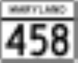
| 5.15 |  MD 458 MD 458Maryland Route 458 Maryland Route 458 is a state highway in the U.S. state of Maryland. Known as Silver Hill Road, the route runs from Maryland Route 5 in Hillcrest Heights north to Walker Mill Road in District Heights.-Route description:... / Silver Hill Rd. - Suitland (to Suitland Parkway Suitland Parkway The Suitland Parkway is a parkway in Washington, D.C., and Prince George's County, Maryland, maintained by the U.S. National Park Service. Conceived in 1937, it was built during World War II to provide a road connection between military facilities in the Washington, D.C., metropolitan area, and... ) |
follows Old Silver Hill Rd. north of this intersection |
|
| 5.61 | MD 414A / Old Silver Hill Rd. north |
former route of |
|
| 5.64 | MD 5 Maryland Route 5 Maryland Route 5 is a long state highway that runs north–south in the U.S. state of Maryland. The highway runs from Point Lookout in St. Mary's County north to the Washington, D.C. border in Suitland, Prince George's County.... / Branch Avenue |
northern terminus of |
|