
Maryland Route 370
Encyclopedia
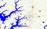
Maryland Route 370 is a state highway
in the U.S. state
of Maryland
. Known as Unionville Road, the state highway runs 1.58 mi (2.5 km) from MD 33
near Easton to Miles River Road near Unionville
. MD 370 connects Easton with the northwestern Talbot County
villages of Unionville and Tunis Mills, which are separated from the county seat
by the Miles River
. The Miles River Bridge was constructed in the early 1910s. MD 370 was completed in the early 1930s when the bridge was connected with a modern road to MD 33.
before reaching its northern terminus at an intersection with Miles River Road near Unionville. Unionville Road continues north as a county highway toward the center of Unionville and Tunis Mills.
.
{|class=wikitable
!Location
!Mile
!Destinations
!Notes
|-
|
|0.00
|
|Southern terminus
|-
|Unionville
|1.58
|Unionville Road north / Miles River Road west
|Northern terminus
State highway
State highway, state road or state route can refer to one of three related concepts, two of them related to a state or provincial government in a country that is divided into states or provinces :#A...
in the U.S. state
U.S. state
A U.S. state is any one of the 50 federated states of the United States of America that share sovereignty with the federal government. Because of this shared sovereignty, an American is a citizen both of the federal entity and of his or her state of domicile. Four states use the official title of...
of Maryland
Maryland
Maryland is a U.S. state located in the Mid Atlantic region of the United States, bordering Virginia, West Virginia, and the District of Columbia to its south and west; Pennsylvania to its north; and Delaware to its east...
. Known as Unionville Road, the state highway runs 1.58 mi (2.5 km) from MD 33
Maryland Route 33
Maryland Route 33 is a state highway in the U.S. state of Maryland. The state highway runs from Tilghman Island east to Washington Street in Easton...
near Easton to Miles River Road near Unionville
Unionville, Talbot County, Maryland
Unionville is an unincorporated community in Talbot County, Maryland, United States. Unionville is located on Maryland Route 370 northwest of Easton....
. MD 370 connects Easton with the northwestern Talbot County
Talbot County, Maryland
-2010:Whereas according to the 2010 U.S. Census Bureau:*81.4% White*12.8% Black*0.2% Native American*1.2% Asian*0.1% Native Hawaiian or Pacific Islander*1.6% Two or more races*2.7% Other races*5.5% Hispanic or Latino -2000:...
villages of Unionville and Tunis Mills, which are separated from the county seat
County seat
A county seat is an administrative center, or seat of government, for a county or civil parish. The term is primarily used in the United States....
by the Miles River
Miles River
The Miles River is a tidal river in Talbot County, Maryland. It is a tributary of the Eastern Bay and is thus part of the Chesapeake Bay watershed. The town of St. Michaels is located on the Miles River, and the river's name is believed to be derived from the name of the town.Its watershed area...
. The Miles River Bridge was constructed in the early 1910s. MD 370 was completed in the early 1930s when the bridge was connected with a modern road to MD 33.
Route description
MD 370 begins at an intersection with MD 33 (St. Michaels Road) west of Easton. The state highway heads northwest as a two-lane road through a mix of farmland and residential subdivisions. MD 370 crosses the Miles River on a bascule drawbridgeBascule bridge
A bascule bridge is a moveable bridge with a counterweight that continuously balances the span, or "leaf," throughout the entire upward swing in providing clearance for boat traffic....
before reaching its northern terminus at an intersection with Miles River Road near Unionville. Unionville Road continues north as a county highway toward the center of Unionville and Tunis Mills.
History
The original Miles River Bridge was constructed as a state-aid project in 1913, along with 2 mi (3.2 km) of roads connecting the bridge to Unionville and Tunis Mills. The bridge was connected with a modern road to MD 33 by 1933. The original Miles River Bridge was replaced by the present bridge in 1984.Junction list
The entire route is in Talbot CountyTalbot County, Maryland
-2010:Whereas according to the 2010 U.S. Census Bureau:*81.4% White*12.8% Black*0.2% Native American*1.2% Asian*0.1% Native Hawaiian or Pacific Islander*1.6% Two or more races*2.7% Other races*5.5% Hispanic or Latino -2000:...
.
{|class=wikitable
!Location
!Mile
!Destinations
!Notes
|-
|
|0.00
|
|Southern terminus
|-
|Unionville
Unionville, Talbot County, Maryland
Unionville is an unincorporated community in Talbot County, Maryland, United States. Unionville is located on Maryland Route 370 northwest of Easton....
|1.58
|Unionville Road north / Miles River Road west
|Northern terminus