
Markstay-Warren, Ontario
Encyclopedia
Markstay-Warren is a town
in the Canadian province
of Ontario
, located in the Sudbury District
. Highway 17, from the city limits of Greater Sudbury to the Sudbury District's border with Nipissing District
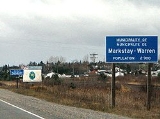
, lies entirely within Markstay-Warren. The town had a population
of 2,475 in the Canada 2006 Census
.
The town was created on January 1, 1999 by amalgamating the political township
s of Ratter and Dunnet and Hagar, the geographic township
of Awrey, and parts of the geographic townships of Hawley, Henry, Loughrin and Street. Along with the municipalities
of St. Charles and French River, it is part of the region known as Sudbury East
.
Stinson, Callum, Hagar and Warren are all located directly on Highway 17, a branch of the Trans-Canada Highway
. Appleby Corner is located south of Hagar on Highway 535
. The other communities are all located along local roads that branch off from one of these two highways. In 2010, planning commenced on a future extension of Highway 17's freeway alignment in Sudbury, which will eventually see the freeway's eastern terminus located near Main Street into Markstay.
. Most settlers were French-Canadian Roman Catholics who came by rail from the province of Quebec
.
Shortly after the completion of the transcontinental line of the CPR in 1885, a station and community was established at Rivière-Veuve, taking its name from the Veuve River that flows through this area. In 1890, the Warren family of Toronto established a sawmill, slightly east of Rivière-Veuve, operating under the name Imperial Lumber Company. A standard gauge logging railroad was also constructed to bring logs to the mill.
In the first part of the 20th century, lumber and agriculture were the main economic activities in the area. By the 1960s, Warren's population and economy grew steadily and because of its proximity (60 km) to Sudbury, many area residents were employed in the mines of the Sudbury area. By the 1970s, important local employers included Ontario Hydro
and the Ontario Provincial Police
.
The economic recession of the early 1990s hit the Warren area significantly hard as corporate restructuring and downsizing at Ontario Hydro and the OPP resulted in the closure of the Ontario Hydro office and reductions in staff at the OPP. As a consequence, Warren's population suffered and many residents moved to larger centres such as Sudbury or North Bay.
Town
A town is a human settlement larger than a village but smaller than a city. The size a settlement must be in order to be called a "town" varies considerably in different parts of the world, so that, for example, many American "small towns" seem to British people to be no more than villages, while...
in the Canadian province
Province
A province is a territorial unit, almost always an administrative division, within a country or state.-Etymology:The English word "province" is attested since about 1330 and derives from the 13th-century Old French "province," which itself comes from the Latin word "provincia," which referred to...
of Ontario
Ontario
Ontario is a province of Canada, located in east-central Canada. It is Canada's most populous province and second largest in total area. It is home to the nation's most populous city, Toronto, and the nation's capital, Ottawa....
, located in the Sudbury District
Sudbury District, Ontario
The Sudbury District is a district in Northeastern Ontario in the Canadian province of Ontario. It was created in 1894 from townships of eastern Algoma District and west Nipissing District....
. Highway 17, from the city limits of Greater Sudbury to the Sudbury District's border with Nipissing District
Nipissing District, Ontario
Nipissing District, Ontario is a district in Northeastern Ontario in the Canadian province of Ontario. It was created in 1858. The district seat is North Bay.In 2006, the population was 84,688...
, lies entirely within Markstay-Warren. The town had a population
Population
A population is all the organisms that both belong to the same group or species and live in the same geographical area. The area that is used to define a sexual population is such that inter-breeding is possible between any pair within the area and more probable than cross-breeding with individuals...
of 2,475 in the Canada 2006 Census
Canada 2006 Census
The Canada 2006 Census was a detailed enumeration of the Canadian population. Census day was May 16, 2006. The next census following will be the 2011 Census. Canada's total population enumerated by the 2006 census was 31,612,897...
.
The town was created on January 1, 1999 by amalgamating the political township
Township (Canada)
The term township generally means the district or area associated with a town. However in some systems no town needs to be involved. The specific use of the term to describe political subdivisions has varied by country, usually to describe a local rural or semi-rural government within the county...
s of Ratter and Dunnet and Hagar, the geographic township
Township (Canada)
The term township generally means the district or area associated with a town. However in some systems no town needs to be involved. The specific use of the term to describe political subdivisions has varied by country, usually to describe a local rural or semi-rural government within the county...
of Awrey, and parts of the geographic townships of Hawley, Henry, Loughrin and Street. Along with the municipalities
Municipality
A municipality is essentially an urban administrative division having corporate status and usually powers of self-government. It can also be used to mean the governing body of a municipality. A municipality is a general-purpose administrative subdivision, as opposed to a special-purpose district...
of St. Charles and French River, it is part of the region known as Sudbury East
Sudbury East
Sudbury East was a provincial electoral riding in the Canadian province of Ontario, that was represented in the Legislative Assembly of Ontario from 1967 to 1999. It served the easternmost portion of the former city of Sudbury, the eastern portion of the Regional Municipality of Sudbury, and...
.
Communities
The town includes the communities of Appleby Corner, Callum, Dunnet Corner, Hagar, Markstay, Rivière-Veuve, Stinson and Warren. Markstay is the location of the town's municipal offices.Stinson, Callum, Hagar and Warren are all located directly on Highway 17, a branch of the Trans-Canada Highway
Trans-Canada Highway
The Trans-Canada Highway is a federal-provincial highway system that joins the ten provinces of Canada. It is, along with the Trans-Siberian Highway and Australia's Highway 1, one of the world's longest national highways, with the main route spanning 8,030 km...
. Appleby Corner is located south of Hagar on Highway 535
Ontario Highway 535
Secondary Highway 535, commonly referred to as Highway 535, is a provincially maintained secondary highway in the Canadian province of Ontario. Passing through the municipalities of Markstay-Warren, St...
. The other communities are all located along local roads that branch off from one of these two highways. In 2010, planning commenced on a future extension of Highway 17's freeway alignment in Sudbury, which will eventually see the freeway's eastern terminus located near Main Street into Markstay.
History
Much of the area owes its existence to the Canadian Pacific RailwayCanadian Pacific Railway
The Canadian Pacific Railway , formerly also known as CP Rail between 1968 and 1996, is a historic Canadian Class I railway founded in 1881 and now operated by Canadian Pacific Railway Limited, which began operations as legal owner in a corporate restructuring in 2001...
. Most settlers were French-Canadian Roman Catholics who came by rail from the province of Quebec
Quebec
Quebec or is a province in east-central Canada. It is the only Canadian province with a predominantly French-speaking population and the only one whose sole official language is French at the provincial level....
.
Shortly after the completion of the transcontinental line of the CPR in 1885, a station and community was established at Rivière-Veuve, taking its name from the Veuve River that flows through this area. In 1890, the Warren family of Toronto established a sawmill, slightly east of Rivière-Veuve, operating under the name Imperial Lumber Company. A standard gauge logging railroad was also constructed to bring logs to the mill.
In the first part of the 20th century, lumber and agriculture were the main economic activities in the area. By the 1960s, Warren's population and economy grew steadily and because of its proximity (60 km) to Sudbury, many area residents were employed in the mines of the Sudbury area. By the 1970s, important local employers included Ontario Hydro
Ontario Hydro
Ontario Hydro was the official name from 1974 of the Hydro-Electric Power Commission of Ontario which was established in 1906 by the provincial Power Commission Act to build transmission lines to supply municipal utilities with electricity generated by private companies already operating at Niagara...
and the Ontario Provincial Police
Ontario Provincial Police
The Ontario Provincial Police is the Provincial Police service for the province of Ontario, Canada.-Overview:The OPP is the the largest deployed police force in Ontario, and the second largest in Canada. The service is responsible for providing policing services throughout the province in areas...
.
The economic recession of the early 1990s hit the Warren area significantly hard as corporate restructuring and downsizing at Ontario Hydro and the OPP resulted in the closure of the Ontario Hydro office and reductions in staff at the OPP. As a consequence, Warren's population suffered and many residents moved to larger centres such as Sudbury or North Bay.