

Maine State Route 228
Encyclopedia
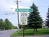
State Route 228 is part of Maine
's system of numbered state highways. It runs 16.93 miles (27.2 km) from Washburn
to Caribou
. It begins at an intersection with State Route 164
in downtown Washburn, and ends at an intersection of State Route 161
in Caribou. The road is also known as Hines Street (in Washburn), Perham Street (in Wade and Perham), Woodland Center Road (in Woodland), and Sweden Street (in Caribou).
228 runs through the communities of Wade
, Perham
, and Woodland
.
 State Route 228T is part of Maine
's system of numbered state highways. It is a 0.6 mile (0.965604 km) long truck route
that bypasses downtown Washburn
. It begins at an intersection with Maine State Route 164
on the West side of downtown Washburn, and ends at an intersection with Maine State Route 228 just North of downtown. The road is also known as Canaan Avenue and Victoria Street. State Route 228T is notable for being the only truck route ever in the Maine State Highway System.
Maine
Maine is a state in the New England region of the northeastern United States, bordered by the Atlantic Ocean to the east and south, New Hampshire to the west, and the Canadian provinces of Quebec to the northwest and New Brunswick to the northeast. Maine is both the northernmost and easternmost...
's system of numbered state highways. It runs 16.93 miles (27.2 km) from Washburn
Washburn, Maine
Washburn is a town in Aroostook County, Maine, United States. It was incorporated on February 25, 1861, and named after Israel Washburn, the governor of Maine at the time...
to Caribou
Caribou, Maine
Caribou is the second largest city in Aroostook County, Maine, United States. Its population was 8,189 at the 2010 census.-History:Between 1838 and 1839, the undeclared Aroostook War flared between the United States and Canada, and the Battle of Caribou occurred in December 1838...
. It begins at an intersection with State Route 164
Maine State Route 164
State Route 164 is part of Maine's system of numbered state highways. It runs from Presque Isle to Caribou. It begins at an intersection with U.S. 1 just north of Presque Isle, and ends at a junction of State Route 161 and U.S. Route 1 in Caribou...
in downtown Washburn, and ends at an intersection of State Route 161
Maine State Route 161
State Route 161 is part of Maine's system of numbered state highways. It runs from Fort Fairfield to Allagash. It begins at an intersection with U.S. 1A in Fort Fairfield, and deadends at the St. John River west of Allagash.....
in Caribou. The road is also known as Hines Street (in Washburn), Perham Street (in Wade and Perham), Woodland Center Road (in Woodland), and Sweden Street (in Caribou).
228 runs through the communities of Wade
Wade, Maine
Wade is a town in Aroostook County, Maine, United States. The population was 250 at the 2000 census.-Geography:According to the United States Census Bureau, the town has a total area of , of which, of it is land and of it is water.-Demographics:...
, Perham
Perham, Maine
Perham is a town in Aroostook County, Maine, United States. The population was 434 at the 2000 census. The town was named after Maine's 33rd governor, Sidney Perham.-Geography:...
, and Woodland
Woodland, Aroostook County, Maine
Woodland is a town in Aroostook County, Maine, United States. The population was 1,403 at the 2000 census. Because the state of Maine has a law stating that no two towns may share the same name, Woodland of Aroostook County and Woodland of Washington County found themselves before the Maine State...
.
SR 228 Truck
Maine
Maine is a state in the New England region of the northeastern United States, bordered by the Atlantic Ocean to the east and south, New Hampshire to the west, and the Canadian provinces of Quebec to the northwest and New Brunswick to the northeast. Maine is both the northernmost and easternmost...
's system of numbered state highways. It is a 0.6 mile (0.965604 km) long truck route
Bypass (road)
A bypass is a road or highway that avoids or "bypasses" a built-up area, town, or village, to let through traffic flow without interference from local traffic, to reduce congestion in the built-up area, and to improve road safety....
that bypasses downtown Washburn
Washburn, Maine
Washburn is a town in Aroostook County, Maine, United States. It was incorporated on February 25, 1861, and named after Israel Washburn, the governor of Maine at the time...
. It begins at an intersection with Maine State Route 164
Maine State Route 164
State Route 164 is part of Maine's system of numbered state highways. It runs from Presque Isle to Caribou. It begins at an intersection with U.S. 1 just north of Presque Isle, and ends at a junction of State Route 161 and U.S. Route 1 in Caribou...
on the West side of downtown Washburn, and ends at an intersection with Maine State Route 228 just North of downtown. The road is also known as Canaan Avenue and Victoria Street. State Route 228T is notable for being the only truck route ever in the Maine State Highway System.