
Louisiana Highway 8
Encyclopedia
Louisiana Highway 8 is a state highway
in Louisiana
. It spans 156.09 miles (251.2 km) beginning at the Louisiana/Texas
state line and ending at an intersection with LA 15.
becomes LA 8 after crossing the Sabine River near Burr Ferry
. at the Burr's Ferry Bridge
, in Vernon Parish heading east, and merges with U.S. Highway 171 north in Leesville. In Leesville, U.S. 171/LA 8 continues north as a four lane, divided road through town. LA 8 breaks off from U.S. 171 at the northern city limits and joins and runs concurrent with LA 28 east, and continues northeastward as a four lane divided Highway. LA 28/8 intersects with LA 468 (The old Slagle road) south just before LA 8 splits and heads northeast as a two lane road, Intersecting with LA 469, passing through Slagle, intersecting LA 121, the LA 465, and passing north of Simpson, before exiting Vernon Parish and entering northwestern Rapides Parish.
In Rapides Parish, LA 8 continues northeastward, passing north of Lake Rodemacher, and merges with I-49
for approximately a mile. When LA 8 merges with I-49 south, Louisiana Highway 8 Spur connects LA 8 with LA 1, which parallels I-49. LA 8 then splits from I-49 after approximately a mile and passes through Boyce and heads due north, crossing the Red River
into Grant Parish. At Colfax, LA 8 turns eastward and intersects U.S. Highway 71, U.S. 167, and U.S 165 in Pollock. LA 8 then turns northeastward and enters La Salle Parish.
In Jena, LA 8 merges with U.S. 84 and turns to the southeast. After approximately 6 miles (9.7 km), LA 8 splits with U.S. 84 and continues eastward into Catahoula Parish. In Catahoula Parish, LA 8 passes through Harrisonburg and Sicily Island, where it ends at an intersection with LA 15.
State highway
State highway, state road or state route can refer to one of three related concepts, two of them related to a state or provincial government in a country that is divided into states or provinces :#A...
in Louisiana
Louisiana
Louisiana is a state located in the southern region of the United States of America. Its capital is Baton Rouge and largest city is New Orleans. Louisiana is the only state in the U.S. with political subdivisions termed parishes, which are local governments equivalent to counties...
. It spans 156.09 miles (251.2 km) beginning at the Louisiana/Texas
Texas
Texas is the second largest U.S. state by both area and population, and the largest state by area in the contiguous United States.The name, based on the Caddo word "Tejas" meaning "friends" or "allies", was applied by the Spanish to the Caddo themselves and to the region of their settlement in...
state line and ending at an intersection with LA 15.
Route description
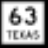
From the west State Highway 63 (Texas)State Highway 63 (Texas)
State Highway 63 or SH 63 is a highway in east Texas that runs from Zavalla through Jasper, continuing east to the Louisiana border. The highway was originally designated by 1926 along the easternmost branch of previously numbered SH 7 from Zavalla southeast to Bon Wier. By 1938, the section from...
becomes LA 8 after crossing the Sabine River near Burr Ferry
Burr Ferry, Louisiana
Burr Ferry is a community at the junction of LA 8 and LA 111 south, in Vernon Parish, Louisiana, United States. This is only a couple of miles from the site of the old Burr’s Ferry on the Sabine River, at the Texas line...
. at the Burr's Ferry Bridge
Burr's Ferry Bridge
Burr's Ferry Bridge is a bridge on the Sabine River where LA 8 meets Texas State Highway 63 at the Louisiana and Texas state lines.-External links:* *...
, in Vernon Parish heading east, and merges with U.S. Highway 171 north in Leesville. In Leesville, U.S. 171/LA 8 continues north as a four lane, divided road through town. LA 8 breaks off from U.S. 171 at the northern city limits and joins and runs concurrent with LA 28 east, and continues northeastward as a four lane divided Highway. LA 28/8 intersects with LA 468 (The old Slagle road) south just before LA 8 splits and heads northeast as a two lane road, Intersecting with LA 469, passing through Slagle, intersecting LA 121, the LA 465, and passing north of Simpson, before exiting Vernon Parish and entering northwestern Rapides Parish.
In Rapides Parish, LA 8 continues northeastward, passing north of Lake Rodemacher, and merges with I-49
Interstate 49
Interstate 49 is currently an intrastate Interstate Highway located entirely within the state of Louisiana in the southern United States. Its southern terminus is in Lafayette, Louisiana, at Interstate 10 while its northern terminus is in Shreveport, Louisiana, at Interstate 20.-Route...
for approximately a mile. When LA 8 merges with I-49 south, Louisiana Highway 8 Spur connects LA 8 with LA 1, which parallels I-49. LA 8 then splits from I-49 after approximately a mile and passes through Boyce and heads due north, crossing the Red River
Red River (Mississippi watershed)
The Red River, or sometimes the Red River of the South, is a major tributary of the Mississippi and Atchafalaya Rivers in the southern United States of America. The river gains its name from the red-bed country of its watershed. It is one of several rivers with that name...
into Grant Parish. At Colfax, LA 8 turns eastward and intersects U.S. Highway 71, U.S. 167, and U.S 165 in Pollock. LA 8 then turns northeastward and enters La Salle Parish.
In Jena, LA 8 merges with U.S. 84 and turns to the southeast. After approximately 6 miles (9.7 km), LA 8 splits with U.S. 84 and continues eastward into Catahoula Parish. In Catahoula Parish, LA 8 passes through Harrisonburg and Sicily Island, where it ends at an intersection with LA 15.
Parishes served by LA 8
- VernonVernon Parish, LouisianaVernon Parish is a parish located in the U.S. state of Louisiana. The parish seat is Leesville and as of 2000, the population was 52,531....
- RapidesRapides Parish, Louisiana-Military Installations:*Camp Beauregard *Esler Airfield *England Air Force Base *Camp Claiborne *Camp Livingston -Demographics:...
- GrantGrant Parish, Louisiana-Demographics:As of the census of 2000, there were 18,698 people, 7,073 households, and 5,276 families residing in the parish. The population density was 29 people per square mile . There were 8,531 housing units at an average density of 13 per square mile...
- LaSalle
- CatahoulaCatahoula Parish, LouisianaCatahoula Parish is a parish located in the U.S. state of Louisiana. Its seat is Harrisonburg, located on the Ouachita River, which forms the eastern boundary of the parish. In 2000, the population of the parish was 10,920.-Prehistory:...