
Louisiana Highway 2
Encyclopedia
Louisiana Highway 2 is a state highway
in the U.S. state
of Louisiana
. It runs in a west to east direction, beginning at State Highway 49
and ending at an intersection with U.S. Highway 65 in East Carroll Parish. Highway 2 is approximately 180 miles (289.7 km) long and is located entirely north of and parallel to Interstate 20
.
and runs due north. The highways split in Vivian, where LA 2 continues eastward. In Sarepta, Louisiana Highway 2 Spur connects LA 2 with the L&A Railroad Station. LA 2 still continues nearly due east into Claiborne Parish. In Shongaloo, LA 2 Alternate splits from LA 2 and runs north of and parallel to the original highway. LA 2 also merges with U.S. Highway 165 in northern Ouachita Parish, but the highways split in Bastrop. From there, LA 2 runs almost due east until it ends at an intersection with U.S. Highway 65 just north of Lake Providence. With the exception of the merges with LA 1 and U.S. 165 and a 3½ mile stretch in Plan Dealing, LA 2 is a two lane, undivided highway.
in Haynesville as it heads due east. LA 2 ALT also intersects Louisiana Highway 9
just before LA 2 ALT enters Union Parish, where LA 2 ALT ends at an intersection with U.S. Route 167
/U.S. Route 63
in Bernice
State highway
State highway, state road or state route can refer to one of three related concepts, two of them related to a state or provincial government in a country that is divided into states or provinces :#A...
in the U.S. state
U.S. state
A U.S. state is any one of the 50 federated states of the United States of America that share sovereignty with the federal government. Because of this shared sovereignty, an American is a citizen both of the federal entity and of his or her state of domicile. Four states use the official title of...
of Louisiana
Louisiana
Louisiana is a state located in the southern region of the United States of America. Its capital is Baton Rouge and largest city is New Orleans. Louisiana is the only state in the U.S. with political subdivisions termed parishes, which are local governments equivalent to counties...
. It runs in a west to east direction, beginning at State Highway 49
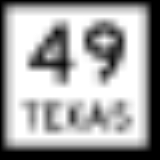
State Highway 49 (Texas)
State Highway 49 is a designated north–south state highway in Texas, running from Mount Pleasant, Texas to a point on the Texas-Louisiana border about three miles north of Caddo Lake, where it meets Louisiana Highway 2, which continues onward to Trees, Louisiana. SH 49 covers a total...
and ending at an intersection with U.S. Highway 65 in East Carroll Parish. Highway 2 is approximately 180 miles (289.7 km) long and is located entirely north of and parallel to Interstate 20
Interstate 20
Interstate 20 is a major east–west Interstate Highway in the Southern United States. I‑20 runs 1,535 miles from near Kent, Texas, at Interstate 10 to Florence, South Carolina, at Interstate 95...
.
Route description
LA 2 begins at the Louisiana/Texas state line in northern Caddo Parish. It merges shortly with LA 1Louisiana Highway 1
Louisiana Highway 1 is a state highway in Louisiana. At 436.20 miles , it is the longest numbered highway of any class in Louisiana. It runs diagonally across the state, connecting the oil and gas fields near the island of Grand Isle with the northwest corner of the state, north of Shreveport.The...
and runs due north. The highways split in Vivian, where LA 2 continues eastward. In Sarepta, Louisiana Highway 2 Spur connects LA 2 with the L&A Railroad Station. LA 2 still continues nearly due east into Claiborne Parish. In Shongaloo, LA 2 Alternate splits from LA 2 and runs north of and parallel to the original highway. LA 2 also merges with U.S. Highway 165 in northern Ouachita Parish, but the highways split in Bastrop. From there, LA 2 runs almost due east until it ends at an intersection with U.S. Highway 65 just north of Lake Providence. With the exception of the merges with LA 1 and U.S. 165 and a 3½ mile stretch in Plan Dealing, LA 2 is a two lane, undivided highway.
LA 2 Alternate
Louisiana Highway 2 Alternate (LA 2 ALT) begins in Shongaloo after splitting from LA 2 and runs north of the original highway. LA 2 ALT intersects U.S. Route 79U.S. Route 79
U.S. Route 79 is a north–south United States highway. The route is a northeast-southwest diagonal, with both east–west segments and north–south segments equally mixed. The highway's northern terminus is in Russellville, Kentucky, at an intersection with U.S. Highway 68 and KY 80...
in Haynesville as it heads due east. LA 2 ALT also intersects Louisiana Highway 9
Louisiana Highway 9
Louisiana Highway 9 is a state highway that serves Natchitoches Parish, Bienville Parish, and Claiborne Parish in north Louisiana. It spans , running a north–south route.-Route description:...
just before LA 2 ALT enters Union Parish, where LA 2 ALT ends at an intersection with U.S. Route 167
U.S. Route 167
U.S. Route 167 runs for 499 miles from Ash Flat, Arkansas at U.S. Route 62 to Abbeville, Louisiana at Louisiana Highway 14. It goes through the cities of Little Rock, Arkansas, Alexandria, Louisiana, and Lafayette, Louisiana....
/U.S. Route 63
U.S. Route 63
U.S. Route 63 is a long north–south United States highway primarily in the Midwestern United States. The southern terminus of the route is at Interstate 20 in Ruston, Louisiana. The northern terminus is at U.S. Route 2 in Benoit, Wisconsin, about east of Duluth, Minnesota. It is not related to U.S...
in Bernice