
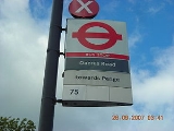
London Buses route 75
Encyclopedia
London Buses route 75 is a Transport for London
contracted bus route in London, United Kingdom. The service is currently contracted to Metrobus
.
) and South Croydon
(Swan & Sugar Loaf). It was operated by Tillings Bus Company and has been the only motor bus route in London to carry the route number 75. The route was acquired by the London General Omnibus Company Co Ltd which extended it from Croydon to Caterham
Valley.
In 1950 the 75 worked from Woolwich Ferry
by way of Charlton
, Blackheath
and Lee Green and carry on from Catford
missing out Lewisham
. RT type
buses were used. In 1960 the route was extended, on weekdays only, to South Croydon, from West Croydon station
. In 1983 it converted to single person operation, using Leyland Titans
.
In 1991 the 75 was withdrawn between Woolwich and Blackheath and, later in the same year, stopped running to Blackheath in favour of Lewisham being the terminating stop, additionally there was an extended Saturday shopping hours service to Surrey Quays
. The route was also diverted in Sydenham, running to Woolstone Road and Mayow Road instead of the original Bell Green. In 1994 beyond Lewisham was abandoned to make the more or less current route of Lewisham to West Croydon, although, in that year, it was converted to single decker operation. Volvo Olympian
operation started again in 1997 and, in 2002, the route was extended to Croydon
Fairfield Halls
.
In 2000 the 54 route
was shortened to Elmers End (due to the new Tramlink) and so the 75 had become quite a busy route. Despite this, the night service of the route, between 2am and 4am, was little used during the week and was withdrawn on 19 May 2007.
In November 2005 and February 2006, three cases of sexual assault were reported to have occurred on the route.
On 15 September 2008, Metrobus
won the contract to operate the route, beating three other tenders by bidding jointly for routes 75 and 54
. They took over operation of the route on 25 April 2009 using 18 new Scania N230UD / Optare Olympus
. The movement of the route into Metrobus' Croydon garage led to the garage car park being locked for nine hours each night, causing bus drivers to park on a nearby footpath.
Bill Wyman
used this service regularly to visit his grandmother.
There were also in London:
Transport for London
Transport for London is the local government body responsible for most aspects of the transport system in Greater London in England. Its role is to implement the transport strategy and to manage transport services across London...
contracted bus route in London, United Kingdom. The service is currently contracted to Metrobus
Metrobus (Go-Ahead Group)
Metrobus is a bus operator with routes in south and south-east London, and parts of Surrey, Kent, West and East Sussex. The company operates many routes on tender from Transport for London. Formed through a management buyout of Tillingbourne Ltd...
.
History
The 75 started operation on 15 December 1912 as a daily route between Woolwich (Free FerryWoolwich Ferry
The Woolwich Free Ferry is a boat service across the River Thames, London, UK, which is licensed and financed by London River Services, the maritime arm of Transport for London...
) and South Croydon
South Croydon
South Croydon is a locality in Greater London, the area surrounding the valley south of central Croydon about 1 km in radius, centred on the Red Deer public house on the Brighton Road. It is part of the South Croydon post town and in the London Borough of Croydon...
(Swan & Sugar Loaf). It was operated by Tillings Bus Company and has been the only motor bus route in London to carry the route number 75. The route was acquired by the London General Omnibus Company Co Ltd which extended it from Croydon to Caterham
Caterham
Caterham is a town in the Tandridge District of Surrey, England. The town is geographically divided into two sections: Caterham on the Hill and Caterham Valley - the main town centre. The town lies close to the A22, a few miles south of Croydon, in a valley cut into the dip slope of the North Downs...
Valley.
In 1950 the 75 worked from Woolwich Ferry
Woolwich Ferry
The Woolwich Free Ferry is a boat service across the River Thames, London, UK, which is licensed and financed by London River Services, the maritime arm of Transport for London...
by way of Charlton
Charlton, London
Charlton is a district of south London, England, and part of the London Borough of Greenwich. It is located east-southeast of Charing Cross. Charlton next Woolwich was an ancient parish in the county of Kent, which became part of the metropolitan area of London in 1855. It is home to Charlton...
, Blackheath
Blackheath, London
Blackheath is a district of South London, England. It is named from the large open public grassland which separates it from Greenwich to the north and Lewisham to the west...
and Lee Green and carry on from Catford
Catford
Catford is a district in south London, England, located in the London Borough of Lewisham. It is situated south-east of Charing Cross. The area is identified in the London Plan as one of 35 major centres in Greater London.-Architecture:...
missing out Lewisham
Lewisham
Lewisham is a district in South London, England, located in the London Borough of Lewisham. It is situated south-east of Charing Cross. The area is identified in the London Plan as one of 35 major centres in Greater London.-History:...
. RT type
AEC Regent III RT
The AEC Regent III RT was a variant of the AEC Regent III. It was a double-decker bus produced jointly between AEC and London Transport. It was the standard red London bus during the 1950s.-Prototype:...
buses were used. In 1960 the route was extended, on weekdays only, to South Croydon, from West Croydon station
West Croydon station
West Croydon station is a transport interchange for National Rail and Tramlink services, as well as London Buses. It is in the London Borough of Croydon and Travelcard Zone 5...
. In 1983 it converted to single person operation, using Leyland Titans
Leyland Titan (B15)
The Leyland Titan was a model of double-decker bus produced by the Leyland Truck & Bus division of British Leyland from 1977 until 1984, almost exclusively for London Transport.-Development:...
.
In 1991 the 75 was withdrawn between Woolwich and Blackheath and, later in the same year, stopped running to Blackheath in favour of Lewisham being the terminating stop, additionally there was an extended Saturday shopping hours service to Surrey Quays
Surrey Quays
Surrey Quays is a name given to a largely residential area of Rotherhithe in south-east London, occupied until 1970 by the Surrey Commercial Docks...
. The route was also diverted in Sydenham, running to Woolstone Road and Mayow Road instead of the original Bell Green. In 1994 beyond Lewisham was abandoned to make the more or less current route of Lewisham to West Croydon, although, in that year, it was converted to single decker operation. Volvo Olympian
Volvo Olympian
The Volvo Olympian was a rear-engine double decker bus built by Volvo at Irvine, North Ayrshire, Scotland. It was first built in 1992 and entered production in March 1993, replacing the Leyland Olympian....
operation started again in 1997 and, in 2002, the route was extended to Croydon
Croydon
Croydon is a town in South London, England, located within the London Borough of Croydon to which it gives its name. It is situated south of Charing Cross...
Fairfield Halls
Fairfield Halls
Fairfield Hall is an arts centre in Croydon, London, England and opened in 1962. It contains a concert hall, the Ashcroft Theatre , the Arnhem Gallery civic hall and an art gallery....
.
In 2000 the 54 route
London Buses route 54
London Buses route 54 is a Transport for London bus route in the United Kingdom, it is now contracted to Metrobus.-Bases:Before 2009, when Stagecoach Selkent ran the route under tender from Transport for London, the 54 was based based at Catford garage, although other depots, notably Plumstead,...
was shortened to Elmers End (due to the new Tramlink) and so the 75 had become quite a busy route. Despite this, the night service of the route, between 2am and 4am, was little used during the week and was withdrawn on 19 May 2007.
In November 2005 and February 2006, three cases of sexual assault were reported to have occurred on the route.
On 15 September 2008, Metrobus
Metrobus (Go-Ahead Group)
Metrobus is a bus operator with routes in south and south-east London, and parts of Surrey, Kent, West and East Sussex. The company operates many routes on tender from Transport for London. Formed through a management buyout of Tillingbourne Ltd...
won the contract to operate the route, beating three other tenders by bidding jointly for routes 75 and 54
London Buses route 54
London Buses route 54 is a Transport for London bus route in the United Kingdom, it is now contracted to Metrobus.-Bases:Before 2009, when Stagecoach Selkent ran the route under tender from Transport for London, the 54 was based based at Catford garage, although other depots, notably Plumstead,...
. They took over operation of the route on 25 April 2009 using 18 new Scania N230UD / Optare Olympus
Optare Olympus
The Optare Olympus is a double-decker bus built by Optare...
. The movement of the route into Metrobus' Croydon garage led to the garage car park being locked for nine hours each night, causing bus drivers to park on a nearby footpath.
Bill Wyman
Bill Wyman
Bill Wyman is an English musician best known as the bass guitarist for the English rock and roll band the Rolling Stones from 1962 until 1992. Since 1997, he has recorded and toured with his own band, Bill Wyman's Rhythm Kings...
used this service regularly to visit his grandmother.
Current route
- Lewisham StationLewisham stationLewisham station is a National Rail and Docklands Light Railway station in Lewisham, south east London. It is on the south-east London commuter rail network operated by Southeastern. The Docklands Light Railway station opened in 1999 on a southward extension from Island Gardens on the Isle of Dogs...
Loampit Vale - LewishamLewishamLewisham is a district in South London, England, located in the London Borough of Lewisham. It is situated south-east of Charing Cross. The area is identified in the London Plan as one of 35 major centres in Greater London.-History:...
High Street - Lee BridgeLewishamLewisham is a district in South London, England, located in the London Borough of Lewisham. It is situated south-east of Charing Cross. The area is identified in the London Plan as one of 35 major centres in Greater London.-History:...
- Lewis GroveLewishamLewisham is a district in South London, England, located in the London Borough of Lewisham. It is situated south-east of Charing Cross. The area is identified in the London Plan as one of 35 major centres in Greater London.-History:...
- LewishamLewishamLewisham is a district in South London, England, located in the London Borough of Lewisham. It is situated south-east of Charing Cross. The area is identified in the London Plan as one of 35 major centres in Greater London.-History:...
High Street - Rushey GreenCatfordCatford is a district in south London, England, located in the London Borough of Lewisham. It is situated south-east of Charing Cross. The area is identified in the London Plan as one of 35 major centres in Greater London.-Architecture:...
- Catford RoadCatfordCatford is a district in south London, England, located in the London Borough of Lewisham. It is situated south-east of Charing Cross. The area is identified in the London Plan as one of 35 major centres in Greater London.-Architecture:...
- Catford Bridge StationCatford Bridge railway stationCatford Bridge railway station is on the Mid-Kent Line, serving Hayes line trains from Charing Cross to Hayes. It lies between Ladywell and Lower Sydenham stations, in Travelcard Zone 3. It is next to, and on a lower level than, Catford railway station on the Catford Loop line...
- Catford StationCatford railway stationCatford railway station serves the London suburb of Catford. Mainly used by commuters, it is on the line from mostly Kentish Town to Sevenoaks, between and in Travelcard Zone 3. Connections to London Victoria and are available at Peckham Rye....
- Catford RoadCatfordCatford is a district in south London, England, located in the London Borough of Lewisham. It is situated south-east of Charing Cross. The area is identified in the London Plan as one of 35 major centres in Greater London.-Architecture:...
- Catford HillCatfordCatford is a district in south London, England, located in the London Borough of Lewisham. It is situated south-east of Charing Cross. The area is identified in the London Plan as one of 35 major centres in Greater London.-Architecture:...
- Woolstone RoadSydenhamSydenham is an area and electoral ward in the London Borough of Lewisham; although some streets towards Crystal Palace Park, Forest Hill and Penge are outside the ward and in the London Borough of Bromley, and some streets off Sydenham Hill are in the London Borough of Southwark. Sydenham was in...
- Perry ValeSydenhamSydenham is an area and electoral ward in the London Borough of Lewisham; although some streets towards Crystal Palace Park, Forest Hill and Penge are outside the ward and in the London Borough of Bromley, and some streets off Sydenham Hill are in the London Borough of Southwark. Sydenham was in...
- Mayow RoadSydenhamSydenham is an area and electoral ward in the London Borough of Lewisham; although some streets towards Crystal Palace Park, Forest Hill and Penge are outside the ward and in the London Borough of Bromley, and some streets off Sydenham Hill are in the London Borough of Southwark. Sydenham was in...
- Sydenham RoadSydenhamSydenham is an area and electoral ward in the London Borough of Lewisham; although some streets towards Crystal Palace Park, Forest Hill and Penge are outside the ward and in the London Borough of Bromley, and some streets off Sydenham Hill are in the London Borough of Southwark. Sydenham was in...
- SydenhamSydenhamSydenham is an area and electoral ward in the London Borough of Lewisham; although some streets towards Crystal Palace Park, Forest Hill and Penge are outside the ward and in the London Borough of Bromley, and some streets off Sydenham Hill are in the London Borough of Southwark. Sydenham was in...
(near Station) - Newlands Park
- Penge East StationPenge East railway stationPenge East railway station is in the London Borough of Bromley in south London. It is in Travelcard Zone 4, and the station and nearly all trains are operated by Southeastern...
- Lennard Road
- Parish Lane
- Green LanePengePenge is a suburb of London in the London Borough of Bromley. It is located south east of Charing Cross.-History:Penge was once a small town, which was recorded under the name Penceat in a Saxon deed dating from 957...
- PengePengePenge is a suburb of London in the London Borough of Bromley. It is located south east of Charing Cross.-History:Penge was once a small town, which was recorded under the name Penceat in a Saxon deed dating from 957...
- Croydon RoadAnerleyAnerley is a district of South London, England, located in the London Borough of Bromley. It is situated south south-east of Charing Cross. Anerley is geographically an outer lying area of London, although it is considered to have characteristics of an Inner city suburb...
- AnerleyAnerleyAnerley is a district of South London, England, located in the London Borough of Bromley. It is situated south south-east of Charing Cross. Anerley is geographically an outer lying area of London, although it is considered to have characteristics of an Inner city suburb...
- Croydon RoadAnerleyAnerley is a district of South London, England, located in the London Borough of Bromley. It is situated south south-east of Charing Cross. Anerley is geographically an outer lying area of London, although it is considered to have characteristics of an Inner city suburb...
- Penge RoadPengePenge is a suburb of London in the London Borough of Bromley. It is located south east of Charing Cross.-History:Penge was once a small town, which was recorded under the name Penceat in a Saxon deed dating from 957...
- Goat House BridgeSouth NorwoodSouth Norwood is an urban town and in south London, England, in the London Borough of Croydon. It is a suburban development 7.8 miles south-east of Charing Cross. South Norwood is an electoral with a resident population in 2001 of just over 14,000...
- South NorwoodSouth NorwoodSouth Norwood is an urban town and in south London, England, in the London Borough of Croydon. It is a suburban development 7.8 miles south-east of Charing Cross. South Norwood is an electoral with a resident population in 2001 of just over 14,000...
Clocktower (for Norwood Junction StationNorwood Junction railway stationNorwood Junction railway station is in South Norwood in the London Borough of Croydon in south London, in Travelcard Zone 4.The station is managed by London Overground and trains operated by Southern and London Overground .-History:...
) - Selhurst RoadSelhurstSelhurst is a suburban development in the London Borough of Croydon south-south-east of Charing Cross. A relatively small area, Selhurst is bounded by South Norwood, Croydon and Thornton Heath and, like nearby Broad Green, has lost its distinct identity from these larger neighbours in recent years...
- Selhurst StationSelhurst railway stationSelhurst railway station is in the London Borough of Croydon in south London from Victoria. The station is operated by Southern, who also provide the majority of services , and is in Travelcard Zone 4.- History :The Balham Hill and East Croydon line was constructed by the London Brighton...
- Selhurst RoadSelhurstSelhurst is a suburban development in the London Borough of Croydon south-south-east of Charing Cross. A relatively small area, Selhurst is bounded by South Norwood, Croydon and Thornton Heath and, like nearby Broad Green, has lost its distinct identity from these larger neighbours in recent years...
- Northcote RoadSelhurstSelhurst is a suburban development in the London Borough of Croydon south-south-east of Charing Cross. A relatively small area, Selhurst is bounded by South Norwood, Croydon and Thornton Heath and, like nearby Broad Green, has lost its distinct identity from these larger neighbours in recent years...
(for BRIT SchoolBRIT SchoolThe London School for Performing Arts & Technology is a British school located in Selhurst, Croydon, in London, England, with a mandate to provide education and vocational training for the performing arts, media, art and design and the technologies that make performance possible...
) - Whitehorse RoadCroydonCroydon is a town in South London, England, located within the London Borough of Croydon to which it gives its name. It is situated south of Charing Cross...
- St. James’s RoadCroydonCroydon is a town in South London, England, located within the London Borough of Croydon to which it gives its name. It is situated south of Charing Cross...
- NewgateCroydonCroydon is a town in South London, England, located within the London Borough of Croydon to which it gives its name. It is situated south of Charing Cross...
- Wellesley RoadCroydonCroydon is a town in South London, England, located within the London Borough of Croydon to which it gives its name. It is situated south of Charing Cross...
(for West Croydon Bus and Rail StationsWest Croydon stationWest Croydon station is a transport interchange for National Rail and Tramlink services, as well as London Buses. It is in the London Borough of Croydon and Travelcard Zone 5...
) then - Wellesley RoadWellesley Road tram stopWellesley Road tram stop is a halt on the Tramlink service in the London Borough of Croydon. It consists of a single platform on Wellesley Road at the diverge just before the Croydon Underpass and is served southbound only. All three Tramlink routes call at the stop.-External links:* on The Trams...
- CroydonCroydonCroydon is a town in South London, England, located within the London Borough of Croydon to which it gives its name. It is situated south of Charing Cross...
Park Lane - CroydonCroydonCroydon is a town in South London, England, located within the London Borough of Croydon to which it gives its name. It is situated south of Charing Cross...
Fairfield HallsFairfield HallsFairfield Hall is an arts centre in Croydon, London, England and opened in 1962. It contains a concert hall, the Ashcroft Theatre , the Arnhem Gallery civic hall and an art gallery....
Previous route 75s in London
This has been the only route to carry the number 75 on a motor-bus route in London.There were also in London:
- In 1913 a HighburyHighbury- Early Highbury :The area now known as Islington was part of the larger manor of Tolentone, which is mentioned in the Domesday Book. Tolentone was owned by Ranulf brother of Ilger and included all the areas north and east of Canonbury and Holloway Road. The manor house was situated by what is now...
Moorgate MoorgateMoorgate was a postern in the London Wall originally built by the Romans. It was turned into a gate in the 15th century. Though the gate was demolished in 1762, the name survives as a major street in the City of London...
via New North Road Horse Tram route 75. - Between 1914 - 1939 a Stamford HillStamford HillStamford Hill is a place in the north of the London Borough of Hackney, England, near the border with Haringey. It is home to Europe's largest Hasidic Jewish and Adeni Jewish community.Stamford Hill is NNE of Charing Cross.-History:...
Holborn HolbornHolborn is an area of Central London. Holborn is also the name of the area's principal east-west street, running as High Holborn from St Giles's High Street to Gray's Inn Road and then on to Holborn Viaduct...
via DalstonDalstonDalston is a district of north-east London, England, located in the London Borough of Hackney. It is situated northeast of Charing Cross. The area is identified in the London Plan as one of 35 major centres in Greater London...
, Essex Road, AngelAngelAngels are mythical beings often depicted as messengers of God in the Hebrew and Christian Bibles along with the Quran. The English word angel is derived from the Greek ἄγγελος, a translation of in the Hebrew Bible ; a similar term, ملائكة , is used in the Qur'an...
, Rosebery Avenue Tram route 75.