

List of Pennsylvania state historical markers in Mercer County
Encyclopedia
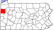
This is intended to be a complete list of the official state historical markers placed in Mercer County, Pennsylvania
Mercer County, Pennsylvania
Mercer County is a county located in the U.S. state of Pennsylvania. As of 2010, the population was 116,638. Its county seat is Mercer; Sharon is its largest city....
by the Pennsylvania Historical and Museum Commission
Pennsylvania Historical and Museum Commission
The Pennsylvania Historical and Museum Commission is the governmental agency of the Commonwealth of Pennsylvania responsible for the collection, conservation and interpretation of Pennsylvania's historic heritage...
(PHMC). The locations of the historical markers, as well as the latitude and longitude coordinates as provided by the PHMC's database, are included below when available. There are 19 historical markers located in Mercer County.
Historical markers
| Marker title | Image | Date dedicated | Location | Marker type | Topics |
|---|---|---|---|---|---|
| Albert Bushnell Hart Albert Bushnell Hart Albert Bushnell Hart, Ph.D. , was an American historian, writer, and teacher. One of the first generation of professionally trained historians in the United States, a prolific author and editor of historical works, Albert Bushnell Hart became, as Samuel Eliot Morison described him, "The Grand Old... |
S side PA 258 at PA 18, across from Tara restaurant, just N of Sharpsville 41.28335°N 80.42853°W |
Roadside | Education, Professions & Vocations | ||
| Bigler Graves | PA 58 (628 Mercer Rd.) at Salem Rd., SE of Greenville 41.36298°N 80.35499°W |
Roadside | Government & Politics, Government & Politics 19th Century, Governors | ||
| Bigler Home | Pa. 58 SE of Greenville (MISSING) °N °W |
Roadside | Government & Politics, Government & Politics 19th Century, Governors | ||
| Camp Reynolds | Rte. 18 S of Greenville (MISSING) °N °W |
Roadside | Military, Military Post-Civil War | ||
| Clay Furnace | N side of US 62 at Clay Furnace Rd., W of Charleston 41.23742°N 80.38486°W |
Roadside | Business & Industry, Coal, Furnaces, Iron | ||
| Erie Extension Canal | Wasser Bridge Rd. (SR 4003) just E of Pa. 18, S of Greenville (Missing) °N °W |
Roadside | Canals, Environment, Navigation, Transportation | ||
| Erie Extension Canal | PA 18 & 518 (Lamar Rd.), Lamonts Corners, east of Sharpsville 41.25722°N 80.45276°W |
Roadside | Canals, Navigation, Transportation | ||
| Erie Extension Canal | Wasser Bridge Road, .3 mile E of Pa. 18, S of Greenville (Missing) °N °W |
Roadside | Canals, Environment, Navigation, Transportation | ||
| Freedom Road | US 62, across from Great Stoneboro Fair, SW of Sandy Lake 41.33535°N 80.09734°W |
Roadside | African American, Underground Railroad, Women | ||
| General Hugh Mercer - PLAQUE | n/a | N Diamond St., N side of Co. courthouse, right column support, Mercer 41.22717°N 80.23911°W |
Plaque | American Revolution, Forts, French & Indian War, Military | |
| James Sheakley James Sheakley James Sheakley was an American Democratic politician who was the Governor of the District of Alaska from 1893 to 1897. He was also a member of the United States House of Representatives from Pennsylvania from 1875 to 1877.... |
E side of US 19, across from church, N end of Sheakleyville 40.44521°N 79.98542°W |
Roadside | Government & Politics, Government & Politics 19th Century | ||
| Johnston Tavern | US 19 (across from 1561 Perry Hwy.), near Dydek's Lane, N of Leesburg 41.14998°N 80.22333°W |
Roadside | Buildings, Business & Industry, Inns & Taverns | ||
| Kidd's Mill Covered Bridge | SR 4012 at Kidd's Mill Rd. (Kidd's Mill State Park), 5 miles S of Greenville 41.35481°N 80.39709°W |
Roadside | Bridges, Transportation | ||
| Mercer County Mercer County, Pennsylvania Mercer County is a county located in the U.S. state of Pennsylvania. As of 2010, the population was 116,638. Its county seat is Mercer; Sharon is its largest city.... |
N Diamond St. at N side of Co courthouse, at Courthouse Square, Mercer 40.44521°N 79.98542°W |
City | Government & Politics, Government & Politics 19th Century | ||
| Pennsylvania Pennsylvania The Commonwealth of Pennsylvania is a U.S. state that is located in the Northeastern and Mid-Atlantic regions of the United States. The state borders Delaware and Maryland to the south, West Virginia to the southwest, Ohio to the west, New York and Ontario, Canada, to the north, and New Jersey to... |
 |
n/a | S side of Tamarack Dr. (Rt. 718), Five Points, NW of Sharpsville, at state line 41.31065°N 80.5181°W |
Roadside | Early Settlement, Government & Politics, Government & Politics 17th Century, William Penn |
| Pennsylvania Pennsylvania The Commonwealth of Pennsylvania is a U.S. state that is located in the Northeastern and Mid-Atlantic regions of the United States. The state borders Delaware and Maryland to the south, West Virginia to the southwest, Ohio to the west, New York and Ontario, Canada, to the north, and New Jersey to... |
 |
SR 358 (Vernon Rd.) at state line, ~3 miles W of Maysville 41.38729°N 80.51867°W |
Roadside | Government & Politics 17th Century, Government & Politics 18th Century, William Penn | |
| Pymatuning | Pa. 258 E of Clark (Missing) °N °W |
Roadside | Early Settlement, Native American | ||
| Pymatuning | Pa. 258 E of Clark (Missing) °N °W |
Roadside | Early Settlement, Native American | ||
| Shenango Town | Pa. 118 SE of West Middlesex (Missing) °N °W |
Roadside | Cities & Towns, Early Settlement, Native American |
See also
- List of Pennsylvania state historical markers
- National Register of Historic Places listings in Mercer County, PennsylvaniaNational Register of Historic Places listings in Mercer County, PennsylvaniaThis is a list of the National Register of Historic Places listings in Mercer County, Pennsylvania.This is intended to be a complete list of the properties and districts on the National Register of Historic Places in Mercer County, Pennsylvania, United States...