

List of Pennsylvania state historical markers in Lackawanna County
Encyclopedia
This is intended to be a complete list of the official state historical markers placed in Lackawanna County, Pennsylvania
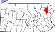
Lackawanna County, Pennsylvania
As of the census of 2000, there were 213,295 people, 86,218 households, and 55,783 families residing in the county. The population density was 465 people per square mile . There were 95,362 housing units at an average density of 208 per square mile...
by the Pennsylvania Historical and Museum Commission
Pennsylvania Historical and Museum Commission
The Pennsylvania Historical and Museum Commission is the governmental agency of the Commonwealth of Pennsylvania responsible for the collection, conservation and interpretation of Pennsylvania's historic heritage...
(PHMC). The locations of the historical markers, as well as the latitude and longitude coordinates as provided by the PHMC's database, are included below when available. There are 32 historical markers located in Lackawanna County.
Historical markers
| Marker title | Image | Date dedicated | Location | Marker type | Topics |
|---|---|---|---|---|---|
| Pioneer, The | Nay Aug Park at railroad car (on "road" across from Vine St., near Arthur Ave., behind Everhart Mus.), Scranton 41.40078°N 75.6435°W |
Roadside | Railroads, Transportation | ||
| 1902 Anthracite Coal Strike | Courthouse Square, Scranton °N °W |
Roadside | Coal, Government & Politics 20th Century, Labor | ||
| Anthracite Mine Disaster | In front of Throop Borough Bldg., Charles St. & Sanderson Ave., Throop 41.44598°N 75.62039°W |
Roadside | Business & Industry, Coal, Government & Politics 20th Century, Labor | ||
| Capoose | 1030 Providence Rd., at Diamond St., West Scranton 41.42548°N 75.66625°W |
Roadside | Early Settlement, Native American | ||
| Carbondale Carbondale, Pennsylvania Carbondale is a city in Lackawanna County, Pennsylvania, United States. Carbondale is located approximately 15 miles due northeast of the city of Scranton in Northeastern Pennsylvania... |
60 S Main St. (Bus. 6), at Housing Authority, Carbondale 41.56963°N 75.50335°W |
Roadside | Cities & Towns, Coal | ||
| Carbondale Carbondale, Pennsylvania Carbondale is a city in Lackawanna County, Pennsylvania, United States. Carbondale is located approximately 15 miles due northeast of the city of Scranton in Northeastern Pennsylvania... |
#5 6th Ave., at City Hall (6th Ave. side), Carbondale 41.57225°N 75.50316°W |
Roadside | Cities & Towns, Coal | ||
| Carbondale Carbondale, Pennsylvania Carbondale is a city in Lackawanna County, Pennsylvania, United States. Carbondale is located approximately 15 miles due northeast of the city of Scranton in Northeastern Pennsylvania... |
208 Fallbrook St. (PA 106), next to guard rail, N end of Carbondale 41.58317°N 75.51279°W |
Roadside | Cities & Towns, Coal | ||
| Coal Miners' and Laborers' Strike | SW corner of Lackawanna & Washington Aves., downtown Scranton °N °W |
City | Coal, Government & Politics 19th Century, Labor | ||
| Elder Miller | 1214 N Abington Rd. (PA 407), at PA 632, Waverly 41.52798°N 75.7051°W |
Roadside | Early Settlement, Education, Religion | ||
| First Aid Pioneer | Bus. US 6 & PA 107, near bridge next to guardrail, Jermyn 41.53406°N 75.55189°W |
Roadside | Business & Industry, Coal, Medicine & Science, Professions & Vocations | ||
| First Electric Cars | 235 Adams Ave. at Spruce St. (Courthouse Square), Scranton 41.40754°N 75.66196°W |
Roadside | Business & Industry, Electricity, Railroads | ||
| Gravity Railroad Gravity railroad A gravity railroad or Gravity railway is a railroad on a slope that allow cars carrying minerals or passengers to coast down the slope by the force of gravity alone. The cars are then hauled back up the slope using animal power or a stationary engine and a cable, chain or one or more wide, flat... |
97 N Main St. (Rt. 6), at entrance to Gravity Park, Carbondale 41.57549°N 75.49854°W |
Roadside | Coal, Railroads, Transportation | ||
| Hickory Grove Cemetery | 273 Miller Rd., just south of Carbondale Road (Rt. 632), Waverly 41.52546°N 75.69275°W |
Roadside | African American, Underground Railroad | ||
| Jay Gould Jay Gould Jason "Jay" Gould was a leading American railroad developer and speculator. He has long been vilified as an archetypal robber baron, whose successes made him the ninth richest American in history. Condé Nast Portfolio ranked Gould as the 8th worst American CEO of all time... |
Bear Lake Rd. (SR 2016), just N of River Rd., Thornhurst 41.17881°N 75.58084°W |
Roadside | Business & Industry, Professions & Vocations, Railroads | ||
| Jay Gould Jay Gould Jason "Jay" Gould was a leading American railroad developer and speculator. He has long been vilified as an archetypal robber baron, whose successes made him the ninth richest American in history. Condé Nast Portfolio ranked Gould as the 8th worst American CEO of all time... |
River & Locust Ridge (Hwy. 2015) Rds., just S of Thornhurst 41.17486°N 75.58849°W |
Roadside | Business & Industry, Professions & Vocations, Railroads | ||
| Keyser Creek | 331 N Main St. (SR 3013), 200 yds from Taylor Profess. Plaza, near guardrail, Taylor 41.3876°N 75.70477°W |
Roadside | Early Settlement, Government & Politics, Government & Politics 18th Century, Native American | ||
| Lackawanna County Lackawanna County, Pennsylvania As of the census of 2000, there were 213,295 people, 86,218 households, and 55,783 families residing in the county. The population density was 465 people per square mile . There were 95,362 housing units at an average density of 208 per square mile... |
512 Spruce St., (betw. N Washington Ave. & Dix Ct.) Courthouse Sq., Scranton 41.40768°N 75.66341°W |
City | Coal, Government & Politics, Government & Politics 19th Century, Native American | ||
| Lackawanna Iron | at Scranton Iron Furnace, Cedar Ave. near Lackawanna Ave., (across from Gen. Dynamics) Scranton 41.40373°N 75.66382°W |
Roadside | Business & Industry, Iron, Railroads, Steel | ||
| Loretta Perfectus Walsh Loretta Perfectus Walsh Loretta Perfectus Walsh became the first American active-duty Navy woman, and the first woman allowed to serve as a woman, in any of the United States armed forces other than as a nurse, when she enlisted in the U.S. Naval Reserve on March 17, 1917... |
108 Willow Ave. at Lackawanna Ave. (Hwy. 347), at Am. Legion Post, Olyphant 41.46987°N 75.60516°W |
City | Military, Military Post-Civil War, Women | ||
| Munsee Indian Village - PLAQUE | 843 Providence Rd., on wall near stadium entrance, West Scranton 41.41975°N 75.66541°W |
Plaque | Early Settlement, Native American | ||
| Old Forge Old Forge, Lackawanna County, Pennsylvania Old Forge is a borough in Lackawanna County, Pennsylvania, United States. The population was 8,313 at the 2010 census.-Geography:Old Forge is located at . The borough has a total area of 3.5 square miles which is all land..-History:The history of Old Forge can be traced back to the creation of... |
S. Main St. (SR 3013) at Lonesome Rd., near metal bridge, Old Forge 41.35925°N 75.74621°W |
Roadside | Business & Industry, Cities & Towns | ||
| Pennsylvania Gravity | Tigue St., near I-84 overpass (across from hotel), Dunmore 41.4141°N 75.59976°W |
Roadside | Railroads, Transportation | ||
| Rev. Jacob M. Koehler (1860-1932) | 1800 N. Washington Ave., betw. Electric & Columbia, at Scranton State Schl. for Deaf, Scranton 41.4299°N 75.64159°W |
Roadside | Education, Government & Politics, Professions & Vocations, Religion | ||
| Rev. William Bishop | 1124 Price St., at Main Ave., West Scranton 41.41363°N 75.67928°W |
Roadside | Religion | ||
| Rocky Glen Park Rocky Glen Park Known by a variety of names over its 101-year existence, Rocky Glen Park was a park near Moosic, Pennsylvania, USA. Founded by Arthur Frothingham in 1886 as a picnic park, it was transformed into an amusement park by engineer and entrepreneur Frederick Ingersoll in 1905... |
Rocky Glen Rd., 1/4 mile off Rt. 502, at old park entrance, Moosic °N °W |
Roadside | Ethnic & Immigration, Railroads | ||
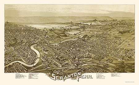
| Scranton Scranton, Pennsylvania Scranton is a city in the northeastern part of Pennsylvania, United States. It is the county seat of Lackawanna County and the largest principal city in the Scranton/Wilkes-Barre metropolitan area. Scranton had a population of 76,089 in 2010, according to the U.S... |
 |
PA 307 E of Scranton, (Missing) °N °W |
Roadside | Cities & Towns, Government & Politics 19th Century, Iron, Steel | |
| Scranton Scranton, Pennsylvania Scranton is a city in the northeastern part of Pennsylvania, United States. It is the county seat of Lackawanna County and the largest principal city in the Scranton/Wilkes-Barre metropolitan area. Scranton had a population of 76,089 in 2010, according to the U.S... |
 |
US 6 / I-81 northbound, at mile marker 189, just north of exit 187, N of Scranton 41.43808°N 75.62914°W |
Roadside | Cities & Towns, Government & Politics 19th Century, Iron, Steel | |
| Scranton Scranton, Pennsylvania Scranton is a city in the northeastern part of Pennsylvania, United States. It is the county seat of Lackawanna County and the largest principal city in the Scranton/Wilkes-Barre metropolitan area. Scranton had a population of 76,089 in 2010, according to the U.S... |
US 6 / I-81 southbound, near exit 191B, next to guardrail, NE of Scranton 41.46125°N 75.6668°W |
Roadside | Cities & Towns, Government & Politics 19th Century, Iron, Steel | ||
| Scranton Scranton, Pennsylvania Scranton is a city in the northeastern part of Pennsylvania, United States. It is the county seat of Lackawanna County and the largest principal city in the Scranton/Wilkes-Barre metropolitan area. Scranton had a population of 76,089 in 2010, according to the U.S... |
 |
S Main & Rundle Ave., by Taylor Shopping Ctr. sign, West Scranton 41.3967°N 75.68893°W |
Roadside | Cities & Towns | |
| Terence V. Powderly Terence V. Powderly Terence Vincent "Terry" Powderly was born in Carbondale, Pennsylvania, the son of Irish Catholic immigrants. He was a highly visible national spokesman for the working man as head of the Knights of Labor from 1879 until 1893... |
N. Main Ave. & Mears St., West Scranton 41.41935°N 75.67445°W |
Roadside | Government & Politics, Labor | ||
| Thomas J. Foster | Wyoming Ave. near Ash St., Scranton (Missing) °N °W |
Roadside | Education, Government & Politics 19th Century, Labor, Professions & Vocations, Publishing | ||
| Tripp House, The | n/a | 1011 N. Main Ave. near Scranton Expy., Scranton 41.42638°N 75.66969°W |
Roadside | Government & Politics, Government & Politics 18th Century |
See also
- List of Pennsylvania state historical markers
- National Register of Historic Places listings in Lackawanna County, PennsylvaniaNational Register of Historic Places listings in Lackawanna County, PennsylvaniaThis is a list of the National Register of Historic Places listings in Lackawanna County, Pennsylvania.This is intended to be a complete list of the properties and districts on the National Register of Historic Places in Lackawanna County, Pennsylvania, United States...