
Lilli Pilli, New South Wales
Encyclopedia
Suburb
The word suburb mostly refers to a residential area, either existing as part of a city or as a separate residential community within commuting distance of a city . Some suburbs have a degree of administrative autonomy, and most have lower population density than inner city neighborhoods...
in southern
Southern Sydney
This article refers to an area the same as a combination of St George and SutherlandSouthern Sydney is a general term which is used to describe the southern metropolitan area of Sydney, in the state of New South Wales, Australia....
Sydney
Sydney
Sydney is the most populous city in Australia and the state capital of New South Wales. Sydney is located on Australia's south-east coast of the Tasman Sea. As of June 2010, the greater metropolitan area had an approximate population of 4.6 million people...
, in the state of New South Wales
New South Wales
New South Wales is a state of :Australia, located in the east of the country. It is bordered by Queensland, Victoria and South Australia to the north, south and west respectively. To the east, the state is bordered by the Tasman Sea, which forms part of the Pacific Ocean. New South Wales...
, Australia
Australia
Australia , officially the Commonwealth of Australia, is a country in the Southern Hemisphere comprising the mainland of the Australian continent, the island of Tasmania, and numerous smaller islands in the Indian and Pacific Oceans. It is the world's sixth-largest country by total area...
. Lilli Pilli is located 26 kilometres south of the Sydney central business district
Sydney central business district
The Sydney central business district is the main commercial centre of Sydney, New South Wales, Australia. It extends southwards for about 3 kilometres from Sydney Cove, the point of first European settlement. Its north–south axis runs from Circular Quay in the north to Central railway station in...
, in the local government area of the Sutherland Shire
Sutherland Shire
The Sutherland Shire is a Local Government Area in the Southern Sydney region of Sydney, Australia. Geographically, it is the area to the south of Botany Bay and the Georges River...
. There is also another Lilli Pilli in New South Wales (postcode 2536), located 12 kilometres south of Batemans Bay
Batemans Bay, New South Wales
- Media :Radio Stations*East Coast Radio 2EC *Power FM NSW South Coast - POWER FM from Nowra can also be received in parts of Batemans Bay on FM 94.9....
.
History
Lilli Pilli was named for the Lilly PillyAcmena smithii
Syzygium smithii is a summer flowering evergreen tree, belonging to the myrtle family Myrtaceae. It is commonly planted as shrubs or hedgerows. It features rough woody bark, cream and green smooth waxy leaves with flushes of pink new growth and pink to mauve edible berries. It shares the common...
, the native myrtles that grew on the point. Thomas Holt (1811-88) owned most of the land that stretched from Sutherland to Cronulla, including land on the point. In 1840, parish maps also showed that 20 acres (8.1 ha) of land on the point were owned by Francis Mitchell. The public school opened in 1957, and has just recently celebrated its 50th Anniversary.
Geography
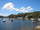
Lilli Pilli is located on the north shore of the Port HackingPort Hacking
Port Hacking is an Australian estuary, located in Southern Sydney, New South Wales and fed by the Hacking River and several smaller creeks, including Bundeena Creek and The Basin. It is a ria, a river basin which has become submerged by the sea...
estuary. The only adjacent suburbs are Caringbah
Caringbah, New South Wales
Caringbah is a suburb, in southern Sydney, in the state of New South Wales, Australia. Caringbah is located 24 kilometres south of the Sydney central business district in the local government area of Sutherland Shire...
, Port Hacking
Port Hacking, New South Wales
Port Hacking is a small suburb in southern Sydney, in the state of New South Wales, Australia. Port Hacking is located 26 kilometres south of the Sydney central business district in the local government area of the Sutherland Shire...
and Dolans Bay
Dolans Bay, New South Wales
Dolans Bay is a suburb in southern Sydney, in the state of New South Wales, Australia. Dolans Bay is located 26 kilometres south of the Sydney central business district, in the local government area of the Sutherland Shire....
. The villages of Maianbar
Maianbar, New South Wales
Maianbar is a village on the outskirts of southern Sydney, in the state of New South Wales, Australia. Maianbar is located 29 kilometres south of the Sydney central business district and is part of the Sutherland Shire....
and Bundeena
Bundeena, New South Wales
Bundeena is a village on the outskirts of southern Sydney, in the state of New South Wales, Australia. Bundeena is located 29km south of the Sydney central business district and is part of the local government area of the Sutherland Shire....
are located on the opposite bank of Port Hacking.
Lilli Pilli is surrounded by Gannons Bay, Little Turriel Bay, Port Hacking River and Great Turriel Bay. Lilli Pilli Point is situated at the end of Lilli Pilli Point Road, off Port Hacking Road. Lilli Pilli Point Bushland Reserve overlooks The Royal National Park
Royal National Park
Royal National Park is a national park in New South Wales, Australia, 29 km south of Sydney CBD.Founded by Sir John Robertson, Acting Premier of New South Wales, and formally proclaimed on 26 April 1879, it is the world's second oldest purposed national park, the first usage of the term...
. This bushland reserve is a great secluded picnic area that is often protected from the wind. A rock ledge runs along the northern point up to Speed Alley. Many fishing spots can be found here, all the way to Little Turriell Bay.
Commercial area
On the southern-end of Port Hacking road, a small group of shops exist. These include, "The Gum Tree Food Store", "Vintage Cellars", "D'lish on port". Also, nextdoor of these shops, are a Butcher, A Hair dresser, and a beauty shop.There is also a small group of shops located in Port Hacking Road near Lilli Pilli, but technically in Caringbah. It features a small supermarket-IGA, patisserie/cafe, pizzeria, seafood take-away and hairdresser.
Schools
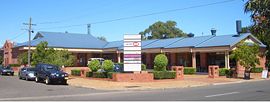
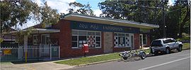
- Lilli Pilli Primary School is on Lilli Pilli Point Road. The Lilli Pilli Kindergarten is located nearby in Caringbah. The school has had many great sporting achievements, including the winninng of the PSSA Soccer Division One Cup in 2008.
Sport and recreation
On The western side of Lilli Pilli Point Reserve there are some public baths and a fishing jetty. The baths are deep salt water baths that may be used by anyone that wishes to swim in the Port Hacking River protected by a net. There is a 20 metre hole just outside the baths where many fish swimming down river seem to gather and feed. The channel provides opportunities for catching fish on the changing tide. At low tide the channel can be swum and the sand bank can be walked on, almost the other side. Locals take their dogs across for play but are always careful about the rising tide which can pose problems if not watched.Lilli Pilli is home to the Lilli Pilli Football Club
Lilli Pilli Football Club
Lilli Pilli Football Club are Australian football based in Lilli Pilli, New South Wales.-History:The formation of Lilli Pilli soccer club can be attributed mainly to the work of Cliff Horsley, whose untiring efforts during 1960 and early 1961 prepared the ground work for the formation of a soccer...
. Their homeground is Lilli Pilli Oval but other fields are also used such as Caringbah Oval, Solander Fields, Captain Cook Oval and Breen Park. Lilli Pilli is also home to 1st Lilli Pilli Sea Scouts.