

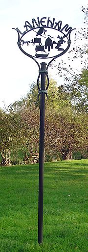
Laneham
Encyclopedia
Nottinghamshire
Nottinghamshire is a county in the East Midlands of England, bordering South Yorkshire to the north-west, Lincolnshire to the east, Leicestershire to the south, and Derbyshire to the west...
village on the banks of the River Trent
River Trent
The River Trent is one of the major rivers of England. Its source is in Staffordshire on the southern edge of Biddulph Moor. It flows through the Midlands until it joins the River Ouse at Trent Falls to form the Humber Estuary, which empties into the North Sea below Hull and Immingham.The Trent...
. It is 13 miles (20.9 km) due west of the city of Lincoln
Lincoln, Lincolnshire
Lincoln is a cathedral city and county town of Lincolnshire, England.The non-metropolitan district of Lincoln has a population of 85,595; the 2001 census gave the entire area of Lincoln a population of 120,779....
and 8 miles (12.9 km) east of the market town of Retford
Retford
Retford is a market town in Nottinghamshire in the East Midlands of England, located 31 miles from the city of Nottingham, and 23 miles west of Lincoln, in the district of Bassetlaw. The town is situated in a valley with the River Idle and the Chesterfield Canal running through the centre of the...
.
Geography
The Parish of Laneham had a total population of 279 people at the 2001 census, somewhat reduced from the 410 people who lived in the village in 1851. The parish covers an area of 1589 acres (643 ha), and includes the two settlements of "Town" Laneham and "Church" Laneham, separated by the village beck and a short stretch of low-lying ground. The eastern boundary is formed by the River TrentRiver Trent
The River Trent is one of the major rivers of England. Its source is in Staffordshire on the southern edge of Biddulph Moor. It flows through the Midlands until it joins the River Ouse at Trent Falls to form the Humber Estuary, which empties into the North Sea below Hull and Immingham.The Trent...
. Prior to 1884, the parish included 155 acres (62.7 ha) of land used for parture on the eastern bank of the Trent, but most of this was transferred to the parish of Kettlethorpe
Kettlethorpe, Lincolnshire
Kettlethorpe is a village and civil parish west of the city of Lincoln, Lincolnshire, England. The hamlets of Hardwick and Laughterton lie within this parish.-Church:...
. Communication to the east was once easier, as a ferry crossed the river here until 1922. The ferry had a very long history, since a list of stock held by the manor in 1388 included two gangways, which were used by passengers boarding the ferry. In earlier times the parish suffered some flooding from the Trent and the village beck, but the situation was improved by an Act of 1768-9 which set up drainage commissioners who were to protect Laneham and several other villages from flooding and improve the drainage of the land.
Infrastructure
There are a number of listed buildings in the village, including Manor Farmhouse, with three bays and two storeys, built in the early nineteenth century, and Binge Farmhouse, with five bays and two storeys, together with a basement and garret, built in the middle eighteenth century. Willow Tree Cottage is a single-storeyed eighteenth century building with three bays and an attic, while Willow Tree Farmhouse is an L-shaped building, consisting of a seventeenth century gable-ended wing and a nineteenth century wing. The substantial farmhouses reflect the former prosperity of the village, based on the well ordered fields surrounding the village which in turn show the influence of the enclosure movement. Laneham was enclosed by Act of Parliament in the 12th year of George III's reign - 1772; the enclosure involved 1,073 of the parish's 1589 acres (6.4 km²).The village had three public houses: The Butchers Arms (demolished 2009-10), The Ferryboat, and the Ring o' Bells which stood on the site of the present senior citizens' bungalows. A village hall makes use of the former school building. The Parish Church
Parish church
A parish church , in Christianity, is the church which acts as the religious centre of a parish, the basic administrative unit of episcopal churches....
of St. Peter remains open, and is a grade I listed building. Various parts were constructed in the 12th, 13th, 14th and 15th centuries. It was restored in 1891, and the porch was renovated in 1932. The Church is the focal point of Church Laneham
Church Laneham
Church Laneham is a hamlet in Nottinghamshire, England. It is located 9 miles east of Retford, on the west bank of the tidal section of the River Trent. The hamlet is within the Laneham civil parish, and is ½ mile to the east of Laneham...
, it is built on a small knoll above the river and contains a large, elaborate alabaster memorial to Ellis Markham and his son Jervase, which dates from 1636.
Laneham Drainage
In December 1768, a group of landowners from this part of Nottinghamshire asked the civil engineer John Grundy, Jr.John Grundy, Jr.
John Grundy, Jr. was an English civil engineer, who worked on a number of drainage schemes, canal projects and dock works. He lived in Spalding, Lincolnshire from 1739...
to investigate the possibility of draining some 10 square miles (25.9 km²) of land on the west bank of the River Trent
River Trent
The River Trent is one of the major rivers of England. Its source is in Staffordshire on the southern edge of Biddulph Moor. It flows through the Midlands until it joins the River Ouse at Trent Falls to form the Humber Estuary, which empties into the North Sea below Hull and Immingham.The Trent...
, stretching from Laneham to West Burton
West Burton
West Burton refers to more than one place in England:*West Burton, Nottinghamshire*West Burton, North Yorkshire*West Burton, West Sussex...
. He was accompanied by Samuel Goodhand, his clerk, on the initial site visit, and proposed three components to a solution. The first was a catchwater drain, which would intercept the streams flowing into the area at its western edge, and discharge into the Trent at West Burton. In order to prevent high water levels in the river flooding the land, he proposed a 7 miles (11.3 km) flood bank, which would run from Laneham to West Burton. Finally, rainwater would be collected by a Mother Drain and numerous side drains, which would discharge into the Trent through an outfall sluice at Sturton Cow Pasture.
The landowners liked the plans, asking Grundy to produce detailed proposals, and to supervise the obtaining of an Act of Parliament
Act of Parliament
An Act of Parliament is a statute enacted as primary legislation by a national or sub-national parliament. In the Republic of Ireland the term Act of the Oireachtas is used, and in the United States the term Act of Congress is used.In Commonwealth countries, the term is used both in a narrow...
to authorise the work. Assisted by the surveyor George Kelk and a colleague called David Buffery, who checked the levels, he spent six weeks producing his plans, which he presented in February 1769. He estimated that 5900 acres (2,387.6 ha) would be improved by the scheme, which would cost £2,700 for the catchwater drain, £6,800 for the bank along the river from Laneham to West Burton, £2,400 for the Mother Drain, with an additional £1,200 for the side drains, and £900 for the sluice at Sturton, making a total of £14,000. He spent most of March and April in London, to ensure the bill passed through Parliament, and received £329 for his work up to this point. A detailed plan of the area at a scale of 1:21,120 was published.
The Act appointed Drainage Commissioners, who met for the first time on 29 May 1769. Grundy became the engineer for the scheme, Buffery was the surveyor of works, and Kelk was the land surveyor. Grundy's plans for Sturton Sluice show a 12 feet (3.7 m) waterway. Brickwork and masonry were erected by local contractors, while the major excavations were handled by Dyson and Pinkerton. Grundy changed the plans somewhat, as he decided that a drainage mill would be needed at Sturton. This had a 15 feet (4.6 m) scoop wheel
Scoop wheel
right|thumb|Rim driven Scoop wheel of the [[Stretham Old Engine]], CambridgeshireA scoop wheel may be a pump or an excavator.-Scoop wheel pump:...
, and was completed in April 1770 by Henry Bennett from Spalding
Spalding
-Places:Australia* Spalding, South Australia, a town north of the Clare Valley* Spalding, Western Australia, a suburb of GeraldtonCanada* Spalding, Saskatchewan, a village* Spalding No...
, at a cost of £458. The works were finished on time in May 1772, with the final cost amounting to around £15,000. Grundy visited the works at least seven times to ensure that his specifications were being met. The only known details of the scheme are preserved in Grundy's Report Books, which he spent the last few years of his life preparing. Running to 12 volumes and 4,000 pages, they were lost, but were re-discovered in the library at the University of Leeds
University of Leeds
The University of Leeds is a British Redbrick university located in the city of Leeds, West Yorkshire, England...
in 1988. The Laneham Drainage scheme is covered in volumes 10 and 11.
The drainage mill which pumped water from the Mother Drain into the Trent was replaced by a 43 hp steam-powered beam engine in 1847. It had a larger scoop wheel, which was 26.5 feet (8.1 m) in diameter and 2.25 foot (0.6858 m) wide. It was scrapped some time before 1937, and has been replaced by an Allen-Gwynnes 24 inches (61 cm) electric pump. With the passing of the 1930 Land Drainage Act, most land drainage authorities were superseded by Internal Drainage Board
Internal Drainage Board
An internal drainage board is a type of operating authority which is established in areas of special drainage need in England and Wales with permissive powers to undertake work to secure clean water drainage and water level management within drainage districts...
s (IDBs), and the original scheme now forms the central section of the Laneham IDB, who are responsible for 78.5 miles (126.3 km) of drains and ditches, which help to prevent flooding of 22.9 square miles (59.3 km²) of low-lying land. They maintain 10 pumping stations, which include those at the end of the catchwater drain and the Mother Drain.