

Lakeland, Louisiana
Encyclopedia
Pointe Coupee Parish, Louisiana
Pointe Coupee Parish, pronounced "Pwent Koo-Pay" and , is a parish located in the U.S. state of Louisiana. The parish seat is New Roads. As of 2000, the population was 22,763....
, Louisiana
Louisiana
Louisiana is a state located in the southern region of the United States of America. Its capital is Baton Rouge and largest city is New Orleans. Louisiana is the only state in the U.S. with political subdivisions termed parishes, which are local governments equivalent to counties...
(USA
United States
The United States of America is a federal constitutional republic comprising fifty states and a federal district...
). The area is home to several plantation
Plantation
A plantation is a long artificially established forest, farm or estate, where crops are grown for sale, often in distant markets rather than for local on-site consumption...
houses, such as Alma, and Poydras Plantations. The zip code assigned to this area is 70752.
Geography
There are no officially designated boundaries to the village, but the area is more or less bounded by LA-416 on the northern edge of the area, Louisiana Highway 983 on the eastern edge, Louisiana Highway 1Louisiana Highway 1
Louisiana Highway 1 is a state highway in Louisiana. At 436.20 miles , it is the longest numbered highway of any class in Louisiana. It runs diagonally across the state, connecting the oil and gas fields near the island of Grand Isle with the northwest corner of the state, north of Shreveport.The...
on the western edge, and U.S. Highway 190 on the southern edge. This area is generally referred to as Lakeland. This area is home to Immaculate Conception Catholic Church and Alma Plantation Sugar Mill. The first post office in the area was established in 1878.
Education
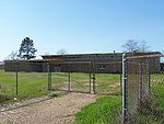
There is one school in the area, Rougon Elementary School (formerly High School). The community was formerly home to the now defunct Lakeland Elementary School that was located on Louisiana Highway 413Louisiana Highway 413
Louisiana Highway 413 is a state highway in Louisiana. It spans north–south for .-Route description:LA 413 begins at an intersection with LA 76 in West Baton Rouge Parish, and heads due north approximately towards Erwinville. This stretch of LA-413 is locally known as Poydras Bayou Road. ...
, south of Louisiana Highway 416
Louisiana Highway 416
Louisiana Highway 416 is a state highway in Louisiana. It spans east/west for .-Route description:LA 416 begins at an intersection with LA 415 in Pointe Coupee Parish, and heads due west approximately where it intersects LA 982. It continues west where it intersects LA 983. It continues...
.
Major roadways
 Louisiana Highway 413Louisiana Highway 413Louisiana Highway 413 is a state highway in Louisiana. It spans north–south for .-Route description:LA 413 begins at an intersection with LA 76 in West Baton Rouge Parish, and heads due north approximately towards Erwinville. This stretch of LA-413 is locally known as Poydras Bayou Road. ...
 Louisiana Highway 416Louisiana Highway 416Louisiana Highway 416 is a state highway in Louisiana. It spans east/west for .-Route description:LA 416 begins at an intersection with LA 415 in Pointe Coupee Parish, and heads due west approximately where it intersects LA 982. It continues west where it intersects LA 983. It continues...