
Lajinha
Encyclopedia
| Coat of arms | |
|---|---|
 |
|
| Statistics | |
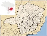
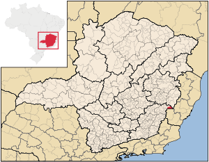
| State: | Minas Gerais Minas Gerais Minas Gerais is one of the 26 states of Brazil, of which it is the second most populous, the third richest, and the fourth largest in area. Minas Gerais is the Brazilian state with the largest number of Presidents of Brazil, the current one, Dilma Rousseff, being one of them. The capital is the... |
| Meso-region: | Zona da Mata |
| Micro-Region: | Manhuaçu |
| Founded: | January 1, 1939 |
| Location Location (geography) The terms location and place in geography are used to identify a point or an area on the Earth's surface or elsewhere. The term 'location' generally implies a higher degree of can certainty than "place" which often has an ambiguous boundary relying more on human/social attributes of place identity... : |
21.1505/21° 9' 3" S lat. 40.629/40° 37' 22" W long. |
| Area Area Area is a quantity that expresses the extent of a two-dimensional surface or shape in the plane. Area can be understood as the amount of material with a given thickness that would be necessary to fashion a model of the shape, or the amount of paint necessary to cover the surface with a single coat... : |
429.303 km² |
| Population Population A population is all the organisms that both belong to the same group or species and live in the same geographical area. The area that is used to define a sexual population is such that inter-breeding is possible between any pair within the area and more probable than cross-breeding with individuals... : |
20,706 (2006) |
| Population density Population density Population density is a measurement of population per unit area or unit volume. It is frequently applied to living organisms, and particularly to humans... : |
48.23/km² |
| Postal code: | 36980-xxx |
Lajinha is a municipality in the northeastern part of the state of Minas Gerais
Minas Gerais
Minas Gerais is one of the 26 states of Brazil, of which it is the second most populous, the third richest, and the fourth largest in area. Minas Gerais is the Brazilian state with the largest number of Presidents of Brazil, the current one, Dilma Rousseff, being one of them. The capital is the...
, Brazil
Brazil
Brazil , officially the Federative Republic of Brazil , is the largest country in South America. It is the world's fifth largest country, both by geographical area and by population with over 192 million people...
. Its coordinates are 20.617/20°32'2" S and the longitude is 41.175/41°10'33" W. It has 13,182 inhabitants and the area is 497.437 km². Its density is 24.5/km² (2006).
Population history
| Year | Population | Change | Density |
|---|---|---|---|
| 2004 | 20,706 | - | 48.23/km² |
Information
The town is bounded with Espirito SantoEspírito Santo
Espírito Santo is one of the states of southeastern Brazil, often referred to by the abbreviation "ES". Its capital is Vitória and the largest city is Vila Velha. The name of the state means literally "holy spirit" after the Holy Ghost of Christianity...
to the east.
The main economy of the city are agriculture (coffee cultivation) and commerce. The municipal agricultural exposition has a local festivities of the city called "Exposição agropecuária de Lajinha-MG (EXPOAL)", held every year in June, in which there are presentations of consecrated national artists. These festivities draw many people from all the surrounding areas and it's a significant source of tourism income.
The city is located between mountains, and the region climate is the 'mountain tropical'. The temperature is one of the lowest in the Zona da Mata region and ranges from 7 to 30 degrees Celsius, approximately.