

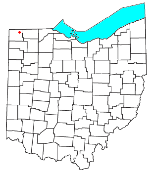
Kunkle, Ohio
Encyclopedia
Census-designated place
A census-designated place is a concentration of population identified by the United States Census Bureau for statistical purposes. CDPs are delineated for each decennial census as the statistical counterparts of incorporated places such as cities, towns and villages...
in southeastern Madison Township
Madison Township, Williams County, Ohio
Madison Township is one of the twelve townships of Williams County, Ohio, United States. The 2000 census found 2,539 people in the township, 1,079 of whom lived in the unincorporated portions of the township.-Geography:...
, Williams County
Williams County, Ohio
Williams County is a county located in the U.S. state of Ohio. As of 2010, the population was 37,642. Its county seat is Bryan and is named for David Williams, one of the captors of John André in the American Revolutionary War.-Geography:According to the U.S...
, Ohio
Ohio
Ohio is a Midwestern state in the United States. The 34th largest state by area in the U.S.,it is the 7th‑most populous with over 11.5 million residents, containing several major American cities and seven metropolitan areas with populations of 500,000 or more.The state's capital is Columbus...
, United States
United States
The United States of America is a federal constitutional republic comprising fifty states and a federal district...
. It is located approximately 65 miles (105 km) west of Toledo
Toledo, Ohio
Toledo is the fourth most populous city in the U.S. state of Ohio and is the county seat of Lucas County. Toledo is in northwest Ohio, on the western end of Lake Erie, and borders the State of Michigan...
.
Although it is unincorporated, it has a post office
Post office
A post office is a facility forming part of a postal system for the posting, receipt, sorting, handling, transmission or delivery of mail.Post offices offer mail-related services such as post office boxes, postage and packaging supplies...
, with the ZIP code
ZIP Code
ZIP codes are a system of postal codes used by the United States Postal Service since 1963. The term ZIP, an acronym for Zone Improvement Plan, is properly written in capital letters and was chosen to suggest that the mail travels more efficiently, and therefore more quickly, when senders use the...
of 43531. It is located along Williams County Road 17, a north-south highway.