
Kintyre, North Dakota
Encyclopedia
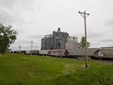
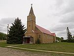
Kintyre is an unincorporated community
in northeastern Emmons County
, North Dakota
, United States
. It lies northeast of the city of Linton
, the county seat
of Emmons County. Its elevation is 2,756 feet (840 m). The community was originally named Campbell for Dugald and Hugh Campbell, brothers who ranched there; it is now named Kintyre for the Kintyre Peninsula
in Argyll
, Scotland
. Although it is unincorporated, it has a post office
, with the ZIP code
of 58549.
Unincorporated area
In law, an unincorporated area is a region of land that is not a part of any municipality.To "incorporate" in this context means to form a municipal corporation, a city, town, or village with its own government. An unincorporated community is usually not subject to or taxed by a municipal government...
in northeastern Emmons County
Emmons County, North Dakota
-Major highways:* U.S. Highway 83*North Dakota Highway 11*North Dakota Highway 13*North Dakota Highway 34*North Dakota Highway 1804-National protected areas:*Appert Lake National Wildlife Refuge*Springwater National Wildlife Refuge...
, North Dakota
North Dakota
North Dakota is a state located in the Midwestern region of the United States of America, along the Canadian border. The state is bordered by Canada to the north, Minnesota to the east, South Dakota to the south and Montana to the west. North Dakota is the 19th-largest state by area in the U.S....
, United States
United States
The United States of America is a federal constitutional republic comprising fifty states and a federal district...
. It lies northeast of the city of Linton
Linton, North Dakota
As of the census of 2000, there were 1,321 people, 613 households, and 386 families residing in the city. The population density was 1,791.4 people per square mile . There were 701 housing units at an average density of 950.6 per square mile . The racial makeup of the city was 99.17% White, 0.23%...
, the county seat
County seat
A county seat is an administrative center, or seat of government, for a county or civil parish. The term is primarily used in the United States....
of Emmons County. Its elevation is 2,756 feet (840 m). The community was originally named Campbell for Dugald and Hugh Campbell, brothers who ranched there; it is now named Kintyre for the Kintyre Peninsula
Kintyre
Kintyre is a peninsula in western Scotland, in the southwest of Argyll and Bute. The region stretches approximately 30 miles , from the Mull of Kintyre in the south, to East Loch Tarbert in the north...
in Argyll
Argyll
Argyll , archaically Argyle , is a region of western Scotland corresponding with most of the part of ancient Dál Riata that was located on the island of Great Britain, and in a historical context can be used to mean the entire western coast between the Mull of Kintyre and Cape Wrath...
, Scotland
Scotland
Scotland is a country that is part of the United Kingdom. Occupying the northern third of the island of Great Britain, it shares a border with England to the south and is bounded by the North Sea to the east, the Atlantic Ocean to the north and west, and the North Channel and Irish Sea to the...
. Although it is unincorporated, it has a post office
Post office
A post office is a facility forming part of a postal system for the posting, receipt, sorting, handling, transmission or delivery of mail.Post offices offer mail-related services such as post office boxes, postage and packaging supplies...
, with the ZIP code
ZIP Code
ZIP codes are a system of postal codes used by the United States Postal Service since 1963. The term ZIP, an acronym for Zone Improvement Plan, is properly written in capital letters and was chosen to suggest that the mail travels more efficiently, and therefore more quickly, when senders use the...
of 58549.