

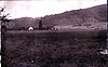
Kings Valley, Oregon
Encyclopedia
Unincorporated area
In law, an unincorporated area is a region of land that is not a part of any municipality.To "incorporate" in this context means to form a municipal corporation, a city, town, or village with its own government. An unincorporated community is usually not subject to or taxed by a municipal government...
in Benton County
Benton County, Oregon
-National protected areas:*Siuslaw National Forest *William L. Finley National Wildlife Refuge-Demographics:As of the census of 2000, there were 78,153 people, 30,145 households, and 18,237 families residing in the county. The population density was 116 people per square mile . There were 31,980...
, Oregon
Oregon
Oregon is a state in the Pacific Northwest region of the United States. It is located on the Pacific coast, with Washington to the north, California to the south, Nevada on the southeast and Idaho to the east. The Columbia and Snake rivers delineate much of Oregon's northern and eastern...
, United States
United States
The United States of America is a federal constitutional republic comprising fifty states and a federal district...
. It is located on the Luckiamute River
Luckiamute River
The Luckiamute River is a tributary of the Willamette River, about long, in western Oregon in the United States. It drains an area of Central Oregon Coast Range and the western Willamette Valley northwest of Corvallis....
and Oregon Route 223.
Kings Valley was named after its first settler
Settler
A settler is a person who has migrated to an area and established permanent residence there, often to colonize the area. Settlers are generally people who take up residence on land and cultivate it, as opposed to nomads...
, Nahum King, who arrived in 1845. A flour mill was built in the community in 1853. Kings Valley post office ran from 1855 to 1974.
Fort Hoskins
Fort Hoskins
Fort Hoskins was one of three "forts" built by the U.S. Army to monitor the Coastal Indian Reservation in Oregon in the mid- 19th century. The Fort Hoskins Site is listed on the National Register of Historic Places.- History :The post was begun in 1856 on the Luckiamute River under the...
Historic Park is nearby, in the former community of Hoskins
Hoskins, Oregon
Hoskins is an unincorporated community in Benton County, Oregon, United States. Hoskins lies west of Oregon Route 223's intersection with Hoskins Road. Hoskins is northwest of Wren and southwest of Kings Valley....
.
The Valley and Siletz Railroad
Valley and Siletz Railroad
The Valley and Siletz Railroad is a defunct railroad located in Polk County and in Benton County, Oregon, United States. The railroad began construction in 1912. It was long by 1915, long by 1917, and was extended to and completed later that year...
formerly ran through Kings Valley.
The Shrewsbury Renaissance Faire
Renaissance Fair
A Renaissance fair, Renaissance faire, or Renaissance festival is an outdoor weekend gathering, usually held in the United States, open to the public and typically commercial in nature, which emulates a historic period for the amusement of its guests. Some are permanent theme parks, others are...
, originally located in nearby Philomath
Philomath, Oregon
Philomath is a city in Benton County, Oregon, United States. It was named for Philomath College. The population was 3,838 at the 2000 census. It is part of the Corvallis, Oregon Metropolitan Statistical Area.- History :...
, now takes place in Kings Valley every September.