

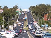
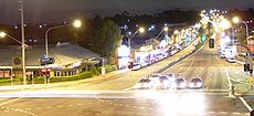
King Georges Road, Sydney
Encyclopedia

Sydney
Sydney is the most populous city in Australia and the state capital of New South Wales. Sydney is located on Australia's south-east coast of the Tasman Sea. As of June 2010, the greater metropolitan area had an approximate population of 4.6 million people...
, Australia
Australia
Australia , officially the Commonwealth of Australia, is a country in the Southern Hemisphere comprising the mainland of the Australian continent, the island of Tasmania, and numerous smaller islands in the Indian and Pacific Oceans. It is the world's sixth-largest country by total area...
, running through the local government areas of the Municipality of Kogarah
Municipality of Kogarah
The Municipality of Kogarah is a Local Government Area in southern Sydney, in the state of New South Wales, Australia. The centre of the municipality is located 14km SSW of the Sydney central business district and west of Botany Bay....
, City of Hurstville
City of Hurstville
The City of Hurstville is a Local Government Area in southern Sydney, in the state of New South Wales, Australia. The city centre is located 17km SSW of the Sydney central business district and west of Botany Bay....
and City of Canterbury
City of Canterbury, New South Wales
The City of Canterbury, previously the Municipality of Canterbury, is a Local Government Area in Sydney, New South Wales, Australia. It lies southwest of the central business district and forms part of the Greater Sydney metropolitan area....
.
King Georges Road begins at a junction with the Princes Highway
Princes Highway
The Princes Highway extends from Sydney to Port Augusta via the coast through the states of New South Wales, Victoria and South Australia, a distance of 1941 km or 1898 km via the former alignments of the highway ....
at Blakehurst
Blakehurst, New South Wales
Blakehurst is a suburb in southern Sydney, in the state of New South Wales, Australia. Blakehurst is located 18 kilometres south of the Sydney central business district, in the local government area of the Municipality of Kogarah and is part of the St George area.Blakehurst is connected to...
and continues north-west for about 12 kilometres through the suburbs of South Hurstville
South Hurstville, New South Wales
South Hurstville is a suburb in southern Sydney, in the state of New South Wales, Australia. South Hurstville is located 18 kilometres south of the Sydney central business district and is part of the St George area. South Hurstville is in the local government area of the Municipality of Kogarah...
, Hurstville
Hurstville, New South Wales
Hurstville is a suburb in southern Sydney, in the state of New South Wales, Australia. Hurstville is located 16 kilometres south of the Sydney central business district and is part of the St George area. Hurstville is the administrative centre of the local government area of the City of...
, Penshurst
Penshurst, New South Wales
Penshurst is a suburb in southern Sydney, in the state of New South Wales, Australia. Penshurst is located 17 km south of the Sydney central business district and is part of the St George area. Penshurst lies across the local government areas of the City of Hurstville and Municipality of...
, Beverly Hills
Beverly Hills, New South Wales
Beverly Hills is a suburb in southern Sydney, in the state of New South Wales, Australia. Beverly Hills is located 17 kilometres south of the Sydney central business district and is part of the St George area. Beverly Hills lies across two local government areas, the City of Hurstville and the...
, Roselands
Roselands, New South Wales
Roselands is a suburb, in south-western Sydney, in the state of New South Wales, Australia. Roselands is located 16 kilometres south-west of the Sydney central business district in the City of Canterbury.-Geography:...
and Wiley Park
Wiley Park, New South Wales
Wiley Park is a suburb in south-western Sydney, in the state of New South Wales, Australia. Wiley Park is located 17 kilometres south-west of the Sydney central business district in the City of Canterbury.-History:...
to Punchbowl
Punchbowl, New South Wales
Punchbowl, a suburb of local government areas City of Bankstown and the City of Canterbury is located 17 kilometres south-west of the Sydney central business district, in the state of New South Wales, Australia, and is a part of the South-western Sydney region.- History :Punchbowl is named for a...
, where it becomes Wiley Avenue for a short distance and then Roberts Road.
King Georges Road is the southernmost section of Metroad 3
Metroad 3
Metroad 3 is a Metroad in Sydney, New South Wales Australia. It replaced State Route 33 in April 1993, from Metroad 10 in Mona Vale to Metroad 1 in Blakehurst. It has many names as it goes through different suburbs. Some of these are Mona Vale Road, Ryde Road, Lane Cove Road, Concord Road and...
, which through various name changes continues to the city's northern beaches area, reaching the coast at Mona Vale
Mona Vale, New South Wales
Mona Vale is a suburb in northern Sydney, in the state of New South Wales, Australia. It is located 28 kilometres north of the Sydney central business district and is the administrative centre of the local government area of Pittwater Council. Mona Vale is also part of the Northern Beaches region.-...
.
Former names
King Georges Road was previously known as Wiley Ave between Punchbowl Road and Canterbury Road, Canary's Road between Canterbury Road and Beverly Hills, Dumbleton Road between Beverly HillsBeverly Hills, New South Wales
Beverly Hills is a suburb in southern Sydney, in the state of New South Wales, Australia. Beverly Hills is located 17 kilometres south of the Sydney central business district and is part of the St George area. Beverly Hills lies across two local government areas, the City of Hurstville and the...
and Penshurst
Penshurst, New South Wales
Penshurst is a suburb in southern Sydney, in the state of New South Wales, Australia. Penshurst is located 17 km south of the Sydney central business district and is part of the St George area. Penshurst lies across the local government areas of the City of Hurstville and Municipality of...
, and Belmore Road between Penshurst and Blakehurst
Blakehurst, New South Wales
Blakehurst is a suburb in southern Sydney, in the state of New South Wales, Australia. Blakehurst is located 18 kilometres south of the Sydney central business district, in the local government area of the Municipality of Kogarah and is part of the St George area.Blakehurst is connected to...
.