

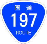
Japan National Route 197
Encyclopedia
National highways of Japan
Japan has a nationwide system of distinct from the expressways. The Ministry of Land, Infrastructure and Transport and other government agencies administer the national highways. Beginning in 1952, Japan classified these as Class 1 or Class 2. Class 1 highways had one- or two-digit numbers, while...
running on the islands of Kyūshū
Kyushu
is the third largest island of Japan and most southwesterly of its four main islands. Its alternate ancient names include , , and . The historical regional name is referred to Kyushu and its surrounding islands....
and Shikoku
Shikoku
is the smallest and least populous of the four main islands of Japan, located south of Honshū and east of the island of Kyūshū. Its ancient names include Iyo-no-futana-shima , Iyo-shima , and Futana-shima...
. It originates at the junction with Routes 10
Route 10 (Japan)
thumb|240px|right|Route 10, Oita, Oitathumb|240px|right|Route 10, Fukuoka, KandaNational Route 10 is a Japanese highway on the island of Kyūshū. It originates at the intersection with Route 2 in Kitakyushu, Fukuoka and passes through the prefectural capitals of Ōita and Miyazaki, terminating at the...
and 210
Route 210 (Japan)
National Route 210 is a national highway of Japan connecting Kurume, Fukuoka and Ōita, Ōita in Japan, with a total length of 136.2 km ....
in Ōita, Ōita
Oita, Oita
is the capital city of Ōita Prefecture located on the island of Kyushu, Japan.- Demographics and geography :Ōita is the most populous city in Ōita Prefecture...
(33.240841°N 131.615181°E) and terminates at the junction with Route 56 in Susaki, Kōchi
Susaki, Kochi
is a city located in Kōchi, Japan.As of 2003, the city had an estimated population of 26,960 and the density of . The total area is .The city was founded on October 1, 1954.-External links:* *...
(33.388381°N 133.274331°E). The route is 223.1 kilometers long but is interrupted between Saganoseki area of Ōita, Ōita
Oita, Oita
is the capital city of Ōita Prefecture located on the island of Kyushu, Japan.- Demographics and geography :Ōita is the most populous city in Ōita Prefecture...
(where it joins with Route 217
Route 217 (Japan)
National Route 217 is a national highway of Japan connecting Ōita, Ōita and Saiki, Ōita in Japan, with a total length of 92.3 km ....
) and Ikata, Ehime
Ikata, Ehime
is a small town located in Nishiuwa District, Ehime, Japan. Following a recent merger with the neighboring towns of Misaki and Seto, the town now spans the mountainous Sadamisaki Peninsula, the narrowest peninsula in Japan and the westernmost point on the island of Shikoku.This unique geography has...
because of the Hōyo Strait
Hoyo Strait
The is the strait at the narrowest part of the Bungo Channel in Japan....
, and traffic between the two islands is carried by a ferry
Ferry
A ferry is a form of transportation, usually a boat, but sometimes a ship, used to carry primarily passengers, and sometimes vehicles and cargo as well, across a body of water. Most ferries operate on regular, frequent, return services...
between the two towns. Though the gap is less than 15 km at the strait's narrowest point, there are currently no plans to bridge the gap.