
Japan National Route 12
Encyclopedia
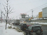
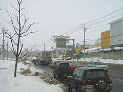
National Route 12 is a national highway
connecting Sapporo and Asahikawa
in Hokkaidō
, Japan
.
National highways of Japan
Japan has a nationwide system of distinct from the expressways. The Ministry of Land, Infrastructure and Transport and other government agencies administer the national highways. Beginning in 1952, Japan classified these as Class 1 or Class 2. Class 1 highways had one- or two-digit numbers, while...
connecting Sapporo and Asahikawa
Asahikawa, Hokkaido
is a city in Kamikawa Subprefecture, Hokkaido, Japan. It is the capital of the subprefecture and the second-largest city in Hokkaido, after Sapporo. It has been a Core city since April 1, 2000...
in Hokkaidō
Hokkaido
, formerly known as Ezo, Yezo, Yeso, or Yesso, is Japan's second largest island; it is also the largest and northernmost of Japan's 47 prefectural-level subdivisions. The Tsugaru Strait separates Hokkaido from Honshu, although the two islands are connected by the underwater railway Seikan Tunnel...
, Japan
Japan
Japan is an island nation in East Asia. Located in the Pacific Ocean, it lies to the east of the Sea of Japan, China, North Korea, South Korea and Russia, stretching from the Sea of Okhotsk in the north to the East China Sea and Taiwan in the south...
.
Route Data
- Length: 135.7 km (84.3 mi)
- Origin: Chuo-ku, SapporoChuo-ku, Sapporois one of the ten wards in Sapporo city, Japan. Chūō-ku means "central ward" in Japanese. As its name suggests, city administration and entertainment facilities are centred in this ward.- History :...
, Sapporo (originates at the origins of Routes 36 and 230Route 230 (Japan)National Route 230 is a national highway of Japan connecting Chūō-ku, Sapporo and Setana, Hokkaidō in Japan, with a total length of 195.4 km ....
) - Terminus: Asahikawa, HokkaidoAsahikawa, Hokkaidois a city in Kamikawa Subprefecture, Hokkaido, Japan. It is the capital of the subprefecture and the second-largest city in Hokkaido, after Sapporo. It has been a Core city since April 1, 2000...
(ends at the origin of Routes 39 and 40) - Major cities: EbetsuEbetsu, Hokkaidois a city located in Ishikari, Hokkaidō, Japan.- History :Ebetsu was settled originally by Japanese people in 1871, that came from the Miyagi Prefecture on Honshu Island. In 1878, militia men began moving into the area. When the Meiji Government, in 1878, designated Hokkaido as part of Japan,...
, IwamizawaIwamizawa, Hokkaidois a city located in Sorachi Subprefecture, Hokkaidō, Japan.On March 27, 2006 the town of Kurisawa, and the village of Kita, both from Sorachi District, Sorachi Subprefecture, have merged into Iwamizawa....
, TakikawaTakikawa, Hokkaidois a city located in Sorachi Subprefecture, Hokkaidō, Japan.As of 2008, the city has an estimated population of 44,465 and the density of 384 persons per km². The total area is 115.82 km².The city was founded on July 1, 1958.-History:...
, FukagawaFukagawa, Hokkaidois a city located in Sorachi Subprefecture, Hokkaidō, Japan.As of 2008, the city has an estimated population of 24,448 and the density of 50.36 persons per km². The total area is 529.12 km².The city was founded on May 1, 1963....
History
- 1952-12-04 - First Class National Highway 12 (from Sapporo to AsahikawaAsahikawa, Hokkaidois a city in Kamikawa Subprefecture, Hokkaido, Japan. It is the capital of the subprefecture and the second-largest city in Hokkaido, after Sapporo. It has been a Core city since April 1, 2000...
) - 1965-04-01 - General National Highway 12 (from Sapporo to AsahikawaAsahikawa, Hokkaidois a city in Kamikawa Subprefecture, Hokkaido, Japan. It is the capital of the subprefecture and the second-largest city in Hokkaido, after Sapporo. It has been a Core city since April 1, 2000...
)
Municipalities passed through
- Ishikari SubprefectureIshikari Subprefectureis a subprefecture of Hokkaidō prefecture, Japan, located in the western part of the island. Its population in 2003 was 2,279,943.There are 6 cities, three towns, and one village under its jurisdiction. The subprefectural capital is Sapporo, also the capital of Hokkaidō prefecture...
- Sapporo - EbetsuEbetsu, Hokkaidois a city located in Ishikari, Hokkaidō, Japan.- History :Ebetsu was settled originally by Japanese people in 1871, that came from the Miyagi Prefecture on Honshu Island. In 1878, militia men began moving into the area. When the Meiji Government, in 1878, designated Hokkaido as part of Japan,...
- Sapporo - Ebetsu
- Sorachi SubprefectureSorachi Subprefectureis a subprefecture of Hokkaidō, Japan. As of 2004, its estimated population is 373,736 and its area is 6,558.26 km².-Cities:* Akabira* Ashibetsu* Bibai* Fukagawa* Iwamizawa * Mikasa* Sunagawa* Takikawa* Utashinai* Yūbari...
- IwamizawaIwamizawa, Hokkaidois a city located in Sorachi Subprefecture, Hokkaidō, Japan.On March 27, 2006 the town of Kurisawa, and the village of Kita, both from Sorachi District, Sorachi Subprefecture, have merged into Iwamizawa....
- MikasaMikasa, Hokkaidois a city located in Sorachi, Hokkaidō, Japan. It is one of the birthplaces of the mining and railroad industries in Hokkaidō, and the Hokkai Bon song was invented there...
- BibaiBibai, Hokkaidois a city located in Sorachi Subprefecture, Hokkaidō, Japan.As of 2008, the city has an estimated population of 27,399 and the density of 98.7 persons per km². The total area is 277.61 km².The city was founded on April 1, 1950.- External links :...
- NaieNaie, Hokkaidois a town located in Sorachi District, Sorachi Subprefecture, Hokkaidō, Japan.As of 2007, the town has an estimated population of 6,748 and a density of 77.59 persons per km²...
- SunagawaSunagawa, Hokkaidois a city located in Sorachi, Hokkaidō, Japan.As of 2008, the city has an estimated population of 19,556 and the density of 249 persons per km². The total area is 78.69 km².The city was founded on July 1, 1958.- History :*1890 Nae Village founded...
- TakikawaTakikawa, Hokkaidois a city located in Sorachi Subprefecture, Hokkaidō, Japan.As of 2008, the city has an estimated population of 44,465 and the density of 384 persons per km². The total area is 115.82 km².The city was founded on July 1, 1958.-History:...
-FukagawaFukagawa, Hokkaidois a city located in Sorachi Subprefecture, Hokkaidō, Japan.As of 2008, the city has an estimated population of 24,448 and the density of 50.36 persons per km². The total area is 529.12 km².The city was founded on May 1, 1963....
- Iwamizawa
- Kamikawa SubprefectureKamikawa Subprefectureis a subprefecture of Hokkaidō, Japan. The name is derived from Kamikawa no hitobito no Shūraku , a translation of the Ainu Peni Unguri Kotan. Settlement began in 1867...
- AsahikawaAsahikawa, Hokkaidois a city in Kamikawa Subprefecture, Hokkaido, Japan. It is the capital of the subprefecture and the second-largest city in Hokkaido, after Sapporo. It has been a Core city since April 1, 2000...
- Asahikawa
Intersects with
- Ishikari SubprefectureIshikari Subprefectureis a subprefecture of Hokkaidō prefecture, Japan, located in the western part of the island. Its population in 2003 was 2,279,943.There are 6 cities, three towns, and one village under its jurisdiction. The subprefectural capital is Sapporo, also the capital of Hokkaidō prefecture...
- Routes 36 and 230Route 230 (Japan)National Route 230 is a national highway of Japan connecting Chūō-ku, Sapporo and Setana, Hokkaidō in Japan, with a total length of 195.4 km ....
- Route 5Route 5 (Japan)National Route 5 is a major highway on the island of Hokkaidō in Japan. Its southern terminus is in Hakodate and its northern end in Sapporo...
- Route 275Route 275 (Japan)National Route 275 is a national highway of Japan connecting Chūō-ku, Sapporo and Hamatonbetsu, Hokkaidō in Japan, with a total length of 315.2 km ....
- Route 274Route 274 (Japan)National Route 274 is a national highway of Japan connecting Kita-ku, Sapporo and Shibecha, Hokkaidō in Japan, with a total length of 371.8 km ....
- Route 337Route 337 (Japan)National Route 337 is a national highway of Japan connecting Chitose, Hokkaidō and Otaru, Hokkaidō in Japan, with a total length of 92.4 km ....
- Routes 36 and 230
- Sorachi SubprefectureSorachi Subprefectureis a subprefecture of Hokkaidō, Japan. As of 2004, its estimated population is 373,736 and its area is 6,558.26 km².-Cities:* Akabira* Ashibetsu* Bibai* Fukagawa* Iwamizawa * Mikasa* Sunagawa* Takikawa* Utashinai* Yūbari...
- Route 234Route 234 (Japan)National Route 234 is a national highway of Japan connecting Iwamizawa, Hokkaidō and Tomakomai, Hokkaidō in Japan, with a total length of 66.8 km ....
- Routes 38 and 451Route 451 (Japan)National Route 451 is a national highway of Japan connecting Rumoi, Hokkaidō and Takikawa, Hokkaidō in Japan, with a total length of 116.5 km ....
- Route 233Route 233 (Japan)National Route 233 is a national highway of Japan connecting Asahikawa, Hokkaidō and Rumoi, Hokkaidō in Japan, with a total length of 78.3 km ....
- Route 234
- Kamikawa SubprefectureKamikawa Subprefectureis a subprefecture of Hokkaidō, Japan. The name is derived from Kamikawa no hitobito no Shūraku , a translation of the Ainu Peni Unguri Kotan. Settlement began in 1867...
- Route 237Route 237 (Japan)National Route 237 is a national highway of Japan connecting Asahikawa, Hokkaidō and Urakawa, Hokkaidō in Japan, with a total length of 260 km ....
- Route 40
- Route 39
- Route 237