

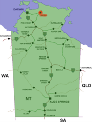
Jabiru, Northern Territory
Encyclopedia
Northern Territory
The Northern Territory is a federal territory of Australia, occupying much of the centre of the mainland continent, as well as the central northern regions...
of Australia
Australia
Australia , officially the Commonwealth of Australia, is a country in the Southern Hemisphere comprising the mainland of the Australian continent, the island of Tasmania, and numerous smaller islands in the Indian and Pacific Oceans. It is the world's sixth-largest country by total area...
. It was originally built in 1982 as a closed town to house the community living at Jabiru East near the Ranger Uranium Mine
Ranger Uranium Mine
The Ranger uranium mine is surrounded by Kakadu National Park, in the Northern Territory of Australia, 230 km east of Darwin. The orebody was discovered in 1969, and the mine commenced operation in 1980, reaching full production of uranium oxide in 1981...
eight kilometres away. Both the mine and the town are completely surrounded by Kakadu National Park
Kakadu National Park
Kakadu National Park is in the Northern Territory of Australia, 171 km southeast of Darwin.Kakadu National Park is located within the Alligator Rivers Region of the Northern Territory of Australia. It covers an area of , extending nearly 200 kilometres from north to south and over 100 kilometres...
.
Overview
Jabiru Township is thirteen square kilometres in size. The town is owned as freehold by the Director of National Parks and Wildlife, from which a head lease is held by the Jabiru Town Development Authority (JTDA). The JTDA subleases to the mining company, government agencies and private business. The head lease expires in 2021.The JTDA has delegated local government responsibility to the Jabiru Town Council. The Northern Territory Government is in the process of amalgamating Jabiru Town Council into the West Arnhem Shire in 2008.
Jabiru at the 2001 census
Census in Australia
The Australian census is administered once every five years by the Australian Bureau of Statistics. The most recent census was conducted on 9 August 2011; the next will be conducted in 2016. Prior to the introduction of regular censuses in 1961, they had also been run in 1901, 1911, 1921, 1933,...
had a population of 1,521.
Apart from the Ranger mine, Jabiru's most notable industries are tourism (it is the commercial and accommodation hub of Kakadu National Park), and Aboriginal arts and culture.
Jabiru features a small town plaza that includes a video souvenir shop, a supermarket, bank, tackle shop, cafe, hairdresser, post office, news agency, bank and bakery (behind the fire station) as well as government, Northern Land Council offices, Magistrates Courts and emergency services (Police, Fire and Ambulance).
During the Wet season
Wet season
The the wet season, or rainy season, is the time of year, covering one or more months, when most of the average annual rainfall in a region occurs. The term green season is also sometimes used as a euphemism by tourist authorities. Areas with wet seasons are dispersed across portions of the...
(October to April), Jabiru experiences heavy rain that often results in widespread flooding along the Arnhem Highway
Arnhem Highway
The Arnhem Highway is a 230 kilometre highway in the Northern Territory of Australia. It links the mining town of Jabiru, in Kakadu National Park, to the Stuart Highway 35 kilometres south of Darwin....
and Kakadu Highway
Kakadu Highway
The Kakadu Highway is 209 kilometres long and extends from Pine Creek to Jabiru, entering Kakadu National Park as the highway crosses the Mary River.The highway is signed and mapped as State Route 21....
. During 2006-07 Jabiru had its biggest wet season cutting both highways. The Arnhem Highway was cut off for several weeks as the West Alligator bridge was severely damaged.
Jabiru town services are administered by the West Arnhem Shire Council, whose council chambers are in the town plaza.
Recreation
Recreational facilities include the Jabiru town lake (picnic areas and barbecues), freshwater fishing for barramundiBarramundi
The Barramundi , also known as Asian Seabass, is a species of catadromous fish in family Latidae of order Perciformes. The native species is widely distributed in the Indo-West Pacific region from the Persian Gulf, through Southeast Asia to Papua New Guinea and Northern Australia. Known in Thai...
(a local specialty), the Yellow Water cruise, day-trips to Ubirr
Ubirr
Ubirr is located in the East Alligator region of Kakadu National Park in the Northern Territory of Australia, and is famous for its rock art. It consists of a group of rock outcrops on the edge of the Nadab floodplain where there are several natural shelters that have a collection of Aboriginal...
Rock, Twin Falls
Twin Falls, Australia
Twin Falls is located in the Kakadu National Park in the Northern Territory, Australia. It is located near the eastern boundary of the park and 80 km south of Jabiru. It is also known as Gungkurdul...
and other natural features of Kakadu National Park, as well as a Sports and Social Club, an Olympic-size swimming pool (the only safe place to swim), cricket ovals where cricket and Australian rules football
Australian rules football
Australian rules football, officially known as Australian football, also called football, Aussie rules or footy is a sport played between two teams of 22 players on either...
is played. Magela Field in Jabiru is home to the World Famous Jabiru Bushratz RUFC, who are currently celebrating their 25th year in 2008. There is also a 9-hole golf course which is the only licensed premises for takeaway alcohol; however only members can buy takeaway alcohol there. Visitors can consume alcohol in opened containers on licensed premises.