Interstate 676 is an Interstate Highway that serves as a major thoroughfare through
Philadelphia, PennsylvaniaPhiladelphia is the largest city in the Commonwealth of Pennsylvania and the county seat of Philadelphia County, with which it is coterminous. The city is located in the Northeastern United States along the Delaware and Schuylkill rivers. It is the fifth-most-populous city in the United States,...
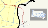
, where it is known as the
Vine Street Expressway, and
CamdenThe city of Camden is the county seat of Camden County, New Jersey. It is located across the Delaware River from Philadelphia, Pennsylvania. As of the 2010 United States Census, the city had a total population of 77,344...
,
New JerseyNew Jersey is a state in the Northeastern and Middle Atlantic regions of the United States. , its population was 8,791,894. It is bordered on the north and east by the state of New York, on the southeast and south by the Atlantic Ocean, on the west by Pennsylvania and on the southwest by Delaware...
, where it is known as the northern segment of the
North–South Freeway, as well as the
Martin Luther King Jr. Memorial Highway. Its western terminus is at
I-76Interstate 76 is an Interstate Highway in the United States, running 435 miles from an interchange with Interstate 71 west of Akron, Ohio, east to Interstate 295 near Camden, New Jersey....
in Philadelphia near the
Philadelphia Museum of ArtThe Philadelphia Museum of Art is among the largest art museums in the United States. It is located at the west end of the Benjamin Franklin Parkway in Philadelphia's Fairmount Park. The Museum was established in 1876 in conjunction with the Centennial Exposition of the same year...
. From there it heads east towards the Ben Franklin Bridge. On the New Jersey side of the bridge, the highway heads south to its southern terminus at I-76 in
Gloucester CityGloucester City is a city in Camden County, New Jersey, United States. As of the United States 2010 Census, the city population was 11,456.-Geography:Gloucester City is located at ....
near the
Walt Whitman BridgeThe Walt Whitman Bridge is a green-colored single-level suspension bridge spanning the Delaware River from Philadelphia to Gloucester City, New Jersey. Named after the poet Walt Whitman, who resided in nearby Camden toward the end of his life, the Walt Whitman Bridge is one of the larger bridges...
. Between the western terminus and downtown Camden, I-676 is
concurrentA concurrency, overlap, or coincidence in a road network is an instance of one physical road bearing two or more different highway, motorway, or other route numbers...
with
U.S. Route 30U.S. Route 30 is an east–west main route of the system of United States Numbered Highways, with the highway traveling across the northern tier of the country. It is the third longest U.S. route, after U.S. Route 20 and U.S. Route 6. The western end of the highway is at Astoria, Oregon; the...
(US 30).
After
World War IIWorld War II, or the Second World War , was a global conflict lasting from 1939 to 1945, involving most of the world's nations—including all of the great powers—eventually forming two opposing military alliances: the Allies and the Axis...
, freeway approaches were planned for both sides of the Ben Franklin Bridge, which was completed in 1926 and served as a part of US 30. In Pennsylvania, the Vine Street Expressway was planned to run along the northern edge of Center City Philadelphia to the
Schuylkill RiverThe Schuylkill River is a river in Pennsylvania. It is a designated Pennsylvania Scenic River.The river is about long. Its watershed of about lies entirely within the state of Pennsylvania. The source of its eastern branch is in the Appalachian Mountains at Tuscarora Springs, near Tamaqua in...
, while in New Jersey, the North-South Freeway was to head south along the Route 42 corridor. When the Interstate Highway System was created in the 1950s, this stretch of highway was a part of I-80S, with
Interstate 680 continuing on the Schuylkill Expressway to the Walt Whitman Bridge. In 1964, the designations became I-76 and I-676, respectively, and in the 1970s the two routes were switched onto their current alignments. I-676 in New Jersey was completed between I-76 and Morgan Boulevard by 1960 and north of there to downtown Camden by the 1980s. The Vine Street Expressway was opened from the Schuylkill Expressway to 18th Street by 1960 and east of there to I-95 on January 10, 1991 after several obstacles to construction. However, there are grade-level intersections in the connections between the Vine Street Expressway and the Ben Franklin Bridge.
Pennsylvania
I-676 begins at an interchange with the
Schuylkill ExpresswayThe Schuylkill Expressway , locally known as the Schuylkill, is a freeway through southwestern Montgomery County and the city of Philadelphia, and the easternmost segment of Interstate 76 in the U.S. state of Pennsylvania...
(
I-76Interstate 76 is an Interstate Highway in the United States, running 435 miles from an interchange with Interstate 71 west of Akron, Ohio, east to Interstate 295 near Camden, New Jersey....
and
US 30In the U.S. state of Pennsylvania, U.S. Route 30 runs east–west across the southern part of the state, passing through Pittsburgh and Philadelphia on its way from the West Virginia state line east to the Benjamin Franklin Bridge over the Delaware River into New Jersey...
) in Philadelphia,
PennsylvaniaThe Commonwealth of Pennsylvania is a U.S. state that is located in the Northeastern and Mid-Atlantic regions of the United States. The state borders Delaware and Maryland to the south, West Virginia to the southwest, Ohio to the west, New York and Ontario, Canada, to the north, and New Jersey to...
, heading to the east on the six-lane Vine Street Expressway
concurrentA concurrency, overlap, or coincidence in a road network is an instance of one physical road bearing two or more different highway, motorway, or other route numbers...
with US 30. It immediately crosses the
Schuylkill RiverThe Schuylkill River is a river in Pennsylvania. It is a designated Pennsylvania Scenic River.The river is about long. Its watershed of about lies entirely within the state of Pennsylvania. The source of its eastern branch is in the Appalachian Mountains at Tuscarora Springs, near Tamaqua in...
on the
Vine Street Expressway BridgeThe Vine Street Expressway Bridge was built in 1959 and reconstructed 1989 by the Pennsylvania Department of Transportation. It carries Interstate 676 over the Schuylkill River, CSX Transportation tracks, and a North 24th Street ramp, in Philadelphia, Pennsylvania.-References:...
and comes to an interchange with 23rd Street and 22nd Street and the Ben Franklin Parkway that has access to the
Philadelphia Museum of ArtThe Philadelphia Museum of Art is among the largest art museums in the United States. It is located at the west end of the Benjamin Franklin Parkway in Philadelphia's Fairmount Park. The Museum was established in 1876 in conjunction with the Centennial Exposition of the same year...
and the
Franklin InstituteThe Franklin Institute is a museum in Philadelphia, Pennsylvania, and one of the oldest centers of science education and development in the United States, dating to 1824. The Institute also houses the Benjamin Franklin National Memorial.-History:On February 5, 1824, Samuel Vaughn Merrick and...
. From this point, the Vine Street Expressway enters a depressed road cut and passes under several streets, running along the northern edge of Center City Philadelphia. Vine Street serves as a
frontage roadA frontage road is a non-limited access road running parallel to a higher-speed road, usually a freeway, and feeding it at appropriate points of access...
to the freeway at street level. Within this alignment, there is an exit for
PA 611Pennsylvania Route 611 is a major state highway in Pennsylvania, United States, running from Interstate 95 south of downtown Philadelphia north to Interstate 380 in Coolbaugh Township, Pennsylvania in The Poconos....
(
Broad StreetBroad Street is a major arterial street in Philadelphia, Pennsylvania, and is nearly 13 miles long.It is Pennsylvania Route 611 along its entire length with the exception of its northernmost part between Old York Road and Pennsylvania Route 309 and the southernmost part south of Interstate 95...
). After passing under 10th Street in
ChinatownPhiladelphia Chinatown is a predominantly Asian American neighborhood located within the Center City district in Philadelphia, Pennsylvania, United States...
, the last street the depressed alignment passes under, the highway rises up and reaches a split between the Vine Street Expressway, which continues to
I-95Interstate 95 is an Interstate highway running from Miami, Florida north to Houlton, Maine. In the U.S. state of Pennsylvania, the route is known by many as the Delaware Expressway, but is officially named The Vietnam Veterans Memorial Highway. and locally known as "95"...
, and I-676/US 30. At this split, there is also an eastbound exit and westbound entrance for 8th Street. After exiting the Vine Street Expressway, eastbound I-676/US 30 has a brief at-grade portion along southbound 6th Street to the Ben Franklin Bridge approach, an example of a
non–limited access section of Interstate Highway. Westbound I-676/US 30 has a ramp from the bridge to the Vine Street Expressway that intersects 7th Street and 8th Street at-grade. From this point, I-676/US 30 crosses over the
Delaware RiverThe Delaware River is a major river on the Atlantic coast of the United States.A Dutch expedition led by Henry Hudson in 1609 first mapped the river. The river was christened the South River in the New Netherland colony that followed, in contrast to the North River, as the Hudson River was then...
on the seven-lane Ben Franklin Bridge, which also carries pedestrians and the PATCO Speedline. This bridge and its approaches are maintained by the
Delaware River Port AuthorityThe Delaware River Port Authority is a bi-state instrumentality created by a Congressionally approved interstate compact between the governments of the Commonwealth of Pennsylvania and the State of New Jersey...
.
New Jersey
After crossing the bridge, the freeway enters the downtown area of
CamdenThe city of Camden is the county seat of Camden County, New Jersey. It is located across the Delaware River from Philadelphia, Pennsylvania. As of the 2010 United States Census, the city had a total population of 77,344...
in
Camden County, New Jersey-Demographics:As of the 2010 Census the population of Camden County was 60.28% Non-Hispanic white, 18.45% Non-Hispanic black, 1.12% Hispanic blacks, 0.17% Non-Hispanic Native American, 0.15% Hispanic Native Americans, 5.07% Non-Hispanic Asian, and 0.14% non-Hispanics reporting some other race...
and passes to the north of
Campbell's FieldCampbell's Field is a 6,425-seat baseball park in Camden, New Jersey that hosted its first regular season baseball game on May 11, 2001. The ballpark is home to the Camden Riversharks and the college baseball team of Rutgers University-Camden...
. Upon entering New Jersey, I-676 becomes signed as a north-south road. There is a southbound ramp to 6th Street in Camden, which is near the
toll boothA tollhouse or toll house is a building with accommodation for a toll collector, beside a tollgate on a toll road or canal. Many tollhouses were built by turnpike trusts in England, Wales and Scotland during the 18th and early 19th centuries...
s for northbound traffic. After the toll plaza,
US 30U.S. Route 30 is a U.S. highway running from Astoria, Oregon east to Atlantic City, New Jersey. In the U.S. state of New Jersey, US 30 runs from the Benjamin Franklin Bridge at the Delaware River in Camden, Camden County while concurrent with Interstate 676 southeast to Virginia...
splits from I-676 at an interchange, at which point I-676 turns south as a six-lane freeway called the Martin Luther King Memorial Highway or the North-South Freeway. Immediately after the US 30 split, there is an interchange with
CR 537County Route 537, abbreviated CR 537, is a county highway in the U.S. state of New Jersey. The highway extends from Delaware Avenue in Camden to Myrtle Avenue in Long Branch.-Camden County:...
(Market Street/Federal Street) and Martin Luther King Boulevard that provides access to downtown Camden. From this point, I-676 continues south through urban areas of the city, passing over several streets and running immediately to the west of a
Conrail Shared Assets OperationsConrail Shared Assets Operations is an American railroad company. It operates three networks—the North Jersey, South Jersey/Philadelphia, and Detroit Shared Assets Areas, where it serves as a local carrier and switching company for CSX Transportation and the Norfolk Southern Railway...
railroad line. The road heads southwest on a viaduct over neighborhoods before the interchange with CR 607 (Kaighns Avenue) and Atlantic Avenue. I-676 turns south at this junction and comes to the exit for Morgan Boulevard. Past Morgan Boulevard, the freeway crosses the North Branch of Newton Creek. Here, I-676 ends at an interchange east of the
Walt Whitman BridgeThe Walt Whitman Bridge is a green-colored single-level suspension bridge spanning the Delaware River from Philadelphia to Gloucester City, New Jersey. Named after the poet Walt Whitman, who resided in nearby Camden toward the end of his life, the Walt Whitman Bridge is one of the larger bridges...
with I-76, CR 630, and Route 76C, the latter being an access road to
US 130U.S. Route 130 is a north–south U.S. Highway completely within the state of New Jersey. It runs from Interstate 295 and US 40 at Deepwater in Pennsville Township, Salem County, where the road continues east as Route 49, north to US 1 in North Brunswick Township, Middlesex County, where...
and Route 168. The North-South Freeway becomes a part of I-76 past this interchange and continues into
Gloucester CityGloucester City is a city in Camden County, New Jersey, United States. As of the United States 2010 Census, the city population was 11,456.-Geography:Gloucester City is located at ....
.
History
The Ben Franklin Bridge was opened on July 1, 1926 and was designated to carry US 30 across the Delaware River. A
parkwayThe term parkway has several distinct principal meanings and numerous synonyms around the world, for either a type of landscaped area or a type of road.Type of landscaped area:...
called the Camden-Atlantic City Parkway was planned in 1932 to connect the Ben Franklin Bridge southeast to
Atlantic CityAtlantic City is a city in Atlantic County, New Jersey, United States, and a nationally renowned resort city for gambling, shopping and fine dining. The city also served as the inspiration for the American version of the board game Monopoly. Atlantic City is located on Absecon Island on the coast...
; this was never built. After
World War IIWorld War II, or the Second World War , was a global conflict lasting from 1939 to 1945, involving most of the world's nations—including all of the great powers—eventually forming two opposing military alliances: the Allies and the Axis...
, freeway connections were planned on both sides of the Ben Franklin Bridge. In Philadelphia, the Vine Street Expressway was planned to run along the Vine Street corridor to the present-day Schuylkill Expressway in 1945. The North-South Freeway was proposed in New Jersey as a connection from the bridge south along the Route 42 corridor. In 1950, the city of Philadelphia began planning the construction of the Vine Street Expressway, which would run along a depressed alignment through the city.
When the
Interstate Highway SystemThe Dwight D. Eisenhower National System of Interstate and Defense Highways, , is a network of limited-access roads including freeways, highways, and expressways forming part of the National Highway System of the United States of America...
was created in the 1950s, the Vine Street Expressway, Ben Franklin Bridge, and part of the North-South Freeway were to become a part of it. In New Jersey, this Interstate was initially designated as FAI Corridor 109. In 1958, this freeway was initially planned as I-895 and I-380 before the American Association of State Highway Officials designated it as a part of I-80S. Meanwhile, I-680 was designated along the present-day Schuylkill Expressway between the Vine Street Expressway and the Walt Whitman Bridge. By 1960, the Vine Street Expressway had been completed between the Schuylkill Expressway and 18th Street. The portion of I-80S in New Jersey on the North-South Freeway had opened south of Morgan Boulevard by this time. On April 16, 1963, Pennsylvania wanted to renumber its Interstate numbers. Part of this was the renumbering from I-80S into I-76, and all of its
auxiliary routes into I-x76. The
Federal Highway AdministrationThe Federal Highway Administration is a division of the United States Department of Transportation that specializes in highway transportation. The agency's major activities are grouped into two "programs," the Federal-aid Highway Program and the Federal Lands Highway Program...
approved the request on February 26, 1964. As a result, I-80S became I-76 and I-680 became I-676. In the 1970s, the I-76 and the I-676 designations were switched onto their current routes. The remainder of the New Jersey portion of I-676 between Morgan Boulevard and US 30 was completed by the 1980s.
There were several challenges in building the Vine Street Expressway between 18th Street and the Ben Franklin Bridge. The road was to run through developed areas of Philadelphia, intersecting several streets and railroad lines. In addition, the route was to run through
Franklin SquareFranklin Square is one of the five original open-space parks planned by William Penn during the late 17th century in central Philadelphia, Pennsylvania.- History :...
, a historically sensitive site, to connect to the Ben Franklin Bridge. As a result, the routing was modified in 1966 to avoid many of these obstacles. The route was to avoid running through Franklin Square, leading to the eastbound direction using surface streets to access the Ben Franklin Bridge, and a planned connector to
Market StreetMarket Street, originally known as High Street, is a major east–west street in Philadelphia, Pennsylvania. For the majority of its length, it serves as Pennsylvania Route 3....
was removed. In the 1970s, the proposed freeway’s environmental impact statement had to be evaluated again per new guidelines; when the new environmental impact statement was issued in 1977, it was found that more improvements were needed for mass transit in the area of the planned freeway. To comply with this, provisions were made concerning the proposed underground
Center City Commuter ConnectionThe Center City Commuter Connection, commonly referred to as "the commuter tunnel", is a passenger railroad tunnel in Center City, Philadelphia, Pennsylvania, United States, built to connect the stub ends of the two separate regional commuter rail systems, originally operated by two rival railroad...
for
SEPTA Regional RailThe SEPTA Regional Rail system consists of commuter rail service on thirteen branches to over 150 active stations in Philadelphia, Pennsylvania, United States and its suburbs. Service on most lines runs from 5:30 AM to midnight...
, in which the railroad tracks would pass under I-676 and residences would be built over the railroad tunnel in Chinatown. Construction was approved in 1986 on the Vine Street Expressway from 18th Street to the Ben Franklin Bridge, with no provisions for elevated connections between the Ben Franklin Bridge and the Vine Street Expressway to avoid disturbing Franklin Square. This portion of the Vine Street Expressway opened to traffic on January 10, 1991, completing I-676.
Exit list
Exit numbers are not signed to the Pennsylvania side of I-676.
{| class="wikitable"
!County
!Location
!Mile
!Exit
!Destinations
!Notes
|-
|rowspan=8|
Philadelphia
(Pennsylvania)-History:Tribes of Lenape were the first known occupants in the area which became Philadelphia County. The first European settlers were Swedes and Finns who arrived in 1638. The Netherlands seized the area in 1655, but permanently lost control to England in 1674...
|rowspan=8|
PhiladelphiaPhiladelphia is the largest city in the Commonwealth of Pennsylvania and the county seat of Philadelphia County, with which it is coterminous. The city is located in the Northeastern United States along the Delaware and Schuylkill rivers. It is the fifth-most-populous city in the United States,...
|0.00
|1
|
|Westbound exit and eastbound entrance; signed as exits 1A (east) and 1B (west)
|-
|0.41
|1H
|Ben Franklin Parkway, 23rd Street
|
|-
|0.78
|1J
|
|
|-
|1.43
|1G
|8th Street south – Chinatown
|
At-grade intersectionAn at-grade intersection is a junction at which two or more transport axes cross at the same level .-Traffic management:With areas of high or fast traffic, an at-grade intersection normally requires a traffic control device such as a stop sign, traffic light or railway signal to manage conflicting...
westbound; interchange eastbound
|-
|1.47
|1
|,
TrentonTrenton is the capital of the U.S. state of New Jersey and the county seat of Mercer County. As of the 2010 United States Census, Trenton had a population of 84,913...
|Signed as exits 1F (north) and 1L (south)
|-
|
|1I
|
|Westbound exit and eastbound entrance
|-
|1.86
|1D
|6th Street south – Independence Hall
|
At-grade intersectionAn at-grade intersection is a junction at which two or more transport axes cross at the same level .-Traffic management:With areas of high or fast traffic, an at-grade intersection normally requires a traffic control device such as a stop sign, traffic light or railway signal to manage conflicting...
|-
|
|1C
|5th Street
|Westbound exit and eastbound entrance
|-
|colspan=2 align=center|
Delaware RiverThe Delaware River is a major river on the Atlantic coast of the United States.A Dutch expedition led by Henry Hudson in 1609 first mapped the river. The river was christened the South River in the New Netherland colony that followed, in contrast to the North River, as the Hudson River was then...
|
|colspan=3 align=center|
Benjamin Franklin BridgeThe Benjamin Franklin Bridge , originally named the Delaware River Bridge, is a suspension bridge across the Delaware River connecting Philadelphia, Pennsylvania and Camden, New Jersey...
|-
|rowspan=11|
Camden
(New Jersey)-Demographics:As of the 2010 Census the population of Camden County was 60.28% Non-Hispanic white, 18.45% Non-Hispanic black, 1.12% Hispanic blacks, 0.17% Non-Hispanic Native American, 0.15% Hispanic Native Americans, 5.07% Non-Hispanic Asian, and 0.14% non-Hispanics reporting some other race...
|rowspan=10|
CamdenThe city of Camden is the county seat of Camden County, New Jersey. It is located across the Delaware River from Philadelphia, Pennsylvania. As of the 2010 United States Census, the city had a total population of 77,344...
|-
|3.84
|2A
|6th Street, Broadway – Downtown Camden, Rutgers University
|Signed as exit 1K eastbound
|-
|3.50
|1E
|
|East end of US 30 overlap; westbound exit is via exit 2B
|-
|3.37
|2A
|,
Adventure AquariumThe Adventure Aquarium, formerly the New Jersey State Aquarium, is a for-profit educational entertainment attraction operated in Camden, New Jersey on the Delaware River waterfront by the Herschend Family Entertainment Corporation...
|Eastbound exit only
|-
|3.28
|2B
|M.L. King Boulevard, Campbell Place – Waterfront
|No westbound entrance
|-
|2.27
|3
|
|
|-
|1.14
|4
| – Port Terminals
|
|-
|0.36
|6
|
|Signed as exits 6A (west) and 6B (east) eastbound
|-
|0.32
|5
| –
PhiladelphiaPhiladelphia is the largest city in the Commonwealth of Pennsylvania and the county seat of Philadelphia County, with which it is coterminous. The city is located in the Northeastern United States along the Delaware and Schuylkill rivers. It is the fifth-most-populous city in the United States,...
|Eastbound exit and westbound entrance
|-
|0.22
|6C
|
|Eastbound exit and westbound entrance
|-
|
Gloucester CityGloucester City is a city in Camden County, New Jersey, United States. As of the United States 2010 Census, the city population was 11,456.-Geography:Gloucester City is located at ....
|0.00
|
|
|Southbound exit and northbound entrance
See also
External links