
Illinois Route 41
Encyclopedia
Illinois Route 41 is a north–south highway in rural west-central Illinois
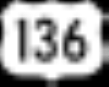
. It runs from U.S. Route 136
near Macomb
north to U.S. Route 34
and Illinois Route 164
in Galesburg
, a distance of 37.53 miles (60.4 km). Illinois 41 is maintained by the Illinois Department of Transportation
.
in eastern McDonough County, east of Macomb
and north of Adair
. The route heads north and intersects Illinois 95
east of Bardolph
. Illinois 41 continues north to Bushnell
, where it becomes concurrent
with Illinois 9
. The two highways run northeast until Illinois 41 splits off of Illinois 9 and heads north into Prairie City
. The highway leaves Prairie City to the east and enters Fulton County
. In Fulton County, Illinois 41 heads north and passes through Avon
before entering Knox County
. The highway enters St. Augustine
in southern Knox County, intersecting Illinois 116 along the village's northern edge. Illinois 41 continues north through Abingdon
before entering western Galesburg
, where it terminates at a junction with U.S. Route 34
and Illinois 164.
. This route crosses over the CB&Q right-of-way (Galesburg to Beardstown) twice along its 38 miles (61.2 km) distance.
The southern terminus in McDonough County at U.S. Route 136 is referred to (locally) as the Nine-Mile Y. The Y in reference to an interchange road architecture historically used on Illinois state routes. While a few of these still remain throughout the state, most of these Y intersections have been replaced with the safer T style intersections and stop signs.
and Illinois Route 164
.
This alignment moved west with the completion of U.S. 34
as a 4-lane expressway to Monmouth. IL-41 now proceeds north on an upgraded and wider Linwood Road to West Main Street Illinois Route 164
where it terminates at the nearby access interchange for U.S. 34
.
Illinois
Illinois is the fifth-most populous state of the United States of America, and is often noted for being a microcosm of the entire country. With Chicago in the northeast, small industrial cities and great agricultural productivity in central and northern Illinois, and natural resources like coal,...
. It runs from U.S. Route 136
U.S. Route 136
U.S. Highway 136 is a spur of U.S. Highway 36. It runs from Edison, Nebraska, at U.S. Highway 6 and U.S. Highway 34 to the Interstate 74/Interstate 465 interchange in Speedway, Indiana. This is a distance of 804 miles .-Nebraska:...
near Macomb
Macomb, Illinois
Macomb is a city in and the county seat of McDonough County, Illinois, United States. It is situated in western Illinois southwest of Galesburg. The population was 18,588 at the 2000 census. Macomb is the home of Western Illinois University.- Geography :...
north to U.S. Route 34
U.S. Route 34
U.S. Route 34 is an east–west United States highway that runs for 1,122 miles from north-central Colorado to the western suburbs of Chicago. Through Rocky Mountain National Park it is known as the Trail Ridge Road where it reaches 12,183 ft , making it the highest paved through highway in...
and Illinois Route 164
Illinois Route 164
Illinois Route 164 is a state road in rural western Illinois. It runs from U.S. Route 34 in Gladstone to U.S. Route 34 and Illinois Route 41 in Galesburg. This distance is .- Route description :...
in Galesburg
Galesburg, Illinois
Galesburg is a city in Knox County, Illinois, in the United States. As of the 2010 census, the city population was 32,195. It is the county seat of Knox County....
, a distance of 37.53 miles (60.4 km). Illinois 41 is maintained by the Illinois Department of Transportation
Illinois Department of Transportation
The Illinois Department of Transportation is a state agency in charge of state-maintained public roadways of the U.S. state of Illinois. In addition, IDOT provides funding for rail, public transit and airport projects and administers fuel tax and federal funding to local juridictions in the...
.
Route description
Illinois 41 begins at a junction with U.S. Route 136U.S. Route 136
U.S. Highway 136 is a spur of U.S. Highway 36. It runs from Edison, Nebraska, at U.S. Highway 6 and U.S. Highway 34 to the Interstate 74/Interstate 465 interchange in Speedway, Indiana. This is a distance of 804 miles .-Nebraska:...
in eastern McDonough County, east of Macomb
Macomb, Illinois
Macomb is a city in and the county seat of McDonough County, Illinois, United States. It is situated in western Illinois southwest of Galesburg. The population was 18,588 at the 2000 census. Macomb is the home of Western Illinois University.- Geography :...
and north of Adair
Adair, Illinois
Adair is an unincorporated census-designated place in McDonough County, Illinois. Adair is part of the New Salem Township. The town is served by U.S. Route 136, and the Chicago, Burlington and Quincy Railroad runs through the town...
. The route heads north and intersects Illinois 95
Illinois Route 95
Illinois Route 95 is a minor east–west state road in west central Illinois. It runs from Illinois Route 41 just west of New Philadelphia east to Illinois Route 97 just south of Cuba. This is a distance of .- Route description :...
east of Bardolph
Bardolph, Illinois
Bardolph is a village in McDonough County, Illinois, United States. The population was 253 at the 2000 census.-Geography:Bardolph is located at ....
. Illinois 41 continues north to Bushnell
Bushnell, Illinois
Bushnell is a city in McDonough County, Illinois, United States. The population was 3,221 at the 2000 census.-Geography:Bushnell is located at ....
, where it becomes concurrent
Concurrency (road)
A concurrency, overlap, or coincidence in a road network is an instance of one physical road bearing two or more different highway, motorway, or other route numbers...
with Illinois 9
Illinois Route 9
Illinois Route 9 is a cross-state, east–west rural state highway in central Illinois. It runs from the Fort Madison Toll Bridge over the Mississippi River to Iowa in Niota east to State Road 26 at the Indiana border. This is a distance of ....
. The two highways run northeast until Illinois 41 splits off of Illinois 9 and heads north into Prairie City
Prairie City, Illinois
Prairie City is a village in McDonough County, Illinois, United States. The population was 461 at the 2000 census.-Geography:Prairie City is located at ....
. The highway leaves Prairie City to the east and enters Fulton County
Fulton County, Illinois
Fulton County is a county located in the U.S. state of Illinois. According to the 2010 census, it has a population of 37,069, which is a decrease of 3.1% from 38,250 in 2000. Its county seat is Lewistown. Canton is the largest city. Both cities are southwest of Peoria, and the county is considered...
. In Fulton County, Illinois 41 heads north and passes through Avon
Avon, Illinois
Avon is a village in Fulton County, Illinois, United States. The population was 915 at the 2000 census.-Geography:Avon is located at .According to the United States Census Bureau, the village has a total area of , all of it land....
before entering Knox County
Knox County, Illinois
Knox County is a county located in the U.S. state of Illinois. According to the 2010 census, it has a population of 52,919, which is a decrease of 5.2% from 55,836 in 2000...
. The highway enters St. Augustine
St. Augustine, Illinois
St. Augustine is a village in Knox County, Illinois, United States. The population was 152 at the 2000 census. It is part of the Galesburg Micropolitan Statistical Area.-Geography:St...
in southern Knox County, intersecting Illinois 116 along the village's northern edge. Illinois 41 continues north through Abingdon
Abingdon, Illinois
Abingdon is a city in Knox County, Illinois, 50 miles west of Peoria. It is part of the Galesburg Micropolitan Statistical Area. The city was first settled in 1828 and was incorporated in 1857. In 1894, the patent for the common spring-loaded mousetrap was given to William Hooker of Abingdon,...
before entering western Galesburg
Galesburg, Illinois
Galesburg is a city in Knox County, Illinois, in the United States. As of the 2010 census, the city population was 32,195. It is the county seat of Knox County....
, where it terminates at a junction with U.S. Route 34
U.S. Route 34
U.S. Route 34 is an east–west United States highway that runs for 1,122 miles from north-central Colorado to the western suburbs of Chicago. Through Rocky Mountain National Park it is known as the Trail Ridge Road where it reaches 12,183 ft , making it the highest paved through highway in...
and Illinois 164.
History
Illinois 41 is exactly the same route as SBI Route 41, as instituted in 1918. There have been only been minor routing changes, largely at its northern terminus in Galesburg, since its inception. This route parallels the CB&Q railroad from Galesburg to its southern terminus at U.S. 136U.S. Route 136
U.S. Highway 136 is a spur of U.S. Highway 36. It runs from Edison, Nebraska, at U.S. Highway 6 and U.S. Highway 34 to the Interstate 74/Interstate 465 interchange in Speedway, Indiana. This is a distance of 804 miles .-Nebraska:...
. This route crosses over the CB&Q right-of-way (Galesburg to Beardstown) twice along its 38 miles (61.2 km) distance.
The southern terminus in McDonough County at U.S. Route 136 is referred to (locally) as the Nine-Mile Y. The Y in reference to an interchange road architecture historically used on Illinois state routes. While a few of these still remain throughout the state, most of these Y intersections have been replaced with the safer T style intersections and stop signs.
Galesburg alignment change
IL-41 enters Galesburg from the south on Linwood Road. The historic alignment turned northeast on Monmouth Blvd. through an industrial section between the former Santa Fe mainline to the north and the former CB&Q connector to the south. At South Henderson, the historic route turned north, crossing the old Santa Fe mainline and terminating at West Main Street U.S. 150U.S. Route 150
U.S. Route 150 is a 571 mile long northwest-southeast United States highway, signed as east–west. It runs from U.S. Route 6 outside of Moline, Illinois to U.S. Route 25 in Mount Vernon, Kentucky .-Illinois:In the state of Illinois, U.S. 150 runs from the Quad City International Airport at U.S...
and Illinois Route 164
Illinois Route 164
Illinois Route 164 is a state road in rural western Illinois. It runs from U.S. Route 34 in Gladstone to U.S. Route 34 and Illinois Route 41 in Galesburg. This distance is .- Route description :...
.
This alignment moved west with the completion of U.S. 34
U.S. Route 34
U.S. Route 34 is an east–west United States highway that runs for 1,122 miles from north-central Colorado to the western suburbs of Chicago. Through Rocky Mountain National Park it is known as the Trail Ridge Road where it reaches 12,183 ft , making it the highest paved through highway in...
as a 4-lane expressway to Monmouth. IL-41 now proceeds north on an upgraded and wider Linwood Road to West Main Street Illinois Route 164
Illinois Route 164
Illinois Route 164 is a state road in rural western Illinois. It runs from U.S. Route 34 in Gladstone to U.S. Route 34 and Illinois Route 41 in Galesburg. This distance is .- Route description :...
where it terminates at the nearby access interchange for U.S. 34
U.S. Route 34
U.S. Route 34 is an east–west United States highway that runs for 1,122 miles from north-central Colorado to the western suburbs of Chicago. Through Rocky Mountain National Park it is known as the Trail Ridge Road where it reaches 12,183 ft , making it the highest paved through highway in...
.