
Illinois Route 138
Encyclopedia
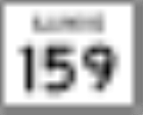
Illinois Route 138 is a state highway in southwestern Illinois
. It runs from Illinois Route 159
north of Bunker Hill
to the city of Mount Olive
at Illinois Street, a former alignment of U.S. Route 66
. This is a distance of 14.95 miles (24.06 km).
. It is a two-lane surface road for its entire length. South of Benld, it also overlaps Illinois Route 4
for a few miles.
to Grayville
; in 1937, this became Illinois Route 1
. It was put on its current alignment in 1942, replacing parts of Illinois Route 38
.
Illinois
Illinois is the fifth-most populous state of the United States of America, and is often noted for being a microcosm of the entire country. With Chicago in the northeast, small industrial cities and great agricultural productivity in central and northern Illinois, and natural resources like coal,...
. It runs from Illinois Route 159
Illinois Route 159
Illinois Route 159 is a north–south state road in southwestern Illinois. Its southern terminus is at Illinois Route 3 and Illinois Route 154 in Red Bud and its northern terminus at Illinois Route 16 in Royal Lakes. This is a distance of ....
north of Bunker Hill
Bunker Hill, Illinois
Bunker Hill is a city in Macoupin County, Illinois, United States. The population was 1,801 at the 2000 census.-Settlement:The original inhabitants of the Bunker Hill area were members of the Peoria, Kickapoo, and Winnebago Indian tribes. As pioneers arrived in Macoupin County, the site of the...
to the city of Mount Olive
Mount Olive, Illinois
Mount Olive is a city in Macoupin County, Illinois, United States. The population was 2,150 at the 2000 census.-Geography:Mount Olive is located at ....
at Illinois Street, a former alignment of U.S. Route 66
U.S. Route 66
U.S. Route 66 was a highway within the U.S. Highway System. One of the original U.S. highways, Route 66 was established on November 11, 1926 -- with road signs erected the following year...
. This is a distance of 14.95 miles (24.06 km).
Route description
Illinois 138 runs east–west, with a bend north through the city of BenldBenld, Illinois
Benld is a city in Macoupin County, Illinois, United States. The population was 1,541 at the 2000 census. The name derives from founder Benjamin L. Dorsey ....
. It is a two-lane surface road for its entire length. South of Benld, it also overlaps Illinois Route 4
Illinois Route 4
Illinois Route 4 is a long state road that runs south from the Interstate 55 business loop around Springfield south to Illinois Route 13 just north of Murphysboro. This is a distance of .-Route description:...
for a few miles.
History
SBI Route 138 ran from Mount CarmelMount Carmel, Illinois
Mount Carmel is a city in and the county seat of Wabash County, Illinois, United States. At the time of the 2000 census, the population was 7,982, while the next largest town in Wabash County is Allendale, population 528. Located at the confluence of the Wabash, Patoka, and White Rivers, Mount...
to Grayville
Grayville, Illinois
Grayville is a city in Edwards and White counties in Illinois. The population was 1,725 at the 2000 census. Grayville is the birthplace of naval hero James Meredith Helm.-Geography:Grayville is located at ....
; in 1937, this became Illinois Route 1
Illinois Route 1
Illinois Route 1 is a state highway in the U.S. state of Illinois. Running parallel to the Indiana border, it is also the longest state road, starting on the south side of Chicago as Halsted Street at the intersection with 95th Street, south to a free ferry crossing to Kentucky at Cave-In-Rock on...
. It was put on its current alignment in 1942, replacing parts of Illinois Route 38
Illinois Route 38
Illinois Route 38 is an east–west state road that runs across northern Illinois. It runs from U.S. Route 52 in downtown Dixon to U.S. Highways 12, 20, and 45 in Westchester. This is a distance of . As Roosevelt Road it continues through Forest Park and into Cicero and Chicago before...
.