
Hurtsboro, Alabama
Encyclopedia
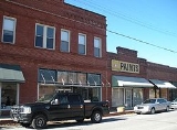
Hurtsboro is a town in Russell County
, Alabama
, United States
. At the 2000 census the population was 592. It was founded in 1857 as Hurtsville and named for Joel Hurt, Sr. (whose son, Joel Hurt
, was an important developer of Atlanta, Georgia
). A railroad spur from Columbus, Georgia
was completed the next year and in 1883 the town name was changed to Hurtsboro.
The town is part of the Columbus, Georgia-Alabama Metropolitan Statistical Area
.
According to the U.S. Census Bureau, the town has a total area of 1 square miles (2.6 km²), all of it land.
of 2000, there were 592 people, 283 households, and 161 families residing in the town. The population density
was 573.7 people per square mile (221.9/km²). There were 342 housing units at an average density of 331.5 per square mile (128.2/km²). The racial makeup of the town was 70.27% Black
or African American
, 29.39% White
, and 0.34% from two or more races. 0.17% of the population were Hispanic
or Latino
of any race.
There were 283 households out of which 25.1% had children under the age of 18 living with them, 31.1% were married couples
living together, 23.3% had a female householder with no husband present, and 43.1% were non-families. 41.7% of all households were made up of individuals and 18.7% had someone living alone who was 65 years of age or older. The average household size was 2.09 and the average family size was 2.86.
In the town the population was spread out with 24.2% under the age of 18, 7.1% from 18 to 24, 25.7% from 25 to 44, 22.8% from 45 to 64, and 20.3% who were 65 years of age or older. The median age was 40 years. For every 100 females there were 93.5 males. For every 100 females age 18 and over, there were 82.5 males.
The median income for a household in the town was $16,691, and the median income for a family was $25,000. Males had a median income of $26,979 versus $19,821 for females. The per capita income
for the town was $16,908. About 28.4% of families and 32.8% of the population were below the poverty line, including 46.3% of those under age 18 and 28.5% of those age 65 or over.
Russell County, Alabama
Russell County is a county of the U.S. state of Alabama. Its name is in honor of Colonel Gilbert C. Russell, who fought in the wars against the Creek Indians. As of 2010, the population was 52,947...
, Alabama
Alabama
Alabama is a state located in the southeastern region of the United States. It is bordered by Tennessee to the north, Georgia to the east, Florida and the Gulf of Mexico to the south, and Mississippi to the west. Alabama ranks 30th in total land area and ranks second in the size of its inland...
, United States
United States
The United States of America is a federal constitutional republic comprising fifty states and a federal district...
. At the 2000 census the population was 592. It was founded in 1857 as Hurtsville and named for Joel Hurt, Sr. (whose son, Joel Hurt
Joel Hurt
Joel Hurt was an important businessman and developer in Atlanta active in the late 19th century through the early 20th century.Born in Hurtsboro, Alabama Joel Hurt (1850–1926) was an important businessman and developer in Atlanta active in the late 19th century through the early 20th...
, was an important developer of Atlanta, Georgia
Atlanta, Georgia
Atlanta is the capital and most populous city in the U.S. state of Georgia. According to the 2010 census, Atlanta's population is 420,003. Atlanta is the cultural and economic center of the Atlanta metropolitan area, which is home to 5,268,860 people and is the ninth largest metropolitan area in...
). A railroad spur from Columbus, Georgia
Columbus, Georgia
Columbus is a city in and the county seat of Muscogee County, Georgia, United States, with which it is consolidated. As of the 2010 census, the city had a population of 189,885. It is the principal city of the Columbus, Georgia metropolitan area, which, in 2009, had an estimated population of 292,795...
was completed the next year and in 1883 the town name was changed to Hurtsboro.
The town is part of the Columbus, Georgia-Alabama Metropolitan Statistical Area
Columbus, Georgia metropolitan area
The Columbus, Georgia Metropolitan Statistical Area, as defined by the United States Census Bureau, is an area consisting of four counties in Georgia and one county in Alabama, anchored by the city of Columbus...
.
Geography
Hurtsboro is located at 32°14′24"N 85°24′55"W (32.240102, -85.415377).According to the U.S. Census Bureau, the town has a total area of 1 square miles (2.6 km²), all of it land.
Demographics
As of the censusCensus
A census is the procedure of systematically acquiring and recording information about the members of a given population. It is a regularly occurring and official count of a particular population. The term is used mostly in connection with national population and housing censuses; other common...
of 2000, there were 592 people, 283 households, and 161 families residing in the town. The population density
Population density
Population density is a measurement of population per unit area or unit volume. It is frequently applied to living organisms, and particularly to humans...
was 573.7 people per square mile (221.9/km²). There were 342 housing units at an average density of 331.5 per square mile (128.2/km²). The racial makeup of the town was 70.27% Black
Race (United States Census)
Race and ethnicity in the United States Census, as defined by the Federal Office of Management and Budget and the United States Census Bureau, are self-identification data items in which residents choose the race or races with which they most closely identify, and indicate whether or not they are...
or African American
Race (United States Census)
Race and ethnicity in the United States Census, as defined by the Federal Office of Management and Budget and the United States Census Bureau, are self-identification data items in which residents choose the race or races with which they most closely identify, and indicate whether or not they are...
, 29.39% White
Race (United States Census)
Race and ethnicity in the United States Census, as defined by the Federal Office of Management and Budget and the United States Census Bureau, are self-identification data items in which residents choose the race or races with which they most closely identify, and indicate whether or not they are...
, and 0.34% from two or more races. 0.17% of the population were Hispanic
Race (United States Census)
Race and ethnicity in the United States Census, as defined by the Federal Office of Management and Budget and the United States Census Bureau, are self-identification data items in which residents choose the race or races with which they most closely identify, and indicate whether or not they are...
or Latino
Race (United States Census)
Race and ethnicity in the United States Census, as defined by the Federal Office of Management and Budget and the United States Census Bureau, are self-identification data items in which residents choose the race or races with which they most closely identify, and indicate whether or not they are...
of any race.
There were 283 households out of which 25.1% had children under the age of 18 living with them, 31.1% were married couples
Marriage
Marriage is a social union or legal contract between people that creates kinship. It is an institution in which interpersonal relationships, usually intimate and sexual, are acknowledged in a variety of ways, depending on the culture or subculture in which it is found...
living together, 23.3% had a female householder with no husband present, and 43.1% were non-families. 41.7% of all households were made up of individuals and 18.7% had someone living alone who was 65 years of age or older. The average household size was 2.09 and the average family size was 2.86.
In the town the population was spread out with 24.2% under the age of 18, 7.1% from 18 to 24, 25.7% from 25 to 44, 22.8% from 45 to 64, and 20.3% who were 65 years of age or older. The median age was 40 years. For every 100 females there were 93.5 males. For every 100 females age 18 and over, there were 82.5 males.
The median income for a household in the town was $16,691, and the median income for a family was $25,000. Males had a median income of $26,979 versus $19,821 for females. The per capita income
Per capita income
Per capita income or income per person is a measure of mean income within an economic aggregate, such as a country or city. It is calculated by taking a measure of all sources of income in the aggregate and dividing it by the total population...
for the town was $16,908. About 28.4% of families and 32.8% of the population were below the poverty line, including 46.3% of those under age 18 and 28.5% of those age 65 or over.