
Houndsditch
Encyclopedia
Houndsditch is a street in the City of London
that connects Bishopsgate
in the north west to Aldgate
in the south east. The modern street runs through a part of the Portsoken
Ward and Bishopsgate
Ward Without. The street marks the route of the old ditch running outside a part of London Wall
.
 A ditch was first constructed outside the City Wall
by the Romans
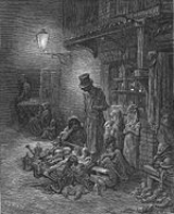
, but became filled in and obliterated. The Danes under Cnut the Great also constructed a town ditch in order to control access to the city. The ditch was redug in 1211 as a part of the defences, and was then about 75 feet (23 m) in width. The City authorities found it a continual problem to scour and clean the ditch, as many of the adjacent houses found it convenient to dispose of filth and refuse in it. In 1595, levelling the ground was first considered, although the street running alongside the ditch had first been paved in 1503. The name Houndsditche first appears in the 13th century, and appears to relate to the quantity of rubbish and dead dogs thrown in the ditch; previously it seems to have been referred to only by the appellation The Ditch. Several dog skeletons were unearthed at Houndsditch in 1989.
, the modern office blocks do not occupy the full building plots, leaving some small areas empty. These were historically the sites of Plague
pits
.
Traffic flows one-way
southeastward from Bishopsgate down the modern Houndsditch, which continues forward into St. Botolph Street, connecting to Aldgate High Street or Whitechapel High Street
. The street is home to a number of offices and bars.
The nearest London Underground
station is Aldgate
and the closest mainline railway station is Liverpool Street
.
City of London
The City of London is a small area within Greater London, England. It is the historic core of London around which the modern conurbation grew and has held city status since time immemorial. The City’s boundaries have remained almost unchanged since the Middle Ages, and it is now only a tiny part of...
that connects Bishopsgate
Bishopsgate
Bishopsgate is a road and ward in the northeast part of the City of London, extending north from Gracechurch Street to Norton Folgate. It is named after one of the original seven gates in London Wall...
in the north west to Aldgate
Aldgate
Aldgate was the eastern most gateway through London Wall leading from the City of London to Whitechapel and the east end of London. Aldgate gives its name to a ward of the City...
in the south east. The modern street runs through a part of the Portsoken
Portsoken
Portsoken is a historical district in the City of London, located outside the former London Wall, on the eastern part of the City, near Aldgate. It is one of the 25 wards of the City....
Ward and Bishopsgate
Bishopsgate
Bishopsgate is a road and ward in the northeast part of the City of London, extending north from Gracechurch Street to Norton Folgate. It is named after one of the original seven gates in London Wall...
Ward Without. The street marks the route of the old ditch running outside a part of London Wall
London Wall
London Wall was the defensive wall first built by the Romans around Londinium, their strategically important port town on the River Thames in what is now the United Kingdom, and subsequently maintained until the 18th century. It is now the name of a road in the City of London running along part of...
.
History
Defensive wall
A defensive wall is a fortification used to protect a city or settlement from potential aggressors. In ancient to modern times, they were used to enclose settlements...
by the Romans
Ancient Rome
Ancient Rome was a thriving civilization that grew on the Italian Peninsula as early as the 8th century BC. Located along the Mediterranean Sea and centered on the city of Rome, it expanded to one of the largest empires in the ancient world....
, but became filled in and obliterated. The Danes under Cnut the Great also constructed a town ditch in order to control access to the city. The ditch was redug in 1211 as a part of the defences, and was then about 75 feet (23 m) in width. The City authorities found it a continual problem to scour and clean the ditch, as many of the adjacent houses found it convenient to dispose of filth and refuse in it. In 1595, levelling the ground was first considered, although the street running alongside the ditch had first been paved in 1503. The name Houndsditche first appears in the 13th century, and appears to relate to the quantity of rubbish and dead dogs thrown in the ditch; previously it seems to have been referred to only by the appellation The Ditch. Several dog skeletons were unearthed at Houndsditch in 1989.
Notable sites
Approaching BishopsgateBishopsgate
Bishopsgate is a road and ward in the northeast part of the City of London, extending north from Gracechurch Street to Norton Folgate. It is named after one of the original seven gates in London Wall...
, the modern office blocks do not occupy the full building plots, leaving some small areas empty. These were historically the sites of Plague
Great Plague of London
The Great Plague was a massive outbreak of disease in the Kingdom of England that killed an estimated 100,000 people, 20% of London's population. The disease is identified as bubonic plague, an infection by the bacterium Yersinia pestis, transmitted through a flea vector...
pits
Plague pit
A plague pit is the informal term used to refer to mass graves in which victims of the Black Death were buried. The term is most often used to describe pits located in Great Britain, but can be applied to any place where Bubonic plague victims were buried....
.
Traffic flows one-way
One-way traffic
One-way traffic is traffic that moves in a single direction. A one-way street is a street either facilitating only one-way traffic, or designed to direct vehicles to move in one direction.-General signs:...
southeastward from Bishopsgate down the modern Houndsditch, which continues forward into St. Botolph Street, connecting to Aldgate High Street or Whitechapel High Street
Whitechapel High Street
Whitechapel High Street is a road in Whitechapel in the East End of London, connecting Aldgate High Street with Whitechapel Road. Now part of the A11 it was anciently part of the Roman road from London to Colchester...
. The street is home to a number of offices and bars.
The nearest London Underground
London Underground
The London Underground is a rapid transit system serving a large part of Greater London and some parts of Buckinghamshire, Hertfordshire and Essex in England...
station is Aldgate
Aldgate tube station
Aldgate tube station is a London Underground station located at Aldgate in the City of London.The station is on the Circle Line between Tower Hill and Liverpool Street. It is also the eastern terminus of the Metropolitan Line...
and the closest mainline railway station is Liverpool Street
Liverpool Street station
Liverpool Street railway station, also known as London Liverpool Street or simply Liverpool Street, is both a central London railway terminus and a connected London Underground station in the north-eastern corner of the City of London, England...
.