
Hobart, Wisconsin
Encyclopedia


U.S. state
A U.S. state is any one of the 50 federated states of the United States of America that share sovereignty with the federal government. Because of this shared sovereignty, an American is a citizen both of the federal entity and of his or her state of domicile. Four states use the official title of...
of Wisconsin
Wisconsin
Wisconsin is a U.S. state located in the north-central United States and is part of the Midwest. It is bordered by Minnesota to the west, Iowa to the southwest, Illinois to the south, Lake Michigan to the east, Michigan to the northeast, and Lake Superior to the north. Wisconsin's capital is...
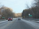
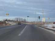
. The population was 5,090 at the 2000 census. Hobart is a part of the Green Bay
Green Bay, Wisconsin
Green Bay is a city in and the county seat of Brown County in the U.S. state of Wisconsin, located at the head of Green Bay, a sub-basin of Lake Michigan, at the mouth of the Fox River. It has an elevation of above sea level and is located north of Milwaukee. As of the 2010 United States Census,...
Metropolitan Statistical Area
Green Bay metropolitan area
The Green Bay Metropolitan Statistical Area, as defined by the United States Census Bureau, is an area consisting of three counties in Wisconsin, anchored by the city of Green Bay...
. A small portion of the village is part of the unincorporated census-designated place
Census-designated place
A census-designated place is a concentration of population identified by the United States Census Bureau for statistical purposes. CDPs are delineated for each decennial census as the statistical counterparts of incorporated places such as cities, towns and villages...
(CDP) given the name of Oneida, Wisconsin
Oneida, Wisconsin
Oneida is an unincorporated community and former census-designated place in the town of Oneida, Outagamie County, Wisconsin, United States. The population was 1,070 at the 2000 census. At the census, part of the CDP lay within the town of Hobart, which has since incorporated as a village, in...
. Most of the CDP is located within the Town of Oneida
Oneida (town), Wisconsin
Oneida is a town in Outagamie County, Wisconsin, United States. The population was 4,001 at the 2000 census. The census-designated place of Oneida is located mostly within the town...
in Outagamie County, Wisconsin
Outagamie County, Wisconsin
Outagamie is a county in the northeast region of the U.S. state of Wisconsin. Its county seat is Appleton. As of the 2009 census estimate, its population was 177,155....
. This CDP is an entity created solely for statistic purposes. Hobart is entirely within the boundaries of the Oneida Nation of Wisconsin
Oneida Nation of Wisconsin
The Oneida Nation of Wisconsin is an Indian reservation of the Oneida tribe on the west side of the Green Bay metropolitan area.-Demography and population:The reservation comprises portions of eastern Outagamie County and western Brown County...
.
History
The village was formerly known as the Town of Hobart, until the entire town incorporated as the Village of Hobart on May 13, 2002. Hobart is named for Episcopal Bishop John Henry HobartJohn Henry Hobart
John Henry Hobart was the third Episcopal bishop of New York .He vigorously promoted the extension of the Episcopal Church in Central and Western New York...
of New York who sent missionaries to the Oneida people and ministered to them after removal from New York to Wisconsin.
Geography
According to the United States Census BureauUnited States Census Bureau
The United States Census Bureau is the government agency that is responsible for the United States Census. It also gathers other national demographic and economic data...
, the village has a total area of 33.3 square miles (86.1 km²), of which, 33.2 square miles (85.9 km²) of it is land and 0.1 square miles (0.3 km²) of it (0.33%) is water.
Demographics
As of the censusCensus
A census is the procedure of systematically acquiring and recording information about the members of a given population. It is a regularly occurring and official count of a particular population. The term is used mostly in connection with national population and housing censuses; other common...
of 2000, there were 5,090 people, 1,717 households, and 1,468 families residing in the village. The population density
Population density
Population density is a measurement of population per unit area or unit volume. It is frequently applied to living organisms, and particularly to humans...
was 153.5 people per square mile (59.3/km²). There were 1,758 housing units at an average density of 53.0 per square mile (20.5/km²). The racial makeup of the village was 80.57% White, 0.10% African American, 16.66% Native American, 0.69% Asian, 0.08% Pacific Islander, 0.39% from other races
Race (United States Census)
Race and ethnicity in the United States Census, as defined by the Federal Office of Management and Budget and the United States Census Bureau, are self-identification data items in which residents choose the race or races with which they most closely identify, and indicate whether or not they are...
, and 1.51% from two or more races. Hispanic or Latino of any race were 0.86% of the population.
There were 1,717 households out of which 40.8% had children under the age of 18 living with them, 75.4% were married couples
Marriage
Marriage is a social union or legal contract between people that creates kinship. It is an institution in which interpersonal relationships, usually intimate and sexual, are acknowledged in a variety of ways, depending on the culture or subculture in which it is found...
living together, 6.5% had a female householder with no husband present, and 14.5% were non-families. 10.7% of all households were made up of individuals and 4.6% had someone living alone who was 65 years of age or older. The average household size was 2.96 and the average family size was 3.20.
In the village the population was spread out with 29.8% under the age of 18, 5.8% from 18 to 24, 25.7% from 25 to 44, 31.2% from 45 to 64, and 7.5% who were 65 years of age or older. The median age was 39 years. For every 100 females there were 96.8 males. For every 100 females age 18 and over, there were 96.4 males.
The median income for a household in the village was $69,034, and the median income for a family was $76,626. Males had a median income of $49,813 versus $30,458 for females. The per capita income
Per capita income
Per capita income or income per person is a measure of mean income within an economic aggregate, such as a country or city. It is calculated by taking a measure of all sources of income in the aggregate and dividing it by the total population...
for the village was $29,059. About 4.1% of families and 6.5% of the population were below the poverty line, including 9.6% of those under age 18 and 10.6% of those age 65 or over.