

Highway 34 (Ontario)
Encyclopedia
Canada
Canada is a North American country consisting of ten provinces and three territories. Located in the northern part of the continent, it extends from the Atlantic Ocean in the east to the Pacific Ocean in the west, and northward into the Arctic Ocean...
province of Ontario
Ontario
Ontario is a province of Canada, located in east-central Canada. It is Canada's most populous province and second largest in total area. It is home to the nation's most populous city, Toronto, and the nation's capital, Ottawa....
. The route connects Hawkesbury
Hawkesbury, Ontario
Hawkesbury is a town in the Eastern portion of Southern Ontario, Canada, on the Ottawa River, near the Quebec-Ontario border.It lies on the south shore of the Ottawa River about halfway between Downtown Ottawa and Downtown Montreal in Prescott and Russell Counties. The Long-Sault Bridge links it...
with Highway 417 south of Vankleek Hill
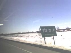
Vankleek Hill, Ontario
Vankleek Hill is a community in Champlain township in eastern Ontario, situated south of Hawkesbury on Highway 34.This agricultural based community became a thriving community in the 1890s and still retains many of the buildings and structures which were present then...
. It is 16.9 kilometres (10.5 mi) long.
The highway formerly continued 40 kilometres (24.9 mi) south of Highway 417 to Highway 2
Ontario Highway 2
King's Highway 2, usually referred to simply as Highway 2 is a provincially maintained highway in Ontario. Once the primary east–west route across the southern end of the province, Highway 2 became mostly redundant in the 1960s following the completion of Highway 401, which more or less...
in Lancaster. This section was since been redesignated as SD&G County Road 34.
Route description
Highway 34 is short highway which today serves to connect the town of Hawkesbury with Highway 417. The 16.9 kilometres (10.5 mi) route ends near the Ottawa RiverOttawa River
The Ottawa River is a river in the Canadian provinces of Ontario and Quebec. For most of its length, it now defines the border between these two provinces.-Geography:...
in downtown Hawkesbury. Between these two points, with the exception of the town of Vankleek Hill, the highway traverses the rural Ottawa Valley
Ottawa Valley
The Ottawa Valley is the valley along the boundary between Eastern Ontario and Western Quebec along the Ottawa River. The valley is the transition between the Saint Lawrence Lowlands and the Canadian Shield...
. The majority of the land use surrounding the highway are commercial shops in urban areas and agricultural in rural areas, though some small woodlots exist alongside the route.
History
Highway 34 has a very tame history, having been assumed in 1930 and remaining unchanged between then and the highway downloads of the late 1990s.On November 26, 1930, the Department of Highways assumed the road between Lancaster and Hawkesbury as King's Highway 34, providing a connection between Highway 2 and Highway 17 immediately west of the Ontario–Quebec border. The route was 55.7 kilometres (34.6 mi) long at the time of its assumption.
Highway 34 remained unchanged for over 60 years, before the portion south of Highway 417 was decommissioned. On January 1, 1998, the section of Highway 34 within the United Counties of Stormont, Dundas and Glengarry was transferred to that jurisdiction.
It has since been redesignated as County Road 34.
Major intersections
The following table lists major intersections located along Highway 34. The entirety of the route is located within Prescott and Russell United Counties.| Location | km | Destinations | Notes |
|---|---|---|---|
| Champlain Champlain, Ontario Champlain is a township in eastern Ontario, Canada, in the United Counties of Prescott and Russell on the Ottawa River.-Communities:The township comprises the communities of Aberdeen, Cassburn, Green Lane, Happy Hollow, Henrys Corners, L'Ange-Gardien, L'Orignal, Pleasant Corners, Ritchance, Riviera... |
0.0 | , Montreal Montreal Montreal is a city in Canada. It is the largest city in the province of Quebec, the second-largest city in Canada and the seventh largest in North America... |
Exit 27 |
| Vankleek Hill Vankleek Hill, Ontario Vankleek Hill is a community in Champlain township in eastern Ontario, situated south of Hawkesbury on Highway 34.This agricultural based community became a thriving community in the 1890s and still retains many of the buildings and structures which were present then... |
5.3 | Vankleek Hill town limits; beginning of Vankleek Hill Connecting Link Connecting Link The Connecting Link program is a provincial subsidy provided to municipalities to assist with road construction, maintenance and repairs in the Canadian province of Ontario. Roads which are designated as connecting links form the portions of provincial highways through built-up communities which... agreement |
|
| 6.7 | Vankleek Hill town limits; end of Vankleek Hill Connecting Link agreement | ||
| Hawkesbury Hawkesbury, Ontario Hawkesbury is a town in the Eastern portion of Southern Ontario, Canada, on the Ottawa River, near the Quebec-Ontario border.It lies on the south shore of the Ottawa River about halfway between Downtown Ottawa and Downtown Montreal in Prescott and Russell Counties. The Long-Sault Bridge links it... |
15.4 | Formerly | |
| 15.6 | Hawkesbury town limits; beginning of Hawkesbury Connecting Link agreement | ||
| 16.9 | Main Street | End of Hawkesbury Connecting Link agreement |