
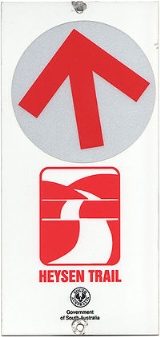
Heysen Trail
Encyclopedia

South Australia
South Australia is a state of Australia in the southern central part of the country. It covers some of the most arid parts of the continent; with a total land area of , it is the fourth largest of Australia's six states and two territories.South Australia shares borders with all of the mainland...
. It runs from Parachilna Gorge, in the Flinders Ranges
Flinders Ranges
Flinders Ranges is the largest mountain range in South Australia, which starts approximately north west of Adelaide. The discontinuous ranges stretch for over from Port Pirie to Lake Callabonna...
via the Adelaide Hills
Adelaide Hills
The Adelaide Hills are part of the Mount Lofty Ranges, east of the city of Adelaide in the state of South Australia. It is unofficially centred on the largest town in the area, Mount Barker, which has a population of around 29,000 and is also one of Australia's fastest growing towns.- History :The...
to Cape Jervis on the Fleurieu Peninsula
Fleurieu Peninsula
The Fleurieu Peninsula is a peninsula located south of Adelaide in South Australia, Australia. It was named after the French explorer and hydrographer Charles Pierre Claret de Fleurieu by the French explorer Nicolas Baudin as he mapped the south coast of Australia in 1802.Towns of interest in the...
and is approximately 1200 km in length.
The trail was first suggested by Warren Bonython
Warren Bonython
Charles Warren Bonython AO is an Australian conservationist, explorer, author and chemical engineer. A keen bushwalker, he is perhaps best known for his role, spanning many years, working towards the promotion, planning and eventual creation of the Heysen Trail...
in 1969 but design was stalled by several years due to Government politics and issues with private land owners. The first 50 kilometres of the track was laid out through the Mount Lofty Ranges
Mount Lofty Ranges
The Mount Lofty Ranges are the range of mountains just to the east of Adelaide in South Australia.-Location and description:The Mount Lofty Ranges stretch from the southernmost point of the Fleurieu Peninsula at Cape Jervis northwards for over before petering out north of Peterborough...
in 1978 after responsibility for the track was handed to the Department of Recreation and Sport. Terry Lavender was the main designer for the track, and oversaw the majority of its construction until it was completed in 1992.
The trail is named after Sir Hans Heysen
Hans Heysen
Sir Hans Heysen, OBE was a well-known German Australian artist. He was particularly recognized for his watercolours of the Australian bush. He won the Wynne Prize for landscape painting a record nine times.-Biography:...
.
Due to bushfire risk, large sections of the trail are closed annually from December through to April.
Most people choose to walk sections of the track for one or a few days at a time. There are many places to stay along the trail, and hardy walkers who walk the track from beginning to end typically do so in about 60 days.
The Friends of the Heysen Trail is a non-profit volunteer organisation dedicated to the maintenance and development of walking trails; and to the promotion of bushwalking as a healthy leisure activity.
A regular walking program is conducted by a walking sub-committee. Different grades of walks cater for beginners and for more experienced walkers.
Route summary
From North to South, the route of the trail may be summarised by the following landmarks in order: ParachilnaParachilna, South Australia
Parachilna was once a town in South Australia. The town was first surveyed in 1863 due to its closeness to a government water well. It is on the railway line and road between Port Augusta and Leigh Creek. Today, the Prairie Hotel, railway station, airstrip and a few buildings remain...
Gorge - Flinders Ranges National Park
Flinders Ranges National Park
The Flinders Ranges National Park is situated approximately 400 km north of Adelaide in the northern central part of South Australia's largest mountain range, the Flinders Ranges. The park covers an area of 912 km², northeast of the small town of Hawker...
- Hawker
Hawker, South Australia
Hawker is a town in the Flinders Ranges area of South Australia, 365 km north of Adelaide. It is in the Flinders Ranges Council, the state Electoral district of Stuart and the federal Division of Grey. At the 2006 census, Hawker had a population of 229....
- Quorn
Quorn, South Australia
Quorn is a township and railhead in the Flinders Ranges in the north of South Australia, 39 km northeast of Port Augusta. At the 2006 census, Quorn had a population of 1068.Quorn is the home of the Flinders Ranges Council local government area...
- Mount Remarkable National Park
Mount Remarkable National Park
Mount Remarkable is a national park in South Australia , 238 km north of Adelaide.Edward John Eyre named Mount Remarkable in June 1840...
- Melrose
Melrose, South Australia
Melrose is the oldest town in the Flinders Ranges. It is in the shadow of Mount Remarkable, 265 km north of Adelaide. At the 2006 census, Melrose had a population of 431....
- Crystal Brook
Crystal Brook, South Australia
Crystal Brook is a town in South Australia, named after the spring-fed creek next to which it was founded. It is north of Adelaide and in 2006 had a population of 1,185.Crystal Brook is situated on Goyder's Line near the border of two climate systems...
- Spalding
Spalding, South Australia
Spalding is a town located north of the Clare Valley in South Australia, Australia at . At the 2006 census, Spalding had a population of 212.It is mainly a farming community and also is home to a slate quarry....
- Burra
Burra, South Australia
Burra is a pastoral centre and historic tourist town in the mid-north of South Australia. It lies east of the Clare Valley in the Bald Hills range, part of the northern Mount Lofty Ranges, and on Burra Creek. The town began as a single company mining township that, by 1851, was a set of townships ...
- Kapunda - Adelaide Hills
Adelaide Hills
The Adelaide Hills are part of the Mount Lofty Ranges, east of the city of Adelaide in the state of South Australia. It is unofficially centred on the largest town in the area, Mount Barker, which has a population of around 29,000 and is also one of Australia's fastest growing towns.- History :The...
- Deep Creek Conservation Park
Deep Creek Conservation Park
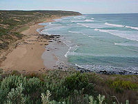
Deep Creek Conservation Park is 45 square kilometres of natural Australian bush land located at the southern end of Fleurieu Peninsula in South Australia, 11 km east of Cape Jervis. It has spectacular cliffs fronting the Southern Ocean. The total of 18 km of coastline include views across...
- Cape Jervis
Cape Jervis, South Australia
Cape Jervis is a town at the southwestern tip of Fleurieu Peninsula in South Australia, approximately 108 km south of Adelaide. The population is approximately 300 people and growing rapidly, with a new estate situated behind the main town...