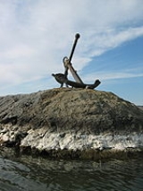
Hat Rock State Park
Encyclopedia
Hat Rock State Park is a state park
in the U.S. state
of Oregon
, administered by the Oregon Parks and Recreation Department
. The park is located off the east side of U.S. Highway 730 in Hermiston
, on the south shore of Lake Wallula
behind McNary Dam
on the Columbia River
.

Hat rock is a geological formation that, along with another outcrop
ping rock in the park called Boat Rock, are thought to be exposed remnants of a 12-million year old basalt flow
. Floods from the Ice Age
eventually left these bedrock
s, as well as others along the Columbia River Gorge exposed at the surface of the Earth.
State park
State parks are parks or other protected areas managed at the federated state level within those nations which use "state" as a political subdivision. State parks are typically established by a state to preserve a location on account of its natural beauty, historic interest, or recreational...
in the U.S. state
U.S. state
A U.S. state is any one of the 50 federated states of the United States of America that share sovereignty with the federal government. Because of this shared sovereignty, an American is a citizen both of the federal entity and of his or her state of domicile. Four states use the official title of...
of Oregon
Oregon
Oregon is a state in the Pacific Northwest region of the United States. It is located on the Pacific coast, with Washington to the north, California to the south, Nevada on the southeast and Idaho to the east. The Columbia and Snake rivers delineate much of Oregon's northern and eastern...
, administered by the Oregon Parks and Recreation Department
Oregon Parks and Recreation Department
The Oregon Parks and Recreation Department , officially known as the State Parks and Recreation Department, is the government agency of the U.S. state of Oregon which operates its system of state parks...
. The park is located off the east side of U.S. Highway 730 in Hermiston
Hermiston, Oregon
As of the census of 2010, there were 16,745 people, 4,964 households, and 3,360 families residing in the city. The population density was 2,035.4 people per square mile . There were 5,383 housing units at an average density of 832.9 per square mile...
, on the south shore of Lake Wallula
Lake Wallula
Lake Wallula is a reservoir on the Columbia River in the United States, between the U.S. states of Washington and Oregon. It was created in 1954 with the construction of McNary Dam. It reaches from McNary Dam near the city of Umatilla, Oregon, to the Tri-Cities of Washington.-See also:* Wallula...
behind McNary Dam
McNary Dam
McNary Dam is a 1.4-mile long concrete gravity run-of-the-river dam which spans the Columbia River. It joins Umatilla County, Oregon with Benton County, Washington, 292 miles upriver from the mouth of the Columbia at Astoria, Oregon. It is operated by the U.S. Army Corps of Engineers' McNary...
on the Columbia River
Columbia River
The Columbia River is the largest river in the Pacific Northwest region of North America. The river rises in the Rocky Mountains of British Columbia, Canada, flows northwest and then south into the U.S. state of Washington, then turns west to form most of the border between Washington and the state...
.
Flood basalt

Hat rock is a geological formation that, along with another outcrop
Outcrop
An outcrop is a visible exposure of bedrock or ancient superficial deposits on the surface of the Earth. -Features:Outcrops do not cover the majority of the Earth's land surface because in most places the bedrock or superficial deposits are covered by a mantle of soil and vegetation and cannot be...
ping rock in the park called Boat Rock, are thought to be exposed remnants of a 12-million year old basalt flow
Flood basalt
A flood basalt or trap basalt is the result of a giant volcanic eruption or series of eruptions that coats large stretches of land or the ocean floor with basalt lava. Flood basalts have occurred on continental scales in prehistory, creating great plateaus and mountain ranges...
. Floods from the Ice Age
Ice age
An ice age or, more precisely, glacial age, is a generic geological period of long-term reduction in the temperature of the Earth's surface and atmosphere, resulting in the presence or expansion of continental ice sheets, polar ice sheets and alpine glaciers...
eventually left these bedrock
Bedrock
In stratigraphy, bedrock is the native consolidated rock underlying the surface of a terrestrial planet, usually the Earth. Above the bedrock is usually an area of broken and weathered unconsolidated rock in the basal subsoil...
s, as well as others along the Columbia River Gorge exposed at the surface of the Earth.

