
Hartley Vale, New South Wales
Encyclopedia
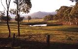
Hartley Vale is a small village in the Blue Mountains area of New South Wales
, Australia
. It is approximately 150 kilometres west of Sydney and 12 kilometres south-east of Lithgow. It is in the Local Government Area of the City of Lithgow
.
. The area is largely open countryside with many substantial private properties, bounded by the River Lett to the north and Mount York
to the south. The village is approximately five kilometres west of the Main Western Railway -- which runs from Sydney to Lithgow and beyond -- and ten kilometres from the nearest railway station at Bell
.
, immediately south of Hartley Vale, and have been incorporated into a walking track.
A kilometre east of Cox's road is Lockyers Road, which was started in 1828 by Major Lockyer as an alternative crossing to Cox's road, but was never finished. It goes down into the valley and finishes slightly west of the Hartley Vale village. Another kilometre east is Lawsons Long Alley, which was started as an alternative road by William Lawson, with the aim of avoiding the steep grades of Cox's road at Mount York. While building the road, Lawson discovered what he thought was coal
, but which was in fact oil shale
. Mining began in the 1860s and a rail line was constructed into the valley of Kerosene Creek. Hartley Vale Station was created on the Main Western Line, but later was abandoned, as was oil shale mining.
Lawsons Long Alley goes through the valley of Kerosene Creek and joins Waltons Road, which goes to Hartley Vale Road on the east side of the village. Lawsons Long Alley and Lockyers Road, along with Coxs Road, were developed as walking tracks by the Department of Lands, New South Wales. They all lead to the Hartley Vale area, culminating at a picnic area just west of the village.
Other notable landmarks in the area are the Comet Inn, which dates back to 1879 and is located in the center of the village, and Collits Inn, which dates back to 1823 and is approximately one and a half kilometres west of the village. The Hartley Vale Cemetery is just a small distance south-west of Collits Inn.
The Hartley Vale area also includes a range of other tourist facilities.


New South Wales
New South Wales is a state of :Australia, located in the east of the country. It is bordered by Queensland, Victoria and South Australia to the north, south and west respectively. To the east, the state is bordered by the Tasman Sea, which forms part of the Pacific Ocean. New South Wales...
, Australia
Australia
Australia , officially the Commonwealth of Australia, is a country in the Southern Hemisphere comprising the mainland of the Australian continent, the island of Tasmania, and numerous smaller islands in the Indian and Pacific Oceans. It is the world's sixth-largest country by total area...
. It is approximately 150 kilometres west of Sydney and 12 kilometres south-east of Lithgow. It is in the Local Government Area of the City of Lithgow
City of Lithgow
Lithgow is a Local Government Area in New South Wales, Australia that includes Lithgow and its surrounding area. It is on the Great Western Highway and the Main Western railway line.- Demographics :According to the , there:...
.
Description
Hartley Vale is centred on Hartley Vale Road, which stretches from the Governors Causeway to the Great Western HighwayGreat Western Highway
The Great Western Highway is a highway in New South Wales, Australia. It runs 210 km from Sydney to Bathurst.Starting as Broadway at the intersection of City Road near the fringe of the Sydney CBD, and becoming Parramatta Road to Parramatta itself, the Great Western Highway heads due west from...
. The area is largely open countryside with many substantial private properties, bounded by the River Lett to the north and Mount York
Mount York
Mount York is a 1061 metre high mountain in the western Blue Mountains of New South Wales, Australia, located approximately 150 kilometres west of Sydney. It is in fact a projection of the Blue Mountains plateau, creating a promontory of the western escarpment with a minor rise at its...
to the south. The village is approximately five kilometres west of the Main Western Railway -- which runs from Sydney to Lithgow and beyond -- and ten kilometres from the nearest railway station at Bell
Bell, New South Wales
Bell is a small rural/residential village in the Blue Mountains with an elevation of approximately 1100 metres above sea level. Bell is approximately 125 km west of Sydney, Australia by road or 137 km by rail, some 20 km east of Lithgow and 10 km north of Mount Victoria. It is a...
.
History
The valley is an historic area where the early roads over the Blue Mountains came down into the plains found to the west of the mountains. The first road through the mountains was built by William Cox from 1814-1815. Parts of his original road can still be seen at Mount YorkMount York
Mount York is a 1061 metre high mountain in the western Blue Mountains of New South Wales, Australia, located approximately 150 kilometres west of Sydney. It is in fact a projection of the Blue Mountains plateau, creating a promontory of the western escarpment with a minor rise at its...
, immediately south of Hartley Vale, and have been incorporated into a walking track.
A kilometre east of Cox's road is Lockyers Road, which was started in 1828 by Major Lockyer as an alternative crossing to Cox's road, but was never finished. It goes down into the valley and finishes slightly west of the Hartley Vale village. Another kilometre east is Lawsons Long Alley, which was started as an alternative road by William Lawson, with the aim of avoiding the steep grades of Cox's road at Mount York. While building the road, Lawson discovered what he thought was coal
Coal
Coal is a combustible black or brownish-black sedimentary rock usually occurring in rock strata in layers or veins called coal beds or coal seams. The harder forms, such as anthracite coal, can be regarded as metamorphic rock because of later exposure to elevated temperature and pressure...
, but which was in fact oil shale
Oil shale
Oil shale, an organic-rich fine-grained sedimentary rock, contains significant amounts of kerogen from which liquid hydrocarbons called shale oil can be produced...
. Mining began in the 1860s and a rail line was constructed into the valley of Kerosene Creek. Hartley Vale Station was created on the Main Western Line, but later was abandoned, as was oil shale mining.
Lawsons Long Alley goes through the valley of Kerosene Creek and joins Waltons Road, which goes to Hartley Vale Road on the east side of the village. Lawsons Long Alley and Lockyers Road, along with Coxs Road, were developed as walking tracks by the Department of Lands, New South Wales. They all lead to the Hartley Vale area, culminating at a picnic area just west of the village.
Other notable landmarks in the area are the Comet Inn, which dates back to 1879 and is located in the center of the village, and Collits Inn, which dates back to 1823 and is approximately one and a half kilometres west of the village. The Hartley Vale Cemetery is just a small distance south-west of Collits Inn.
The Hartley Vale area also includes a range of other tourist facilities.