
Hackensack Riverfront
Encyclopedia
Hackensack Riverfront
The Hackensack Riverfront is an area on the eastern banks of the Hackensack RiverHackensack River
The Hackensack River is a river, approximately 45 miles long, in the U.S. states of New York and New Jersey, emptying into Newark Bay, a back chamber of New York Harbor. The watershed of the river includes part of the suburban area outside New York City just west of the lower Hudson River,...
near its mouth at Newark Bay
Newark Bay
Newark Bay is a tidal bay at the confluence of the Passaic and Hackensack Rivers in northeastern New Jersey. It is home to the Port Newark-Elizabeth Marine Terminal, the largest container shipping facility in Port of New York and New Jersey, 3rd largest and one of busiest in the United States...
. It is on the West Side
West Side, Jersey City
The West Side of Jersey City is a made of several diverse neighborhoods on either side of West Side Avenue, one of the city's main shopping streets...
of the city
Jersey City, New Jersey
Jersey City is the seat of Hudson County, New Jersey, United States.Part of the New York metropolitan area, Jersey City lies between the Hudson River and Upper New York Bay across from Lower Manhattan and the Hackensack River and Newark Bay...
, specifically west of NJ Route 440. It lies north of Droyer's Point
Droyer's Point
Droyer's Point is a section of Jersey City, New Jersey at Newark Bay.-Geography:In the southwestern part of the of the city, Droyer's Point is located on the Newark Bay. Its eastern perimeter is New Jersey Route 440. The point is entered from the highway's intersection with Danforth Avenue...
and south of Lincoln Park
Lincoln Park (Jersey City)
Lincoln Park is an urban park in Jersey City, New Jersey with an area of . Opened in 1905, it was originally known as West Side Park. The park was designed by Daniel W. Langton and Charles N. Lowrie, both founding members of the American Society of Landscape Architects.The park consists of two...
. It is home to the Hudson Mall, Four Hundred Forty Shopping Center and the former Jersey City Public Works incinerator as well as the planned site. Kearny Point
South Kearny, New Jersey
South Kearny is an industrial district and distinct area of Hudson County, New Jersey at the northern end of Newark Bay in the town of Kearny, New Jersey. It is on larger peninisula once called New Barbadoes Neck, which also include the other Kearny districts of the Uplands and the Kearny Meadows...
and the piers of the former Federal Shipbuilding and Drydock Company
Federal Shipbuilding and Drydock Company
The Federal Shipbuilding and Drydock Company was a United States shipyard, active from 1917 to 1949. During World War II, it built ships as part of the U.S. Government's Emergency Shipbuilding Program. Operated by a subsidiary of the United States Steel Corporation, the shipyard was located at...
, now River Terminal, are on the opposite bank. The Hackensack RiverWalk
Hackensack RiverWalk
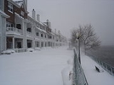
Hackensack RiverWalk a is partially constructed greenway along the Newark Bay and Hackensack River on the west side of the Bergen Neck peninsula in Hudson County, New Jersey...
is a partially complete greenway
Greenway
-People:* Barney Greenway , British death metal vocalist* Brian Greenway , Canadian guitarist and vocalist* Chad Greenway , American football player* Francis Greenway , Australian architect...
promenade intended to run from the Bayonne Bridge
Bayonne Bridge
The Bayonne Bridge is the fourth longest steel arch bridge in the world, and was the longest in the world at the time of its completion. It connects Bayonne, New Jersey with Staten Island, New York, spanning the Kill Van Kull. Despite popular belief, it is not a national landmark.The bridge was...
to the Hackensack Meadowlands in North Bergen
North Bergen, New Jersey
North Bergen is a township in Hudson County, New Jersey, United States. As of the United States 2010 Census, the township had a total population of 60,773. Originally founded in 1843, the town was much diminished in territory by a series of secessions. Situated on the Hudson Palisades, it is one...
, mostly at the water's edge.
Bayfront project
Bayfront is a proposed mixed-use developmentMixed-use development
Mixed-use development is the use of a building, set of buildings, or neighborhood for more than one purpose. Since the 1920s, zoning in some countries has required uses to be separated. However, when jobs, housing, and commercial activities are located close together, a community's transportation...
to be situated on a 100 acre (0.404686 km²) brownfield site and developed though a public-private partnership once environmental remediation of toxic waste
Toxic waste
Toxic waste is waste material that can cause death or injury to living creatures. It spreads quite easily and can contaminate lakes and rivers. The term is often used interchangeably with “hazardous waste”, or discarded material that can pose a long-term risk to health or environment.Toxic waste...
is completed by Honeywell
Honeywell
Honeywell International, Inc. is a major conglomerate company that produces a variety of consumer products, engineering services, and aerospace systems for a wide variety of customers, from private consumers to major corporations and governments....
, which once operated facilities there. Though separated by the highway Bayport and the West Campus of New Jersey City University
New Jersey City University
New Jersey City University is a public university in Jersey City, New Jersey, USA. It is a member of the New Jersey Association of State Colleges and Universities....
will transform large parts of the city from industrial and manufacturing zones to residential, educational, recreational and commercial uses. Development plans are required to incorporate public access to the river's edge along the bulkhead
Bulkhead line
Bulkhead line is an officially set line along a shoreline, usually outside of the dry land, to demark a territory allowable to be treated as dry land, to separate the jurisdictions of dry land and water authorities, for construction and riparian activities, to establish limits to the allowable...
and will connect to the esplanade
Esplanade
An esplanade is a long, open, level area, usually next to a river or large body of water, where people may walk. The original meaning of esplanade was a large, open, level area outside fortress or city walls to provide clear fields of fire for the fortress' guns...
at Droyer's Point
Droyer's Point
Droyer's Point is a section of Jersey City, New Jersey at Newark Bay.-Geography:In the southwestern part of the of the city, Droyer's Point is located on the Newark Bay. Its eastern perimeter is New Jersey Route 440. The point is entered from the highway's intersection with Danforth Avenue...
. in March 2011, NJDOT
New Jersey Department of Transportation
The New Jersey Department of Transportation is the agency responsible for transportation issues and policy in New Jersey. It is headed by the Commissioner of Transportation...
granted nearly $640,000 for engineering work to transform Route 440, between the two projects, to an urban boulevard.
Transportation
Currently bus service is provide by A&C Bus CorporationA&C Bus Corporation
The A&C Bus Corporation, also known as the Montgomery & Westside Bus Owners Association, is a bus company in Jersey City, New Jersey. All buses operated by A&C are known for their solid red line on the side of the bus and the phrase "use the bus card on this bus" on the front of the...
from the shopping centers or Droyer's Point to Journal Square
Journal Square
Journal Square is a business district, residential area, and transportation hub in Jersey City, New Jersey, which takes its name from the newspaper Jersey Journal whose headquarters are located there. The "square" itself is at the intersection of Kennedy Boulevard and Bergen Avenues...
. In May 2011 after two years of studies, New Jersey Transit
New Jersey Transit
The New Jersey Transit Corporation is a statewide public transportation system serving the United States state of New Jersey, and New York, Orange, and Rockland counties in New York State...
announced a plan for 0.7 mile extension of the West Side Branch of the Hudson Bergen Light Rail from its current terminus. The new track would be laid along an elevated viaduct from the West Side Avenue Station
West Side Avenue (HBLR station)
-External links:*...
across Route 440 to the northern end of the redevelopment area, where a new station would be constructed. The trip between the two stations would take 1 minute and 50 seconds. The project, eligible for federal funding, is estimated to cost $171.6 million.
See also
- Canal CrossingCanal Crossing, Jersey CityCanal Crossing is a New Urbanism project on the eastern side of Jersey City, New Jersey between the Greenville Section, Bergen-Lafayette and Liberty State Park...
- Route of the Lincoln Highway
- Marion SectionMarion, Jersey CityThe Marion Section is a district of Jersey City, New Jersey.West of Journal Square and north of Holy Name Cemetery on the West Side, the Marion's two distinct neighborhoods are separated by PATH rail lines It borders other districts of Riverbend, Croxton and the West Side, and is sometimes is...