

Gungahlin, Australian Capital Territory
Encyclopedia
- For the Canberra district of Gungahlin see: GungahlinGungahlinGungahlin is a name of a district and the northernmost town centre of Canberra, Australia. Gungahlin is situated 10 km north of Canberra's city centre and is one of five satellites of Canberra including Woden, Tuggeranong, Weston Creek and Belconnen. Currently Gungahlin comprises 11 suburbs,...
Gungahlin is a suburb in the Canberra
Canberra
Canberra is the capital city of Australia. With a population of over 345,000, it is Australia's largest inland city and the eighth-largest city overall. The city is located at the northern end of the Australian Capital Territory , south-west of Sydney, and north-east of Melbourne...
, Australia
Australia
Australia , officially the Commonwealth of Australia, is a country in the Southern Hemisphere comprising the mainland of the Australian continent, the island of Tasmania, and numerous smaller islands in the Indian and Pacific Oceans. It is the world's sixth-largest country by total area...
district with the same name; Gungahlin. The postcode is 2912. Gungahlin is the name for the entire district, and also the town centre, but it is also the name of the suburb which Gungahlin Town Centre is in.
It is next to the suburbs of Ngunnawal, Palmerston, Franklin, Harrison, Throsby, Forde and Amaroo. Burgmann Anglican School is located in the suburb. The edges of the suburb are on Horse Park Drive, Gundaroo Drive and Gungahlin Drive.
Gungahlin Town Centre
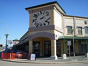
The commercial heart of the Gungahin Town Centre is Hibberson St, the centre's main street, though the boundary of commercial activities in Anthony Rolfe Avenue, Gundaroo Drive and Gozzard Street. There are currently four retail anchor stores in the town centre, namely Coles, Woolworths, Aldi and Big W which are located in separate developments in Hibberson Street. The only licensed club in the Town Centre is the Raiders Club located at the intersection of Hibberson and Gozzard Streets.Geology
Silurian
The Silurian is a geologic period and system that extends from the end of the Ordovician Period, about 443.7 ± 1.5 Mya , to the beginning of the Devonian Period, about 416.0 ± 2.8 Mya . As with other geologic periods, the rock beds that define the period's start and end are well identified, but the...
age Canberra Formation. Most of this is slaty shale
Shale
Shale is a fine-grained, clastic sedimentary rock composed of mud that is a mix of flakes of clay minerals and tiny fragments of other minerals, especially quartz and calcite. The ratio of clay to other minerals is variable. Shale is characterized by breaks along thin laminae or parallel layering...
and mudstone
Mudstone
Mudstone is a fine grained sedimentary rock whose original constituents were clays or muds. Grain size is up to 0.0625 mm with individual grains too small to be distinguished without a microscope. With increased pressure over time the platey clay minerals may become aligned, with the...
. But there are also a couple of bands of ashstone
Ashstone
Ashstone is a kind of volcanic rock formed from fine volcanic ash.During an explosive volcanic eruption, fragmentation of the magma can result in the formation of volcanic ash, consisting of sand-sized or smaller particles....
in the south and north west. The structure of the rock has been folded
Fold (geology)
The term fold is used in geology when one or a stack of originally flat and planar surfaces, such as sedimentary strata, are bent or curved as a result of permanent deformation. Synsedimentary folds are those due to slumping of sedimentary material before it is lithified. Folds in rocks vary in...
by anticline
Anticline
In structural geology, an anticline is a fold that is convex up and has its oldest beds at its core. The term is not to be confused with antiform, which is a purely descriptive term for any fold that is convex up. Therefore if age relationships In structural geology, an anticline is a fold that is...
s and a syncline
Syncline
In structural geology, a syncline is a fold, with younger layers closer to the center of the structure. A synclinorium is a large syncline with superimposed smaller folds. Synclines are typically a downward fold, termed a synformal syncline In structural geology, a syncline is a fold, with younger...
with a north east direction. The Gungahlin Fault
Geologic fault
In geology, a fault is a planar fracture or discontinuity in a volume of rock, across which there has been significant displacement along the fractures as a result of earth movement. Large faults within the Earth's crust result from the action of tectonic forces...
is parallel to the folds and passes through the east of the town center. To the south it passes through Crace
Crace, Australian Capital Territory
Crace is a designated suburb of Canberra, Australia in the district of Gungahlin. It was named after Edward Kendall Crace an original settler in the Gungahlin area. Streets in Crace will be named after parishes and land divisions from colonial times. It is bounded by the Barton Highway, Gungahlin...
, Kaleen
Kaleen, Australian Capital Territory
Kaleen is a suburb in the Canberra district of Belconnen. The postcode is 2617. The suburb's name means ‘water’ in the language of the Wiradhuri Aboriginal tribe of the Central West of New South Wales. It was gazetted on 15 January 1974. The streets are named after Australian Rivers.The suburb is...
, Bruce
Bruce, Australian Capital Territory
Bruce is a suburb of Canberra, Australian Capital Territory, Australia. Bruce was gazetted as a division on 6 June 1968 in recognition of Viscount Stanley Melbourne Bruce, the first Chancellor of the Australian National University and eighth Prime Minister of Australia. S. M. Bruce served as...
and Aranda
Aranda, Australian Capital Territory
Aranda is a suburb in the Canberra district of Belconnen. It is the eastern most suburb in Belconnen, located at the western foot of Black Mountain. Bounded on two sides by nature park, the suburb is characterised by its bush setting...
where it stops at the Deakin Fault. The Gungahlin Fault is also parallel to the Winslade Fault and is no doubt connected with it. In the north east direction it
passes out of the ACT northern end and ends near the Sullivans Fault.